Gfriller Sattel - Sella di Cauria
Gfriller Sattel - Sella di Cauria is a mountain saddle in Egna/Neumarkt, South Tyrol, Trentino-Alto Adige and has an elevation of 1,450 metres. Gfriller Sattel - Sella di Cauria is situated nearby to the locality Kaltwasser - Acque fredde, as well as near Bosco Comunale - Gemeindewald.| Tap on a place to explore it |
Places of Interest
Highlights include Madruttberg and Monte Corno.


Places in the Area
Nearby places include Laag and Kurtatsch an der Weinstraße.
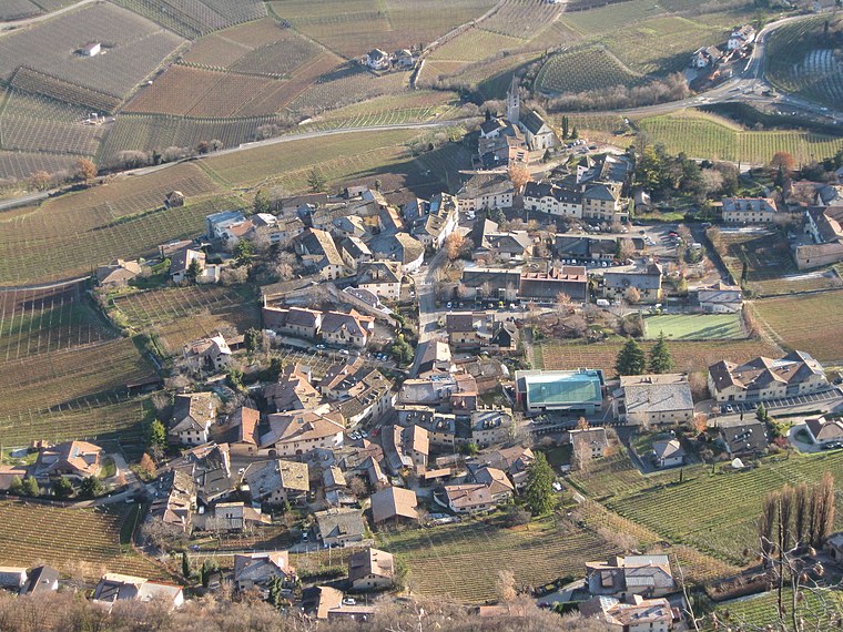
Laag
Hamlet

Photo: Rolandmaps, CC BY-SA 3.0.
Laag is a frazione of the comune of Neumarkt in South Tyrol in the Italian region of Trentino-Alto Adige/Südtirol, located about 30 km northeast of the city of Trento and about 25 km south of the city of Bolzano.
Kurtatsch an der Weinstraße
Village
 Kurtatsch an der Weinstraße, often abbreviated to Kurtatsch or Cortaccia, is a comune and a village in South Tyrol in northern Italy, located about 25 kilometres southwest of the city of Bolzano.

Gfriller Sattel - Sella di Cauria
- Type: Mountain saddle with an elevation of 1,450 metres
- Category: landform
- Location: Egna/Neumarkt, South Tyrol, Trentino-Alto Adige, Northeast Italy, Italy, Europe
- View on OpenStreetMap
Latitude
46.2863° or 46° 17′ 11″ northLongitude
11.2923° or 11° 17′ 32″ eastElevation
1,450 metres (4,757 feet)Open location code
8FRH77PR+GWOpenStreetMap ID
node 457654678OpenStreetMap feature
natural=saddle
This page is based on OpenStreetMap, Wikidata, and Wikimedia Commons.
We’d love your help improving our open data sources. Thank you for contributing.
Satellite Map
Discover Gfriller Sattel - Sella di Cauria from above in high-definition satellite imagery.
In Other Languages
From German to Italian—“Gfriller Sattel - Sella di Cauria” goes by many names.
- German: “Gfriller Sattel”
- Italian: “Sella di Cauria”
Localities in the Area
Explore places such as Kaltwasser - Acque fredde and Bosco Comunale - Gemeindewald.
Notable Places Nearby
Highlights include Königswiese, M. prato del re and Großwiese.
South Tyrol: Must-Visit Destinations
Delve into Bolzano, Brixen, Merano, and Bruneck.
Curious Mountain Saddles to Discover
Uncover intriguing mountain saddles from every corner of the globe.
About Mapcarta. Data © OpenStreetMap contributors and available under the Open Database License". Text is available under the CC BY-SA 4.0 license, except for photos, directions, and the map. Photo: Benreis, CC BY 3.0.