Dg. Hanin ouchen
Dg. Hanin ouchen is a government office in Tangier, Mediterranean Morocco. Dg. Hanin ouchen is situated nearby to the government office Dg. 3imad, as well as near Dg ste allamouh.| Tap on a place to explore it |
Places of Interest Nearby
Highlights include Tangier-Kenitra high-speed railway and Grand Mosque of Tangier.
Tangier-Kenitra high-speed railway
Railway station

Photo: NicholasNCE, CC BY-SA 4.0.
Tangier-Kenitra high-speed railway is a railway station, which is situated 4 km north of Dg. Hanin ouchen.
Grand Mosque of Tangier
Mosque
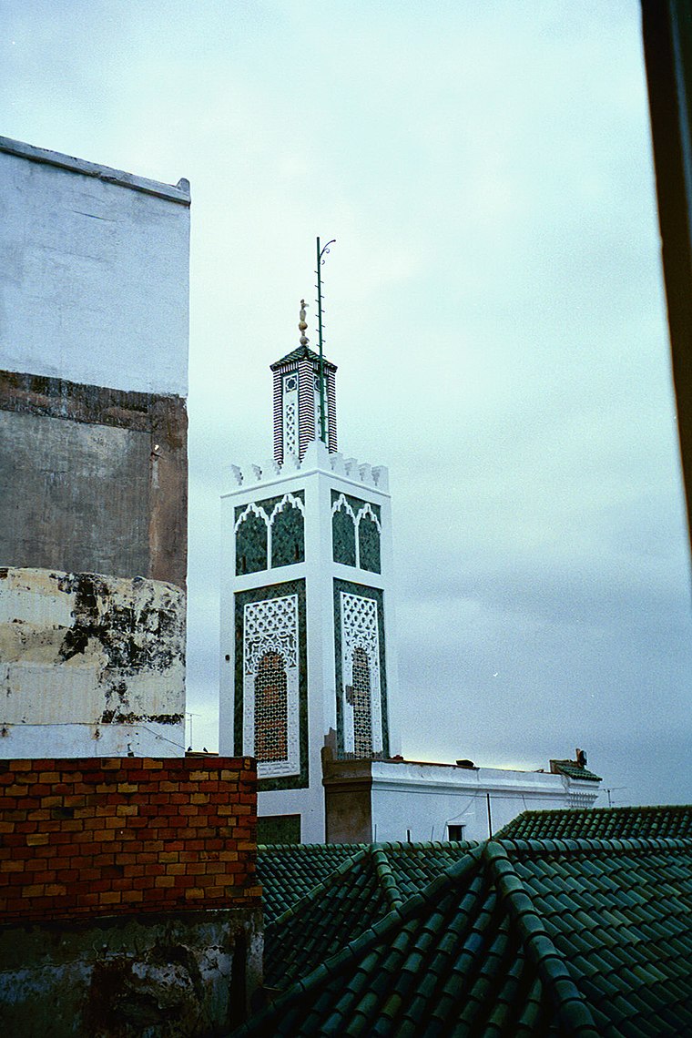
Photo: chris-yunker, CC BY-SA 2.0.
The Grand Mosque of Tangier is the historic main mosque of Tangier, Morocco, located in the city's old medina. While the design of the current mosque dates from the early 19th century during the Alaouite period, the site has been occupied by a succession of religious buildings since antiquity. Grand Mosque of Tangier is situated 3½ km northwest of Dg. Hanin ouchen.
Places in the Area
Nearby places include Laaouama and Gueznaïa.
Laaouama
Village
Laaouama is a small town and rural commune in Fahs-Anjra Province of the Tanger-Tetouan-Al Hoceima region of Morocco. At the time of the 2004 census, the commune had a total population of 20,541 people living in 3834 households.
Gueznaïa
Village

Photo: أنس, CC BY-SA 4.0.
Gueznaïa is a village, which is situated 9 km southwest of Dg. Hanin ouchen.
Dg. Hanin ouchen
- Type: Government office
- Categories: office and government building
- Location: Tangier, Tangier-Tetouan-Al Hoceima, Mediterranean Morocco, Morocco, North Africa, Africa
- View on OpenStreetMap
Latitude
35.73762° or 35° 44′ 15″ northLongitude
-5.80155° or 5° 48′ 6″ westOpen location code
8C7PP5QX+29OpenStreetMap ID
node 4587177095OpenStreetMap feature
office=government
This page is based on OpenStreetMap, Wikidata, and Wikimedia Commons.
We’d love your help improving our open data sources. Thank you for contributing.
Satellite Map
Discover Dg. Hanin ouchen from above in high-definition satellite imagery.
In Other Languages
“Dg. Hanin ouchen” goes by many names.
- French: “Dg. Hanin ouchen”
Notable Places Nearby
Highlights include Dg. 3imad and Dg ste allamouh.
Nearby Places
Explore places such as Place Aouama and Société Générale.
Mediterranean Morocco: Must-Visit Destinations
Delve into Tétouan, Oujda, Chefchaouen, and Nador.
Curious Government Offices to Discover
Uncover intriguing government offices from every corner of the globe.
About Mapcarta. Data © OpenStreetMap contributors and available under the Open Database License". Text is available under the CC BY-SA 4.0 license, except for photos, directions, and the map. Photo: calflier001, CC BY-SA 2.0.