Lowrie Foods
Lowrie Foods is a shop in Newcastle upon Tyne, England which is located on Brinkburn Street South. Lowrie Foods is situated nearby to the church St Lawrence Gospel Hall, as well as near Kings Castle.| Tap on a place to explore it |
Places of Interest Nearby
Highlights include Gateshead International Stadium and Baltic Centre for Contemporary Art.
Gateshead International Stadium
Stadium

Photo: Stephen Sweeney, CC BY-SA 2.0.
Gateshead International Stadium is a multi-purpose, all-seater venue in Gateshead, Tyne and Wear, England. Originally known as the Gateshead Youth Stadium, the venue was built in 1955 and has since been extensively redeveloped on three occasions. Gateshead International Stadium is situated 3,100 feet south of Lowrie Foods.
Baltic Centre for Contemporary Art
Arts center

Photo: 06benste, CC BY-SA 3.0.
Baltic Centre for Contemporary Art is a centre for contemporary art located on the south bank of the River Tyne in Gateshead, Tyne and Wear, England. It hosts a frequently changing variety of exhibitions, events, and educational programmes with no permanent exhibition. Baltic Centre for Contemporary Art is situated 3,900 feet west of Lowrie Foods.
Gateshead Millennium Bridge
Bridge
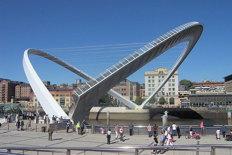
Photo: Mike1024, Public domain.
The Gateshead Millennium Bridge is a pedestrian and cyclist tilt bridge spanning the River Tyne between Gateshead arts quarter on the south bank and Newcastle upon Tyne's Quayside area on the north bank. Gateshead Millennium Bridge is situated 1 mile west of Lowrie Foods.
Places in the Area
Nearby places include Battlefield and Walker.

Walker
Suburb

Photo: John Gallon, CC BY-SA 2.0.
Walker is a residential suburb and electoral ward in the south-east of Newcastle upon Tyne, in the county of Tyne and Wear, England.
Gateshead

Photo: AlasdairW, CC BY-SA 3.0.
Gateshead is a town in Tyne and Wear in the northeast of England. It stands on the south bank of the River Tyne looking across to Newcastle upon Tyne on the north bank.
Lowrie Foods
- Type: Wholesale
- Address: 153 Brinkburn Street South, Newcastle Upon Tyne, NE6 2BU
- Category: shop
- Location: Newcastle upon Tyne, England, United Kingdom, Britain and Ireland, Europe
- View on OpenStreetMap
Latitude
54.96956° or 54° 58′ 10″ northLongitude
-1.57927° or 1° 34′ 45″ westOpen location code
9C6WXC9C+R7OpenStreetMap ID
node 4620441837OpenStreetMap feature
shop=wholesale
This page is based on OpenStreetMap, Wikidata, and Wikimedia Commons.
We’d love your help improving our open data sources. Thank you for contributing.
Satellite Map
Discover Lowrie Foods from above in high-definition satellite imagery.
Notable Places Nearby
Highlights include St Lawrence Gospel Hall and Kings Castle.
Nearby Places
Explore places such as Redwood Cable Projects and Bolam Way - Raby Street.
England: Must-Visit Destinations
Delve into London, Manchester, Sheffield, and Leeds.
Curious Places to Discover
Uncover intriguing places from every corner of the globe.
About Mapcarta. Data © OpenStreetMap contributors and available under the Open Database License". Text is available under the CC BY-SA 4.0 license, except for photos, directions, and the map. Photo: sidibousaid, CC BY 2.0.