Chips Ahoy
Chips Ahoy is a fast food restaurant in Armagh City, Banbridge and Craigavon, Northern Ireland which is located on Gilford Road. Chips Ahoy is situated nearby to Killycomain Post Office, as well as near Portadown Free Presbyterian Church.| Tap on a place to explore it |
- Type: Fast food restaurant
- Cuisine: fish and chips
- Address: Gilford Road, Portadown
Places of Interest Nearby
Highlights include Portadown railway station and Drumcree Church.
Portadown railway station
Railway stop

Photo: Wikimedia, CC BY-SA 2.0.
Portadown Railway Station serves the town of Portadown in County Armagh, Northern Ireland. The station is located on the Belfast-Dublin railway line. The original station opened in 1842, and the present station opened in 1970. Portadown railway station is situated 3,800 feet west of Chips Ahoy.
Drumcree Church
Church
 Drumcree Parish Church, officially The Church of the Ascension, is the Church of Ireland parish church of Drumcree in County Armagh, Northern Ireland. It sits on a hill in the townland of Drumcree, outside Portadown. Drumcree Church is situated 1½ miles northwest of Chips Ahoy.
Clounagh Junior High School
School
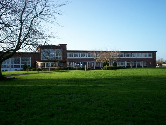
Photo: P Flannagan, CC BY-SA 2.0.
Clounagh Junior High School is a controlled school on the Brownstown Road, Portadown, Northern Ireland. It accepts male and female pupils following primary education. Clounagh Junior High School is situated 1¼ miles west of Chips Ahoy.
Places in the Area
Nearby places include Portadown and Craigavon.
Portadown

Photo: Ardfern, CC BY-SA 3.0.
Portadown is an industrial town historically in County Armagh in Northern Ireland, but since 2015 part of the Armagh-Banbridge-Craigavon District. Its population in 2021 was 33,000.
Craigavon
Town

Photo: P Flannagan, CC BY-SA 2.0.
Craigavon is a town in north County Armagh, Northern Ireland. It was a planned settlement, begun in 1965, and named after the first Prime Minister of Northern Ireland: James Craig, 1st Viscount Craigavon. Craigavon is situated 2½ miles northeast of Chips Ahoy.
Lurgan

Photo: Notafly, CC BY-SA 3.0.
Lurgan is a town historically in County Armagh in Northern Ireland - those counties are no longer units of government so it's now part of Armagh, Banbridge and Craigavon District.
Chips Ahoy
- Categories: food and restaurant
- Location: Armagh City, Banbridge and Craigavon, Northern Ireland, United Kingdom, Britain and Ireland, Europe
- View on OpenStreetMap
Latitude
54.42318° or 54° 25′ 23″ northLongitude
-6.42805° or 6° 25′ 41″ westOpen location code
9C6MCHFC+7QOpenStreetMap ID
node 4656373401OpenStreetMap feature
amenity=fast_foodOpenStreetMap attribute
cuisine=fish_and_chips
This page is based on OpenStreetMap, Wikidata, and Wikimedia Commons.
We’d love your help improving our open data sources. Thank you for contributing.
Satellite Map
Discover Chips Ahoy from above in high-definition satellite imagery.
Places with the Same Name
Discover other places named “Chips Ahoy”.
Notable Places Nearby
Highlights include Killycomain Post Office and Portadown Free Presbyterian Church.
Nearby Places
Explore places such as Winemark and T.A Anderson Pharmacy.
Northern Ireland: Must-Visit Destinations
Delve into Belfast, Derry, Giant’s Causeway, and Armagh.
Curious Fast Food Restaurants to Discover
Uncover intriguing fast food restaurants from every corner of the globe.
About Mapcarta. Data © OpenStreetMap contributors and available under the Open Database License". Text is available under the CC BY-SA 4.0 license, except for photos, directions, and the map. Photo: Chmee2, CC BY 3.0.