Conway Drive
Conway Drive is a bus stop in Hillingdon, Greater London, England. Conway Drive is situated nearby to the mosque Hayes Welfare Association & Abdulla Masjid, as well as near the recreation area Bourne Farm Playing Field.| Tap on a place to explore it |
Places of Interest Nearby
Highlights include Hayes & Harlington railway station and Lake Farm Country Park.
Hayes & Harlington railway station
Railway station
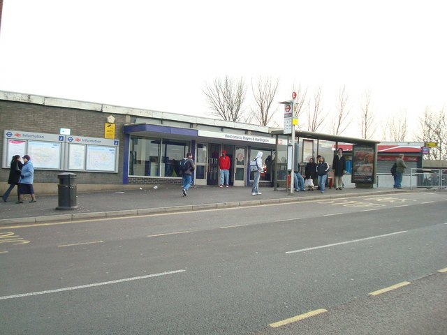
Photo: Stacey Harris, CC BY-SA 2.0.
Hayes & Harlington is a railway station serving the west London districts Hayes and Harlington in the London Borough of Hillingdon. It is in London fare zone 5, 10 miles 71 chains down the line from London Paddington and is situated between Southall and West Drayton. Hayes & Harlington railway station is situated 1 mile east of Conway Drive.
Lake Farm Country Park
Park

Photo: Tony and Maureen Kemp, CC BY-SA 2.0.
Lake Farm Country Park is an expanse of green belt land approximately 60 acres in size fringed by trees and the Grand Union Canal, situated in the south of Hayes in the London Borough of Hillingdon. Lake Farm Country Park is situated 3,900 feet northeast of Conway Drive.
Harlington School
School
Harlington School is a mixed secondary school and sixth form located in the Harlington area of the London Borough of Hillingdon, England. Harlington School is situated 2,700 feet southeast of Conway Drive.
Places in the Area
Nearby places include Harlington and West Drayton.
Harlington
Village

Photo: Rodolph, CC BY-SA 3.0.
Harlington is a district of Hayes in the London Borough of Hillingdon and one of five historic parishes partly developed into London Heathrow Airport and associated businesses, the one most heavily developed being Harmondsworth.
West Drayton
Suburb

Photo: Rod Allday, CC BY-SA 2.0.
West Drayton is a suburban town in the London Borough of Hillingdon. It was an ancient parish in the county of Middlesex and from 1929 was part of the Yiewsley and West Drayton Urban District, which became part of Greater London in 1965.
Hayes
Suburb

Photo: Peter Clare, CC BY-SA 2.0.
Hayes is a town in west London. Historically situated within the county of Middlesex, it is now part of the London Borough of Hillingdon. The town's population, including its localities Hayes End, Harlington and Yeading, was recorded in the 2021 census as 93,928.
Conway Drive
- Type: Bus stop
- Category: transportation
- Location: Hillingdon, Greater London, England, United Kingdom, Britain and Ireland, Europe
- View on OpenStreetMap
Latitude
51.50309° or 51° 30′ 11″ northLongitude
-0.44173° or 0° 26′ 30″ westOpen location code
9C3XGH35+68OpenStreetMap ID
node 469782413OpenStreetMap feature
highway=bus_stopOpenStreetMap feature
public_transport=platform
This page is based on OpenStreetMap, Wikidata, and Wikimedia Commons.
We’d love your help improving our open data sources. Thank you for contributing.
Satellite Map
Discover Conway Drive from above in high-definition satellite imagery.
Places with the Same Name
Discover other places named “Conway Drive”.
Notable Places Nearby
Highlights include Hayes Welfare Association & Abdulla Masjid and Bourne Farm Playing Field.
Nearby Places
Explore places such as Skipton Drive and Bourne news Box.
England: Must-Visit Destinations
Delve into London, Manchester, Sheffield, and Leeds.
Curious Bus Stops to Discover
Uncover intriguing bus stops from every corner of the globe.
About Mapcarta. Data © OpenStreetMap contributors and available under the Open Database License". Text is available under the CC BY-SA 4.0 license, except for photos, directions, and the map. Photo: sidibousaid, CC BY 2.0.