Bentwaters Coach Stop
Bentwaters Coach Stop is a bus stop in Rendlesham, Suffolk Coastal District, England. Bentwaters Coach Stop is situated nearby to the forest Whitmore Wood, as well as near the church St. Felix.| Tap on a place to explore it |
Places of Interest Nearby
Highlights include Bentwaters Cold War Museum and RAF Bentwaters.
Bentwaters Cold War Museum
Museum

Photo: Wikimedia, CC BY-SA 2.0.
Bentwaters Cold War Museum is situated 3,300 feet east of Bentwaters Coach Stop.
RAF Bentwaters

Photo: Wikimedia, Public domain.
Royal Air Force Bentwaters or more simply RAF Bentwaters, now known as Bentwaters Parks, is a former Royal Air Force station about 80 miles northeast of London and 10 miles east-northeast of Ipswich, near Woodbridge, Suffolk in England. RAF Bentwaters is situated 3,300 feet southeast of Bentwaters Coach Stop.
Church of St Gregory the Great
Church
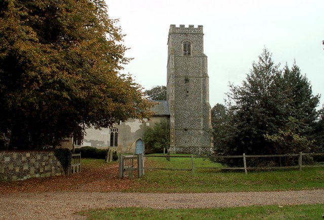
Photo: Robert Edwards, CC BY-SA 2.0.
Church of St Gregory the Great is situated 1 mile west of Bentwaters Coach Stop.
Places in the Area
Nearby places include Rendlesham and Eyke.
Rendlesham
Village
Rendlesham is a village and civil parish near Woodbridge, Suffolk, United Kingdom. It was a royal centre of authority for the king of the East Angles. The proximity of the Sutton Hoo ship burial may indicate a connection between Sutton Hoo and the East Anglian royal house, the Wuffingas.
Eyke
Village

Photo: Oxymoron, CC BY-SA 2.0.
Eyke is a village and a civil parish in the East Suffolk district, in the English county of Suffolk. It is located on the A1152 road near the town of Woodbridge. Eyke is situated 1½ miles southwest of Bentwaters Coach Stop.
Tunstall
Village
Tunstall is a village and civil parish in Suffolk, England. There are two settlements named Tunstall next to each other, 7.5 miles north east of Woodbridge. Tunstall is situated 1½ miles northeast of Bentwaters Coach Stop.
Bentwaters Coach Stop
- Type: Bus stop
- Category: transportation
- Location: Rendlesham, Suffolk Coastal District, Suffolk, East of England, England, United Kingdom, Britain and Ireland, Europe
- View on OpenStreetMap
Latitude
52.12798° or 52° 7′ 41″ northLongitude
1.41849° or 1° 25′ 7″ eastOpen location code
9F434CH9+59OpenStreetMap ID
node 471498406OpenStreetMap feature
highway=bus_stopOpenStreetMap feature
public_transport=platform
This page is based on OpenStreetMap, Wikidata, and Wikimedia Commons.
We’d love your help improving our open data sources. Thank you for contributing.
Satellite Map
Discover Bentwaters Coach Stop from above in high-definition satellite imagery.
Notable Places Nearby
Highlights include Whitmore Wood and St. Felix.
Nearby Places
Explore places such as Magnolia Drive and Sycamore Drive.
Suffolk: Must-Visit Destinations
Delve into Ipswich, Bury St Edmunds, Lowestoft, and Felixstowe.
Curious Bus Stops to Discover
Uncover intriguing bus stops from every corner of the globe.
About Mapcarta. Data © OpenStreetMap contributors and available under the Open Database License". Text is available under the CC BY-SA 4.0 license, except for photos, directions, and the map. Photo: Wikimedia, CC0.