Asrar Al Behar Caterhng
Asrar Al Behar Caterhng is in Northern, Bahrain, and is located on Al Naqeel Highway. Asrar Al Behar Caterhng is situated nearby to the mosque مسجد الشيخ ميثم, as well as near مسجد الشيخ علي الغربي (عبدالصالح).| Tap on a place to explore it |
Places of Interest Nearby
Highlights include Barbar Temple and Bahrain Fort.
Barbar Temple
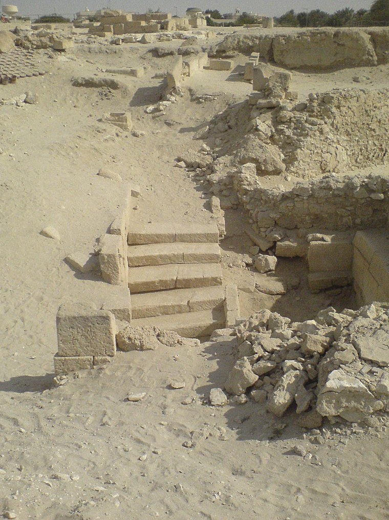
Photo: Graeme, CC BY-SA 2.0.
The Barbar Temple is an archaeological site located in the village of Barbar, Bahrain, considered to be part of the Dilmun culture. The most recent of the three Barbar temples was rediscovered by a Danish archaeological team in 1954. Barbar Temple is situated 1 km southwest of Asrar Al Behar Caterhng.
Bahrain Fort
Castle
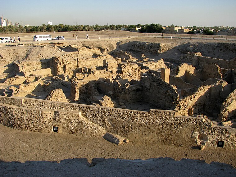 The Qal'at al-Bahrain, also known as the Bahrain Fort or Portuguese Fort, is an archaeological site located in Bahrain. Archaeological excavations carried out since 1954 have unearthed antiquities from an artificial mound of 12 m height containing seven stratified layers, created by various occupants from 2300 BC up to the 18th century, including Kassites, Greeks, Portuguese and Persians. Bahrain Fort is situated 2½ km east of Asrar Al Behar Caterhng.
Ain Umm Sujoor
Archaeological site
 The Ain Umm Sujoor is an archaeological site located in the village of Diraz, Bahrain. Believed to have been built during the 3rd millennium BC, the site consists of an oval hollow, approximately 60x30 meters, with two wells, several rooms and ovens. Ain Umm Sujoor is situated 2½ km southwest of Asrar Al Behar Caterhng.
Places in the Area
Nearby places include Jid Al-Haj and Karbabad.
Karbabad
Village
Karbabad is a village situated in the northern part of the Kingdom of Bahrain, along the northern coastline bordering the Persian Gulf. The village is famously known for being close to the location of the UNESCO World Heritage Site Qal'at al-Bahrain. Karbabad is situated 3½ km east of Asrar Al Behar Caterhng.
Al Markh
Village

Photo: Mohd Almosawy, CC BY-SA 4.0.
Al Markh is one of the oldest and smallest villages of Bahrain. It neighbors Budaiya highway and the village of Duraz to the north, Saar and Magaba highway to the east, the villages of Bani Jamra and Al Garya to the west, and the village of Saar to the south. Al Markh is situated 3½ km southwest of Asrar Al Behar Caterhng.
Asrar Al Behar Caterhng
- Type: Catering
- Address: Al Naqeel Highway
- Category: workshop
- Location: Northern, Bahrain, Middle East, Asia
- View on OpenStreetMap
Latitude
26.23098° or 26° 13′ 52″ northLongitude
50.49358° or 50° 29′ 37″ eastOpen location code
7HRG6FJV+9COpenStreetMap ID
node 4773116815OpenStreetMap feature
craft=caterer
This page is based on OpenStreetMap, Wikidata, and Wikimedia Commons.
We’d love your help improving our open data sources. Thank you for contributing.
Satellite Map
Discover Asrar Al Behar Caterhng from above in high-definition satellite imagery.
Notable Places Nearby
Highlights include مسجد الشيخ ميثم and مسجد الشيخ نسيم (مدخَل الإسكان).
Nearby Places
Explore places such as Alshenow Cafeteria and Salil Al Anbeaa For Food Stuff.
Bahrain: Must-Visit Destinations
Delve into Manama, Muharraq, Riffa, and Southern Governorate.
Curious Places to Discover
Uncover intriguing places from every corner of the globe.
About Mapcarta. Data © OpenStreetMap contributors and available under the Open Database License". Text is available under the CC BY-SA 4.0 license, except for photos, directions, and the map. Photo: Peter, CC BY 2.0.