El Cafetín de María
El Cafetín de María is a pub in Valladolid, Castile and León. El Cafetín de María is situated nearby to the public building Salón de actos, as well as near the church Iglesia de San Agustín.| Tap on a place to explore it |
Places of Interest Nearby
Highlights include Museo Oriental de Valladolid and Valladolid-Campo Grande railway station.
Museo Oriental de Valladolid
Museum
 Museo Oriental de Valladolid is a museum, which is situated 140 metres east of El Cafetín de María.
Valladolid-Campo Grande railway station
Railway station
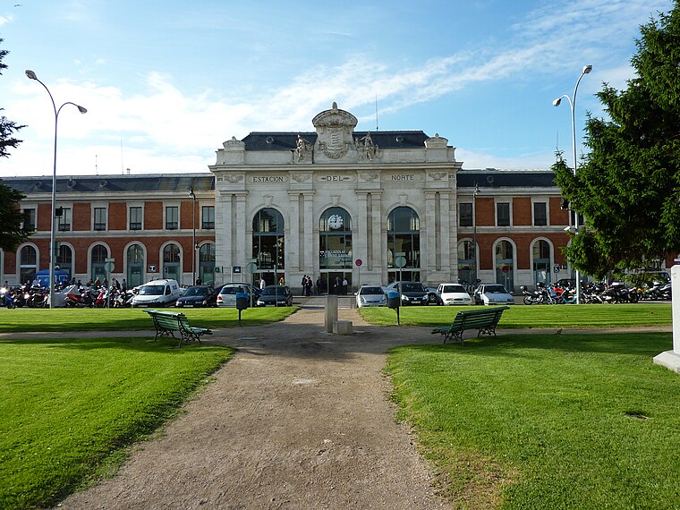
Photo: Klockarnils, CC BY-SA 3.0.
Valladolid-Campo Grande railway station serves the Spanish city of Valladolid. It is served by the Madrid–León high-speed rail line to Madrid-Chamartín and regional trains to Santander, Ponferrada and Vitoria-Gasteiz. Valladolid-Campo Grande railway station is situated 400 metres southeast of El Cafetín de María.
Hospital Militar, Valladolid
Government building

Photo: Nicolás Pérez, CC BY-SA 4.0.
Hospital Militar, Valladolid is a government building, which is situated 200 metres west of El Cafetín de María.
Places in the Area
Nearby places include La Circular and La Rondilla.


Arroyo de la Encomienda
Town
 Arroyo de la Encomienda is a municipality located in the province of Valladolid, Castile and León, Spain. According to the 2015 census, the municipality has a population of 18491 inhabitants. Arroyo de la Encomienda is situated 5 km southwest of El Cafetín de María.
El Cafetín de María
- Type: Pub
- Location: Valladolid, Valladolid, Castile and León, Central Spain, Spain, Iberia, Europe
- View on OpenStreetMap
Latitude
41.64369° or 41° 38′ 37″ northLongitude
-4.73124° or 4° 43′ 52″ westOpen location code
8CHQJ7V9+FGOpenStreetMap ID
node 4827162726OpenStreetMap feature
amenity=pub
This page is based on OpenStreetMap, Wikidata, and Wikimedia Commons.
We’d love your help improving our open data sources. Thank you for contributing.
Satellite Map
Discover El Cafetín de María from above in high-definition satellite imagery.
In Other Languages
“El Cafetín de María” goes by many names.
- Spanish: “El Cafetín de María”
Notable Places Nearby
Highlights include Salón de actos and Iglesia de San Agustín.
Nearby Places
Explore places such as Paseo Arco Ladrillo 3 esquina Aragón and Paseo Arco Ladrillo 8 esquina Paseo Hospital Militar.
Castile and León: Must-Visit Destinations
Delve into Salamanca, Segovia, León, and Burgos.
Curious Pubs to Discover
Uncover intriguing pubs from every corner of the globe.
About Mapcarta. Data © OpenStreetMap contributors and available under the Open Database License". Text is available under the CC BY-SA 4.0 license, except for photos, directions, and the map. Photo: Wikimedia, CC BY 2.5.