Turó de Torreferrera
Turó de Torreferrera is a peak in Sant Cugat del Vallès, Barcelona, Catalonia and has an elevation of 202 metres. Turó de Torreferrera is situated nearby to the locality la Torre Negra, as well as near Can Fatjó.| Tap on a place to explore it |
Photo: Clemens Schmillen, CC BY-SA 4.0.
Places of Interest
Highlights include Ca n’Oliver Iberian Settlement and Museum and Torre Negra.
Ca n’Oliver Iberian Settlement and Museum
Archaeological site

Photo: Clemens Schmillen, CC BY-SA 4.0.
The Ca n'Oliver Iberian settlement is a very large Iberian settlement found in the Collserola mountain range, in the territory formerly known as Laietania, in present-day Cerdanyola del Vallès.
Torre Negra

Photo: Enric, CC BY-SA 4.0.
Torre Negra is a 12th-century fort built in 1145 in Catalonia, to defend the territories of Sant Cugat. Torre Negra is a fortified building built in a strategic defensive position.

Places in the Area
Nearby places include Collserola Natural Park and Sant Martí.
Collserola Natural Park

Photo: Ochoajuli, Public domain.
Collserola Natural Park is a park the preserves part of the Serra de Collserola mountains in Barcelona and Barcelona city.
Sant Martí
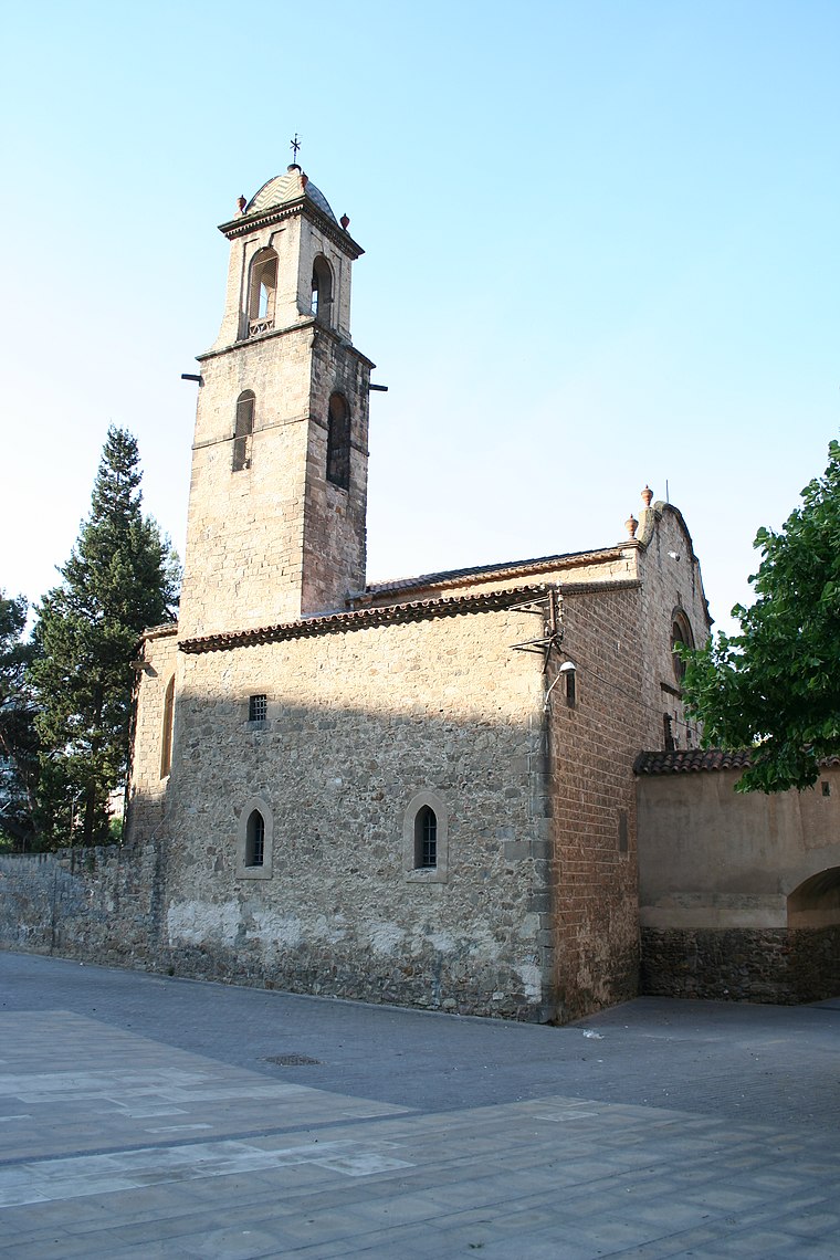
Photo: Wikimedia, CC BY-SA 3.0.
Sant Martí is a district in Barcelona which extends north of the Ciutat Vella. Developed from the former industrial areas of Poblenou, medieval district of Clot and suburbs of Sant Martí, it became a place of large-scale ambitious urban redevelopment.
Inland Suburbs

Photo: Pure-football, CC BY-SA 3.0.
The Inland Suburbs are the districts that ring the main part of Barcelona. To the southwest, it includes Les Corts and Sarrià-Sant Gervasi, and to the northwest it includes Horta-Guinardo, Nou Barris and Sant Andreau.
Turó de Torreferrera
- Type: Peak with an elevation of 202 metres
- Description: mountain in Spain
- Categories: mountain and landform
- Location: Sant Cugat del Vallès, Barcelona, Catalonia, Eastern Spain, Spain, Iberia, Europe
- View on OpenStreetMap
Latitude
41.4662° or 41° 27′ 58″ northLongitude
2.1176° or 2° 7′ 3″ eastElevation
202 metres (663 feet)Open location code
8FH4F489+F2OpenStreetMap ID
node 4838474910OpenStreetMap feature
natural=peakWikidata ID
Q11953573
This page is based on OpenStreetMap, Wikidata, and Wikimedia Commons.
We’d love your help improving our open data sources. Thank you for contributing.
Satellite Map
Discover Turó de Torreferrera from above in high-definition satellite imagery.
In Other Languages
From Breton to Venetian—“Turó de Torreferrera” goes by many names.
- Breton: “Turó de Torreferrera”
- Catalan: “Turó de Torreferrera”
- Czech: “Torreferrera”
- Danish: “Torreferrera”
- Dutch: “Turó de Torreferrera”
- French: “Turó de Torreferrera”
- Italian: “Turó de Torreferrera”
- Ladin: “Turó de Torreferrera”
- Occitan (post 1500): “Turó de Torreferrera”
- Spanish: “Torreferrera”
- Venetian: “Turó de Torreferrera”
Localities in the Area
Explore places such as la Torre Negra and Can Fatjó.
Notable Places Nearby
Highlights include Camp de Futbol and Piscina.
Barcelona: Must-Visit Destinations
Delve into Barcelona, Malgrat de Mar, Terrassa, and Badalona.
Curious Peaks to Discover
Uncover intriguing peaks from every corner of the globe.
About Mapcarta. Data © OpenStreetMap contributors and available under the Open Database License". Text is available under the CC BY-SA 4.0 license, except for photos, directions, and the map. Photo: Clemens Schmillen, CC BY-SA 4.0.