Tram stop Muntplein
Tram stop Muntplein is a tram stop in Government of Amsterdam, North Holland. Tram stop Muntplein is situated nearby to the movie theater Pathé De Munt, as well as near Munttoren.| Tap on a place to explore it |
Photo: Ceescamel, CC BY-SA 4.0.
- Type: Tram stop
- Description: tram stop in Amsterdam, Netherlands
- Wheelchair access: yes
Places of Interest Nearby
Highlights include Canal District and Munttoren.
Canal District

Photo: Massimo Catarinella, CC BY-SA 3.0.
The Canal District is the famous 17th-century district surrounding the Binnenstad of Amsterdam. The whole district is designated as a UNESCO World Heritage Site for its unique cultural and historical value, and its property values are among the highest in the country.
Munttoren

Photo: P.H. Louw, CC BY 2.5 nl.
The Munttoren or Munt is a tower in Amsterdam, Netherlands. It stands on the busy Muntplein square, where the Amstel river and the Singel canal meet, near the flower market and the eastern end of the Kalverstraat shopping street.
Bloemenmarkt
Marketplace

Photo: Massimo Catarinella, CC BY-SA 3.0.
The Bloemenmarkt is the world's only floating flower market. Founded in 1862, it is sited in Amsterdam, Netherlands, on the Singel canal between Muntplein and Koningsplein in the city's southern canal belt. Bloemenmarkt is situated 140 metres northwest of Tram stop Muntplein.
Places in the Area
Nearby places include Amsterdam-Centrum and Burgwallen Oude Zijde.
Amsterdam-Centrum
Suburb
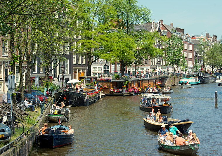
Photo: kevinmcgill, CC BY-SA 2.0.
Amsterdam-Centrum is the inner-most borough and historical city centre of Amsterdam, Netherlands, containing the majority of the city's landmarks. Established in 2002, Amsterdam-Centrum was the last area in the city to be granted the status of self-governing borough.
Burgwallen Oude Zijde
Quarter

Photo: Cainebogdan, Public domain.
Burgwallen Oude Zijde is a neighborhood of Amsterdam, Netherlands.
Amsterdam

Photo: Fabienkhan, CC BY-SA 2.5.
Amsterdam is the capital of the Netherlands. It is known for the canals that cross the city, its impressive architecture, museums and art galleries, its notorious red light district, and more than 1,500 bridges.
Tram stop Muntplein
- Categories: railway stop, transport stop, and transportation
- Location: Government of Amsterdam, North Holland, Western Netherlands, Netherlands, Benelux, Europe
- View on OpenStreetMap
Latitude
52.36627° or 52° 21′ 59″ northLongitude
4.89313° or 4° 53′ 35″ eastOpen location code
9F469V8V+G7OpenStreetMap ID
node 4851477410OpenStreetMap feature
public_transport=stop_positionOpenStreetMap feature
railway=tram_stopOpenStreetMap attribute
wheelchair=yesWikidata ID
Q111442480
This page is based on OpenStreetMap, Wikidata, and Wikimedia Commons.
We’d love your help improving our open data sources. Thank you for contributing.
Satellite Map
Discover Tram stop Muntplein from above in high-definition satellite imagery.
In Other Languages
From Dutch to Spanish—“Tram stop Muntplein” goes by many names.
- Dutch: “Tramhalte Muntplein”
- French: “Arrêt de tramway Muntplein”
- French: “Muntplein”
- German: “Straßenbahnhaltestelle Muntplein”
- Spanish: “Parada de tranvía Muntplein”
Notable Places Nearby
Highlights include Pathé De Munt and Flash Casino.
Nearby Places
Explore places such as Muntplein and Amsterdam, Muntplein.
North Holland: Must-Visit Destinations
Delve into Amsterdam, Haarlem, Alkmaar, and Schiphol Airport.
Curious Tram Stops to Discover
Uncover intriguing tram stops from every corner of the globe.
About Mapcarta. Data © OpenStreetMap contributors and available under the Open Database License". Text is available under the CC BY-SA 4.0 license, except for photos, directions, and the map. Photo: Ceescamel, CC BY-SA 4.0.