Penn Street (S7)
Penn Street (S7) is a bus stop in Bristol, England. Penn Street (S7) is situated nearby to the amusement arcade ImmotionVR, as well as near the miniature golf course Jungle Rumble Adventure Golf.| Tap on a place to explore it |
Places of Interest Nearby
Highlights include Cabot Circus and Bristol Castle.
Cabot Circus
Shopping center

Photo: Ajuk, CC BY-SA 3.0.
Cabot Circus is a covered shopping centre in Bristol, England. It is adjacent to Broadmead, a shopping district in Bristol city centre. The Cabot Circus development area contains shops, offices, a hotel, 250 apartments and a cinema.
Bristol Castle
Archaeological site
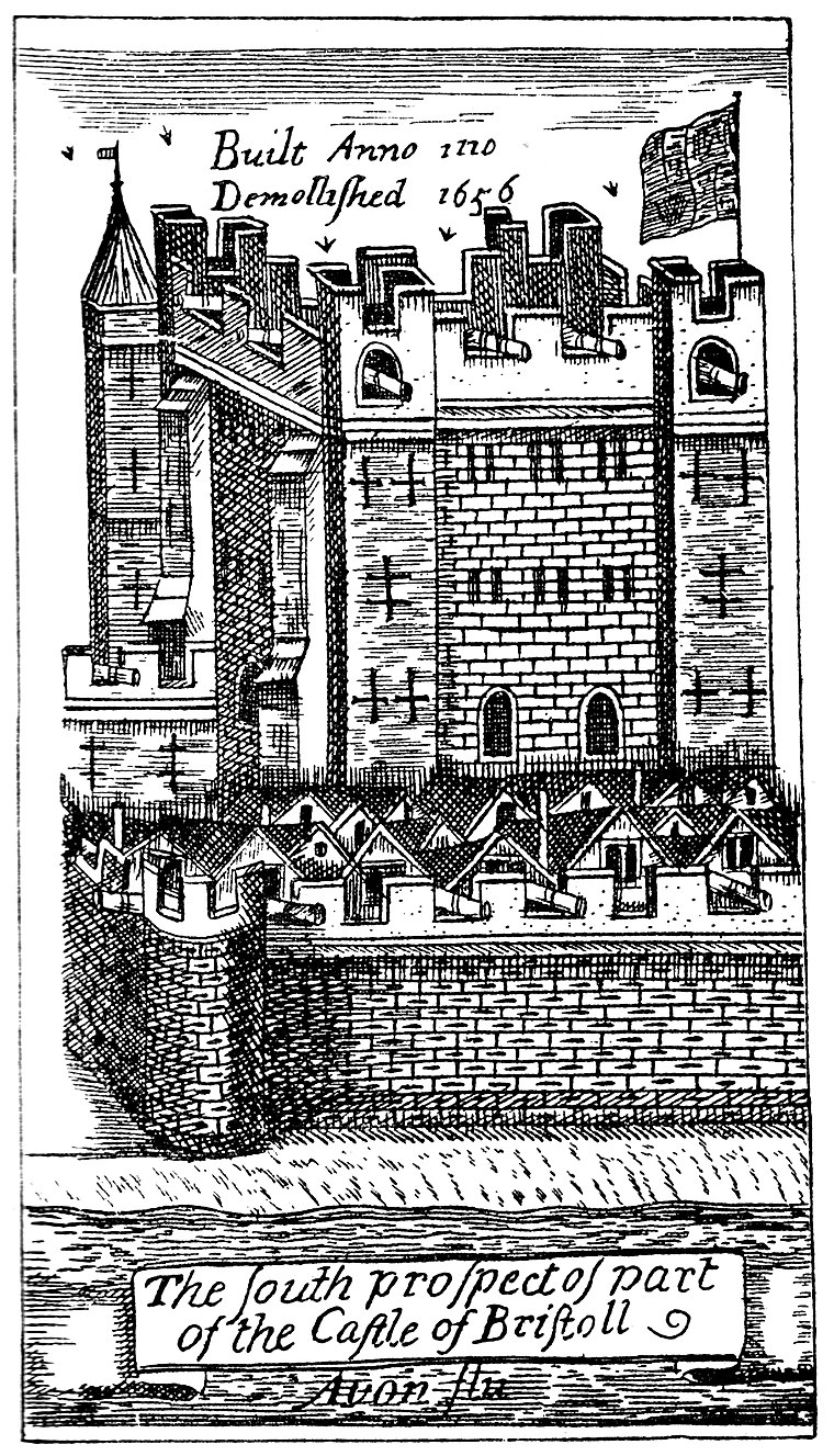
Photo: Wikimedia, Public domain.
Bristol Castle was a Norman castle established in the late 11th century on the north bank of the River Avon in Bristol. Remains can be seen today in Castle Park near the Broadmead Shopping Centre, including the sally port. Bristol Castle is situated 990 feet south of Penn Street (S7).
The Galleries
Shopping center

Photo: Mattbuck, CC BY-SA 3.0.
The Galleries is a shopping mall in the Broadmead area of Bristol city centre, England. Functioning as one of the city's retail malls, it is a three-storey building, which spans over Fairfax Street. The Galleries is situated 940 feet southwest of Penn Street (S7).
Places in the Area
Nearby places include Broadmead and St Pauls.
Broadmead
Suburb
Broadmead is a street in Bristol city centre in England, which has given its name to the principal shopping district of the city. It is part of Bristol Shopping Quarter.
St Pauls
Suburb
St Pauls is an inner suburb of Bristol, England, lying just northeast of the city centre and west of the M32. It is bounded by the A38, the B4051, the A4032 and the A4044, although the River Frome was traditionally the eastern boundary before the A4032 was constructed.
St Jude’s
Neighborhood
St Jude's is a mixed residential, commercial and light industrial area of central Bristol, England. St Jude's forms part of the Lawrence Hill ward of Bristol City Council.
Penn Street (S7)
- Type: Bus stop
- Also known as: “Penn Street (C)”
- Category: transportation
- Location: Bristol, England, United Kingdom, Britain and Ireland, Europe
- View on OpenStreetMap
Latitude
51.45845° or 51° 27′ 30″ northLongitude
-2.58674° or 2° 35′ 12″ westOpen location code
9C3VFC57+98OpenStreetMap ID
node 485403950OpenStreetMap feature
highway=bus_stopOpenStreetMap feature
public_transport=platform
This page is based on OpenStreetMap, Wikidata, and Wikimedia Commons.
We’d love your help improving our open data sources. Thank you for contributing.
Satellite Map
Discover Penn Street (S7) from above in high-definition satellite imagery.
Notable Places Nearby
Highlights include ImmotionVR and Concorde Street.
Nearby Places
Explore places such as Penn Street (S7) and Wingstop.
England: Must-Visit Destinations
Delve into London, Manchester, Sheffield, and Leeds.
Curious Bus Stops to Discover
Uncover intriguing bus stops from every corner of the globe.
About Mapcarta. Data © OpenStreetMap contributors and available under the Open Database License". Text is available under the CC BY-SA 4.0 license, except for photos, directions, and the map. Photo: sidibousaid, CC BY 2.0.