Fentons Ice Cream
Fentons Ice Cream is an ice cream parlor in Westminster, Greater London, England which is located on Bayswater Road. Fentons Ice Cream is situated nearby to the metro station Queensway tube station, as well as near the hotel Hilton London Hyde Park.| Tap on a place to explore it |
Places of Interest Nearby
Highlights include Queensway tube station and Diana, Princess of Wales Memorial Playground.
Queensway tube station
Metro station
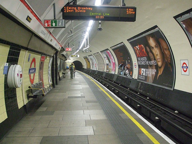
Photo: Sunil060902, CC BY-SA 3.0.
Queensway is a London Underground station in Bayswater, just inside the boundary of the City of Westminster with the Royal Borough of Kensington and Chelsea.
Diana, Princess of Wales Memorial Playground
Playground

Photo: Mark Ahsmann, CC BY-SA 3.0.
The Diana, Princess of Wales Memorial Playground is a memorial to Diana, Princess of Wales, in Kensington Gardens, in The Royal Borough of Kensington and Chelsea, London. Diana, Princess of Wales Memorial Playground is situated 530 feet south of Fentons Ice Cream.
Kensington Gardens
Park

Photo: Diliff, CC BY-SA 3.0.
Kensington Gardens, once part of the private gardens of Kensington Palace, are now among the Royal Parks of London and largely open to the public. The gardens are shared by the City of Westminster and the Royal Borough of Kensington and Chelsea and sit immediately to the west of Hyde Park, in west London.
Places in the Area
Nearby places include Black Lion Gate and Bayswater.

Bayswater
Suburb
Photo: Wikimedia, Public domain.
Bayswater is an area in the City of Westminster. It is a built-up district with a population density of 17,500 per square kilometre, and is located between Kensington Gardens to the south, Paddington to the north-east, and Notting Hill to the west.
Hallfield Estate
Neighborhood

Photo: HallfieldResident, Public domain.
The Hallfield Estate is one of several modernist housing projects in Bayswater, City of Westminster, and was designed in the immediate postwar period by the Tecton architecture practice, led by Berthold Lubetkin.
Fentons Ice Cream
- Type: Ice cream parlor
- Address: 127 Bayswater Road, London, W2 4RH
- Category: food
- Location: Westminster, Greater London, London, England, United Kingdom, Britain and Ireland, Europe
- View on OpenStreetMap
Latitude
51.51039° or 51° 30′ 37″ northLongitude
-0.18732° or 0° 11′ 14″ westOpen location code
9C3XGR67+53OpenStreetMap ID
node 4855558088OpenStreetMap feature
amenity=ice_cream
This page is based on OpenStreetMap, Wikidata, and Wikimedia Commons.
We’d love your help improving our open data sources. Thank you for contributing.
Satellite Map
Discover Fentons Ice Cream from above in high-definition satellite imagery.
Notable Places Nearby
Highlights include Hilton London Hyde Park and Barry’s.
Nearby Places
Explore places such as Lo Spuntino and Eurochange.
London: Must-Visit Destinations
Delve into South Kensington-Chelsea, Heathrow Airport, City of London, and South London.
Curious Ice Cream Parlors to Discover
Uncover intriguing ice cream parlors from every corner of the globe.
About Mapcarta. Data © OpenStreetMap contributors and available under the Open Database License". Text is available under the CC BY-SA 4.0 license, except for photos, directions, and the map. Photo: Pablo BM, CC BY 2.0.