Die Guldenschlucht
Die Guldenschlucht is in Homburg, Kreisstadt, Saarpfalz-Kreis, Saarland. Die Guldenschlucht is situated nearby to the peak Hungerberg, as well as near the forest Hainbuchen.| Tap on a place to explore it |
Places of Interest Nearby
Highlights include Apostelkirche and Einöd (Saar) station.
Apostelkirche
Church

Photo: Mstp77, CC BY-SA 3.0.
Apostelkirche is a church, which is situated 1½ km north of Die Guldenschlucht.
Einöd (Saar) station
Railway stop
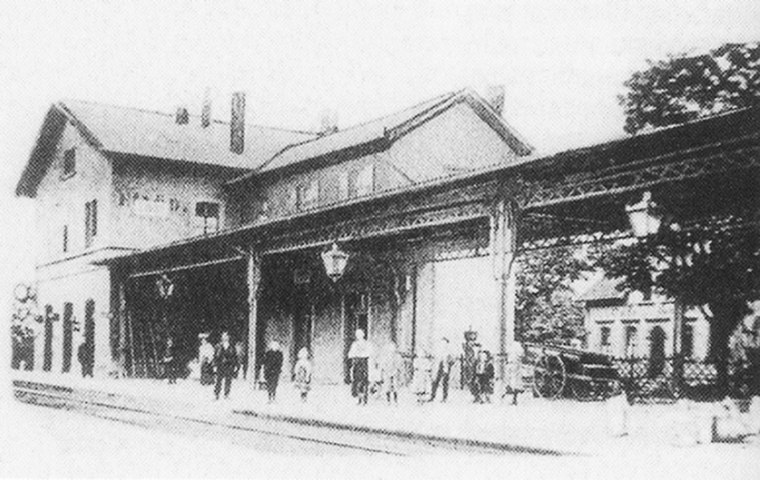
Photo: Wikimedia, Public domain.
Einöd (Saar) station is a railway stop, which is situated 1¼ km north of Die Guldenschlucht.
Schule
School

Photo: FlocciNivis, CC BY 4.0.
Schule is a school, which is situated 2 km north of Die Guldenschlucht.
Places in the Area
Nearby places include Bierbach an der Blies and Zweibrücken.
Bierbach an der Blies
Suburb

Photo: Wikimedia, CC BY-SA 3.0.
Bierbach an der Blies is a part of Blieskastel, Saarland, Germany. It is part of the Bliesgau and was founded on the right river bank of the Blies. As a consequence of the territorial and administrative reform of 1974 in Saarland, Bierbach ceased… Bierbach an der Blies is situated 2½ km west of Die Guldenschlucht.
Zweibrücken
Town

Photo: Thomas W. Jefferson, CC BY-SA 3.0.
Zweibrücken is a town in Rhineland-Palatinate, Germany, on the Schwarzbach River. Zweibrücken is situated 3½ km east of Die Guldenschlucht.
Webenheim
Suburb

Photo: Wikimedia, CC BY-SA 3.0.
Webenheim is a suburb, which is situated 3½ km southwest of Die Guldenschlucht.
Die Guldenschlucht
- Type: Sign
- Categories: information and tourism
- Location: Homburg, Kreisstadt, Saarpfalz-Kreis, Saarland, Germany, Central Europe, Europe
- View on OpenStreetMap
Latitude
49.25498° or 49° 15′ 18″ northLongitude
7.31781° or 7° 19′ 4″ eastOpen location code
8FX97839+X4OpenStreetMap ID
node 4880352559OpenStreetMap feature
tourism=information
This page is based on OpenStreetMap, Wikidata, and Wikimedia Commons.
We’d love your help improving our open data sources. Thank you for contributing.
Satellite Map
Discover Die Guldenschlucht from above in high-definition satellite imagery.
Notable Places Nearby
Highlights include Hungerberg and Hainbuchen.
Nearby Places
Explore places such as Buchenhof and Die Guldenschlucht.
Saarland: Must-Visit Destinations
Delve into Saarbrücken, Saarlouis, Homburg, and Merzig.
Curious Places to Discover
Uncover intriguing places from every corner of the globe.
About Mapcarta. Data © OpenStreetMap contributors and available under the Open Database License". Text is available under the CC BY-SA 4.0 license, except for photos, directions, and the map. Photo: wolfgangstaudt, CC BY 2.0.