Gschleitboden
Gschleitboden is a peak in Pfitsch, South Tyrol, Trentino-Alto Adige. Gschleitboden is situated nearby to the hamlet Gögl, as well as near the village Wiesen.| Tap on a place to explore it |
Places of Interest
Highlights include Vipiteno-Val di Vizze/Sterzing-Pfitsch railway station and Strassberg Castle.
Vipiteno-Val di Vizze/Sterzing-Pfitsch railway station
Railway station
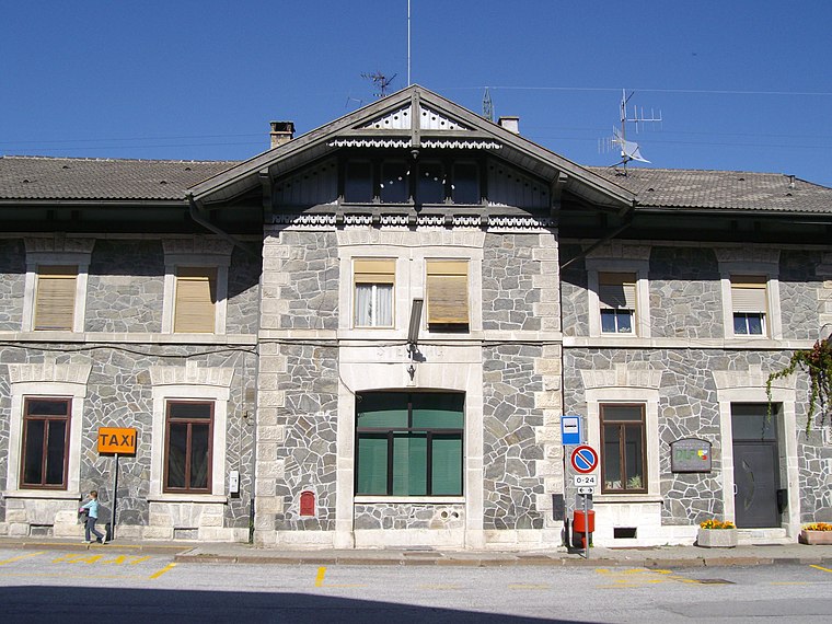
Photo: Wikimedia, Public domain.


Places in the Area
Nearby places include Sterzing and Gossensass.
Sterzing

Photo: Lkcl it, CC BY-SA 3.0.
Sterzing is in South Tyrol. The city is just south of the Brenner Pass. This historic Alpine town is the main town of the Wipptal region and advertises itself as the gateway to South Tyrol.


Gschleitboden
- Type: Peak
- Categories: cross and landform
- Location: Pfitsch, South Tyrol, Trentino-Alto Adige, Northeast Italy, Italy, Europe
- View on OpenStreetMap
Latitude
46.9077° or 46° 54′ 28″ northLongitude
11.4646° or 11° 27′ 53″ eastOpen location code
8FRHWF57+3ROpenStreetMap ID
node 4920333184OpenStreetMap feature
man_made=crossOpenStreetMap feature
natural=peak
This page is based on OpenStreetMap, Wikidata, and Wikimedia Commons.
We’d love your help improving our open data sources. Thank you for contributing.
Satellite Map
Discover Gschleitboden from above in high-definition satellite imagery.
Localities in the Area
Explore places such as Gögl and Schmuders - Smudres.
Notable Places Nearby
Highlights include Gerstegg and Burgstall.
South Tyrol: Must-Visit Destinations
Delve into Bolzano, Brixen, Merano, and Bruneck.
Curious Peaks to Discover
Uncover intriguing peaks from every corner of the globe.
About Mapcarta. Data © OpenStreetMap contributors and available under the Open Database License". Text is available under the CC BY-SA 4.0 license, except for photos, directions, and the map. Photo: Benreis, CC BY 3.0.