Main Street Sweets
Main Street Sweets is a confectionery store in Contra Costa, California which is located on Main Street. Main Street Sweets is situated nearby to Martinez Library, as well as near the public building Contra Costa Coumunity College District.| Tap on a place to explore it |
- Opening hours: Monday—Saturday 11:30 AM—5:30 PM
- Type: Confectionery store
- Address: 815 Main Street, Martinez, CA 94553
Places of Interest Nearby
Highlights include Martinez station and St. Catherine of Siena School.
Martinez station
Railway station
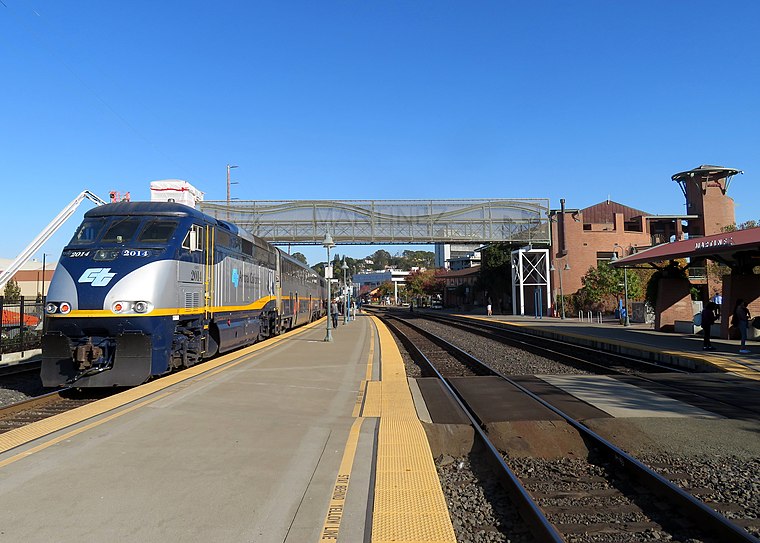
Photo: Pi.1415926535, CC BY-SA 3.0.
Martinez station is an Amtrak passenger train station in Martinez, California, United States. Located at the west end of downtown Martinez, the station has one side platform and one island platform, which serve three of the four tracks of the Union Pacific Railroad Martinez Subdivision. Martinez station is situated 1,000 feet northwest of Main Street Sweets.
St. Catherine of Siena School
School
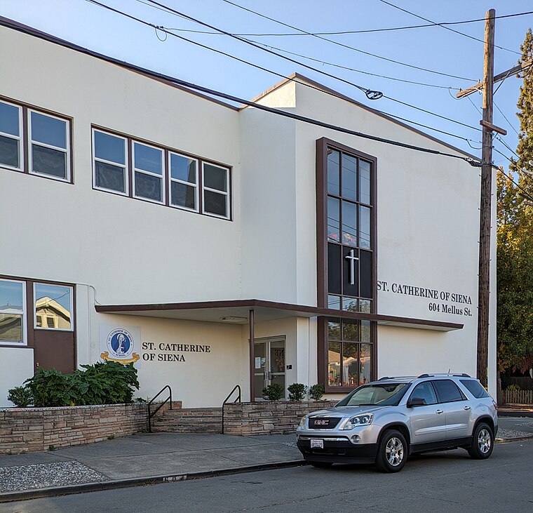
Photo: Mx. Granger, CC0.
St. Catherine of Siena School in Martinez, California is a Catholic school in the Diocese of Oakland. The school has a Preschool and serves students in Kindergarten through Eighth Grade. St. Catherine of Siena School is situated 1,300 feet south of Main Street Sweets.
Forester
Disaster remains

Photo: Rob Hodgkins, CC BY-SA 2.0.
The Forester was a schooner vessel constructed in Alameda in November 1900. The construction was overseen by Captain Otto Daeweritz who served as the only captain of the vessel during the Forester's 75 year history. Forester is situated 3,400 feet northwest of Main Street Sweets.
Places in the Area
Nearby places include Martinez and Mountain View.
Martinez

Photo: Mx. Granger, CC0.
Martinez is in the outer East Bay in the San Francisco Bay Area in California. Martinez has easy access to nature, so it's no wonder the famed naturalist John Muir decided to settle here.
Mountain View
Village
Mountain View is a census designated place in Contra Costa County, California, United States. The population was 2,622 at the 2020 census.
Mococo
Hamlet
Mococo is a former unincorporated community, now annexed to the city of Martinez, located in Contra Costa County, East Bay region, California. It became known as Mococo following the 1905 arrival of a smelting works, operated by the Mountain Copper Company.
Main Street Sweets
- Categories: shop, ice cream parlor, and food
- Location: Contra Costa, California, United States, North America
- View on OpenStreetMap
Latitude
38.018° or 38° 1′ 5″ northLongitude
-122.13549° or 122° 8′ 8″ westOpen location code
84CV2V97+6ROpenStreetMap ID
node 4959112238OpenStreetMap feature
amenity=ice_creamOpenStreetMap feature
shop=confectionery
This page is based on OpenStreetMap, Wikidata, and Wikimedia Commons.
We’d love your help improving our open data sources. Thank you for contributing.
Satellite Map
Discover Main Street Sweets from above in high-definition satellite imagery.
Places with the Same Name
Discover other places named “Main Street Sweets”.
Notable Places Nearby
Highlights include Martinez Library and Contra Costa County Office of the Public Defender.
Nearby Places
Explore places such as Hook Building and Whiskey Lane.
California: Must-Visit Destinations
Delve into San Francisco, Los Angeles, San Diego, and Sacramento.
Curious Confectionery Stores to Discover
Uncover intriguing confectionery stores from every corner of the globe.
About Mapcarta. Data © OpenStreetMap contributors and available under the Open Database License". Text is available under the CC BY-SA 4.0 license, except for photos, directions, and the map. Photo: Wikimedia, CC0.