FlightClub LosAngeles
FlightClub LosAngeles is a shoe store in Los Angeles, Southern California, California which is located on North Fairfax Avenue. FlightClub LosAngeles is situated nearby to the movie theater Cinefamily, as well as near the place of worship Baba Sale Congregation.| Tap on a place to explore it |
Places of Interest Nearby
Highlights include Cinefamily and Fairfax Senior High School.
Cinefamily
Movie theater
 The Cinefamily was a non-profit cinematheque located in Beverly Grove, Los Angeles, at the historic Silent Movie Theatre. The Cinefamily's mission statement was to "reinvigorate the movie-going experience by fostering a spirit of community and a sense… Cinefamily is situated 630 feet north of FlightClub LosAngeles.
Fairfax Senior High School
School
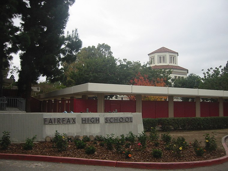
Photo: Minnaert, Public domain.
Fairfax High School is a Los Angeles Unified School District high school located in Los Angeles, California, near the border of West Hollywood in the Fairfax District. Fairfax Senior High School is situated 830 feet northeast of FlightClub LosAngeles.
Los Angeles County Museum of Art
Museum

Photo: Carol M. Highsmith, Public domain.
The Los Angeles County Museum of Art is an art museum located on Wilshire Boulevard in the Miracle Mile vicinity of Los Angeles. LACMA is on Museum Row, adjacent to the La Brea Tar Pits. Los Angeles County Museum of Art is situated 1¼ miles south of FlightClub LosAngeles.
Places in the Area
Nearby places include Fairfax District and Beverly Grove.
Fairfax District
Suburb

Photo: Kkmd, CC BY-SA 3.0.
The Fairfax District is a neighborhood in the Central region of Los Angeles, California. Historically the Fairfax District has been a center of the Jewish community in Los Angeles.
Beverly Grove
Quarter
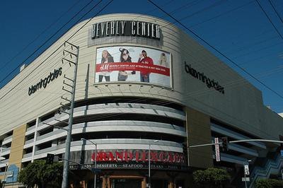
Photo: NotoriousJMG1, Public domain.
Beverly Grove is a neighborhood within the Mid-City West region of Los Angeles, California, adjacent to Beverly Hills. The median household income in 2024 dollars was $119,223, among the highest for Los Angeles and the county.
West Hollywood

Photo: Wikimedia, CC BY-SA 3.0.
West Hollywood is a city on the West Side of Los Angeles, sandwiched between the Hollywood and Fairfax districts of Los Angeles to the east and Beverly Hills to the west.
FlightClub LosAngeles
- Type: Shoe store
- Address: 503 North Fairfax Avenue, 90048
- Category: shop
- Location: Los Angeles, Southern California, California, United States, North America
- View on OpenStreetMap
Latitude
34.08029° or 34° 4′ 49″ northLongitude
-118.36174° or 118° 21′ 42″ westOpen location code
85633JJQ+48OpenStreetMap ID
node 4980785869OpenStreetMap feature
shop=shoes
This page is based on OpenStreetMap, Wikidata, and Wikimedia Commons.
We’d love your help improving our open data sources. Thank you for contributing.
Satellite Map
Discover FlightClub LosAngeles from above in high-definition satellite imagery.
Notable Places Nearby
Highlights include Baba Sale Congregation and Gunther-Hirsh Family Center.
Nearby Places
Explore places such as Dave’s Hot Chichen and Pearl’s Finest Tea.
Los Angeles: Must-Visit Destinations
Delve into Hollywood, San Gabriel Valley, San Fernando Valley, and Long Beach.
Curious Shoe Stores to Discover
Uncover intriguing shoe stores from every corner of the globe.
About Mapcarta. Data © OpenStreetMap contributors and available under the Open Database License". Text is available under the CC BY-SA 4.0 license, except for photos, directions, and the map. Photo: Mfield, CC BY-SA 3.0.