Agrelo y Virrey Liniers
Agrelo y Virrey Liniers is a bus stop in Comuna 5, Buenos Aires, Buenos Aires. Agrelo y Virrey Liniers is situated nearby to the college Instituto Superior de Tecnicaturas para la Salud, as well as near the hospital Sanatorio Dupuytren.| Tap on a place to explore it |
Places of Interest Nearby
Highlights include Hospital Ramos Mejía and Museum of Experimental Psychology in Argentina ‘Dr. Horacio G. Piñero’.
Hospital Ramos Mejía
Hospital
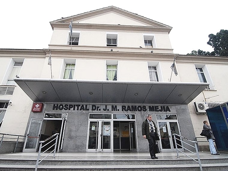
Photo: Wikimedia, CC BY 2.5 ar.
Hospital Ramos Mejía is a hospital in Buenos Aires, Argentina. Hospital Ramos Mejía is situated 310 metres east of Agrelo y Virrey Liniers.
Museum of Experimental Psychology in Argentina ‘Dr. Horacio G. Piñero’
Museum

Photo: Ojota, Public domain.
Museum of Experimental Psychology in Argentina ‘Dr. Horacio G. Piñero’ is situated 480 metres east of Agrelo y Virrey Liniers.
Plaza Boedo
Park

Photo: Roberto Fiadone, CC BY-SA 4.0.
Plaza Boedo is a park, which is situated 490 metres south of Agrelo y Virrey Liniers.
Places in the Area
Nearby places include Once and Caballito.

Caballito
Suburb

Photo: OneEuropeanHeart, CC BY 4.0.
Caballito is a barrio of the Argentine capital, Buenos Aires. It is the only barrio in the administrative division Comuna 6. It is located in the geographical centre of the city, limited by the following streets and avenues: Rio de Janeiro, Av. Caballito is situated 2½ km west of Agrelo y Virrey Liniers.
Barrio Norte
Quarter
Barrio Norte is the informal name given to a part of Buenos Aires centering on Santa Fe Avenue and the district of Recoleta. Barrio Norte is situated 3 km north of Agrelo y Virrey Liniers.
Agrelo y Virrey Liniers
- Type: Bus stop
- Category: transportation
- Location: Comuna 5, Buenos Aires, Buenos Aires, Pampas, Argentina, South America
- View on OpenStreetMap
Latitude
-34.61814° or 34° 37′ 5″ southLongitude
-58.41355° or 58° 24′ 49″ westOpen location code
48Q39HJP+PHOpenStreetMap ID
node 4998983090OpenStreetMap feature
highway=bus_stopOpenStreetMap feature
public_transport=platform
This page is based on OpenStreetMap, Wikidata, and Wikimedia Commons.
We’d love your help improving our open data sources. Thank you for contributing.
Satellite Map
Discover Agrelo y Virrey Liniers from above in high-definition satellite imagery.
Notable Places Nearby
Highlights include Instituto Superior de Tecnicaturas para la Salud and Sanatorio Dupuytren.
Nearby Places
Explore places such as Agrelo y Virrey Liniers and Maza y Agrelo.
Buenos Aires: Must-Visit Destinations
Delve into Centro, Palermo & Recoleta, La Boca & Barracas, and Outskirts.
Curious Bus Stops to Discover
Uncover intriguing bus stops from every corner of the globe.
About Mapcarta. Data © OpenStreetMap contributors and available under the Open Database License". Text is available under the CC BY-SA 4.0 license, except for photos, directions, and the map. Photo: Moemoemoe, CC0.