Instituto Politécnico Nacional
Instituto Politécnico Nacional is a bus stop in Mexico City, Central Mexico. Instituto Politécnico Nacional is situated nearby to the church San Cayetano, as well as near the shopping center Plaza Lindavista.| Tap on a place to explore it |
Places of Interest Nearby
Highlights include Lindavista metro station and Basilica of Our Lady of Guadalupe.
Lindavista metro station
Metro station
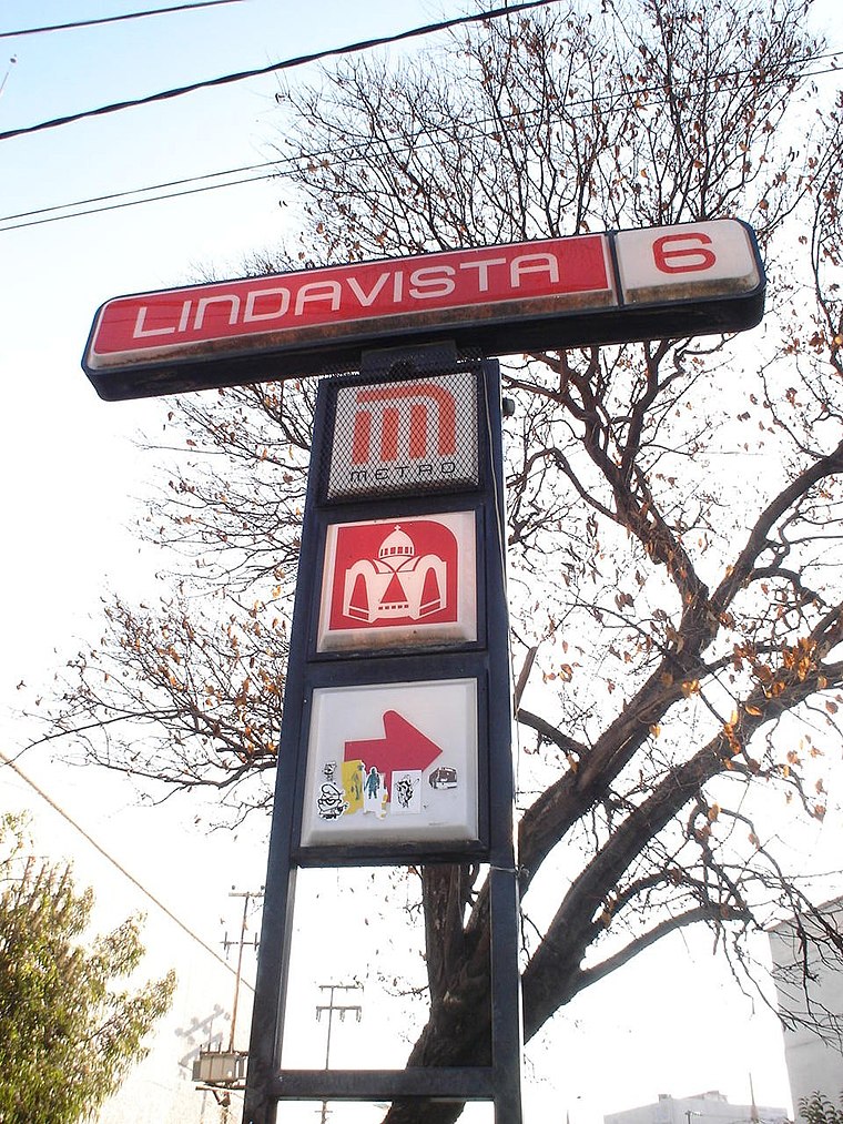
Photo: Wikimedia, CC BY-SA 2.5.
Lindavista is a metro station along Line 6 of the Mexico City Metro. It is located in the Gustavo A. Madero borough. In 2019, the station had an average ridership of 17,878 passengers per day. Lindavista metro station is situated 360 metres southwest of Instituto Politécnico Nacional.
Basilica of Our Lady of Guadalupe
Church

Photo: Wikimedia, Public domain.
The Basilica of Santa María de Guadalupe, officially called Insigne y Nacional Basílica de Santa María de Guadalupe is a basilica of the Catholic Church, dedicated to the Virgin Mary in her invocation of Our Lady of Guadalupe, located at the foot of the Hill of Tepeyac in the Gustavo A. Madero borough of Mexico City. Basilica of Our Lady of Guadalupe is situated 1½ km east of Instituto Politécnico Nacional.
Planetario Luis Enrique Erro
Planetarium
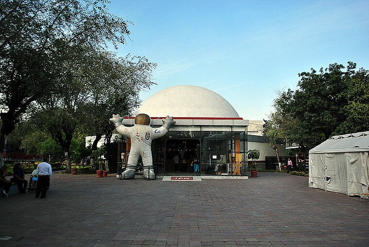
Photo: ProtoplasmaKid, CC BY-SA 3.0.
Planetario Luis Enrique Erro is a planetarium located in Mexico City, owned and operated by the National Polytechnic Institute. It was the first planetarium in Mexico open to the public and is one of the oldest in Latin America. Planetario Luis Enrique Erro is situated 1 km northwest of Instituto Politécnico Nacional.
Places in the Area
Nearby places include La Villa de Guadalupe and Colonia Santa María Insurgentes.
La Villa de Guadalupe

Photo: ProtoplasmaKid, CC BY-SA 4.0.
La Villa de Guadalupe is in the northern part of Mexico City, part of the delegación of Gustavo A. Madero. It is home to the Basílica de Guadalupe complex, and the Tepeyac National Park, which includes Tepeyac Hill.
Colonia Santa María Insurgentes
Neighborhood
Colonia Santa María Insurgentes is a colonia in the Cuauhtémoc borough north east of the Mexico City’s historic center. The colonia’s borders are formed by the following roads: Calzada de San Simon to the south, Jacarandas to the north, Avenida de los Insurgentes Norte to the east and Jacarandas to the west. Colonia Santa María Insurgentes is situated 3½ km southwest of Instituto Politécnico Nacional.
Tlatelolco
Quarter

Photo: Diego Rivera, Public domain.
Tlatelolco was a pre-Columbian altepetl, or city-state, in the Valley of Mexico. Its inhabitants, known as the Tlatelolca, were part of the Mexica, a Nahuatl-speaking people who arrived in what is now central Mexico in the 13th century. Tlatelolco is situated 4½ km south of Instituto Politécnico Nacional.
Instituto Politécnico Nacional
- Type: Bus stop
- Category: transportation
- Location: Mexico City, Central Mexico, Mexico, North America
- View on OpenStreetMap
Latitude
19.49044° or 19° 29′ 26″ northLongitude
-99.13268° or 99° 7′ 58″ westOperator
MetrobúsNetwork
Línea 6Open location code
76F2FVR8+5WOpenStreetMap ID
node 5008303345OpenStreetMap feature
highway=bus_stopOpenStreetMap feature
public_transport=platform
This page is based on OpenStreetMap, Wikidata, and Wikimedia Commons.
We’d love your help improving our open data sources. Thank you for contributing.
Satellite Map
Discover Instituto Politécnico Nacional from above in high-definition satellite imagery.
Places with the Same Name
Discover other places named “Instituto Politécnico Nacional”.
Notable Places Nearby
Highlights include San Cayetano and Plaza Lindavista.
Nearby Places
Explore places such as Av Politecnico and HSBC.
Mexico City: Must-Visit Destinations
Delve into Centro, Xochimilco, Coyoacán, and Condesa and Roma.
Curious Bus Stops to Discover
Uncover intriguing bus stops from every corner of the globe.
About Mapcarta. Data © OpenStreetMap contributors and available under the Open Database License". Text is available under the CC BY-SA 4.0 license, except for photos, directions, and the map. Photo: Wikimedia, CC BY 2.0.