Bromsgrove Station
Bromsgrove Station is a bus stop in Bromsgrove District, Worcestershire, England. Bromsgrove Station is situated nearby to the arts center Jets Craft Café, as well as near Aston Fields Post Office.| Tap on a place to explore it |
Places of Interest Nearby
Highlights include Church of St Godwald and Bromsgrove railway station.
Church of St Godwald
Church

Photo: Mike Dodman, CC BY-SA 2.0.
Church of St Godwald is situated 590 feet northeast of Bromsgrove Station.
Bromsgrove railway station
Railway station
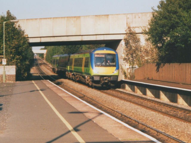
Photo: Stephen Craven, CC BY-SA 2.0.
Bromsgrove railway station serves the town of Bromsgrove in Worcestershire, England. It is located at the foot of the two-mile Lickey Incline which ascends at a gradient of 1-in-37.7 towards Barnt Green on the line between Birmingham and Worcester. Bromsgrove railway station is situated 1,200 feet south of Bromsgrove Station.
Aston Fields Middle School
School
Bromsgrove is a town in Worcestershire, England, about 16 miles north-east of Worcester and 13 miles south-west of Birmingham city centre. It had a population of 34,755 in at the 2021 census. Aston Fields Middle School is situated 1,800 feet northeast of Bromsgrove Station.
Places in the Area
Nearby places include Aston Fields and Charford.
Aston Fields
Suburb

Photo: al partington, CC BY-SA 2.0.
Aston Fields is a village in the district of Bromsgrove, Worcestershire, United Kingdom. It is situated to the south of Bromsgrove and is the site of Bromsgrove railway station.
Charford
Suburb

Photo: Roy Hughes, CC BY-SA 2.0.
Charford is a small village located close to the town centre of Bromsgrove in Worcestershire, England.
Finstall
Village

Photo: al partington, CC BY-SA 2.0.
Finstall is a village and civil parish in the Bromsgrove District of Worcestershire, England, with a population of 663. Finstall Park, the home ground of Bromsgrove RFC, can be found in the village along with Bromsgrove Cricket, Tennis and Hockey Clubs, as well as their corresponding sporting facilities and club houses.
Bromsgrove Station
- Type: Bus stop
- Category: transportation
- Location: Bromsgrove District, Worcestershire, West Midlands, England, United Kingdom, Britain and Ireland, Europe
- View on OpenStreetMap
Latitude
52.32344° or 52° 19′ 24″ northLongitude
-2.04851° or 2° 2′ 55″ westOpen location code
9C4V8XF2+9HOpenStreetMap ID
node 502411402OpenStreetMap feature
highway=bus_stopOpenStreetMap feature
public_transport=platform
This page is based on OpenStreetMap, Wikidata, and Wikimedia Commons.
We’d love your help improving our open data sources. Thank you for contributing.
Satellite Map
Discover Bromsgrove Station from above in high-definition satellite imagery.
Places with the Same Name
Discover other places named “Bromsgrove Station”.
Notable Places Nearby
Highlights include Jets Craft Café and Aston Fields Post Office.
Nearby Places
Explore places such as Fuso and Ascotts Bromsgrove.
Worcestershire: Must-Visit Destinations
Delve into Worcester, Redditch, Kidderminster, and Evesham.
Curious Bus Stops to Discover
Uncover intriguing bus stops from every corner of the globe.
About Mapcarta. Data © OpenStreetMap contributors and available under the Open Database License". Text is available under the CC BY-SA 4.0 license, except for photos, directions, and the map. Photo: brianac37, CC BY 2.0.