Stoke Pound Lane
Stoke Pound Lane is a bus stop in Stoke Heath, Bromsgrove District, England. Stoke Pound Lane is situated nearby to the peak Stoke Prior Hill, as well as near Church of St Michael.| Tap on a place to explore it |
Places of Interest Nearby
Highlights include Avoncroft Museum of Historic Buildings and Church of St Michael.
Avoncroft Museum of Historic Buildings
Museum

Photo: Mike Goodwin, CC BY-SA 2.0.
Avoncroft Museum of Historic Buildings is an open-air museum of rescued buildings which have been relocated to its site in Stoke Heath, a district of Bromsgrove, Worcestershire, England. Avoncroft Museum of Historic Buildings is situated 3,400 feet northwest of Stoke Pound Lane.
Church of St Michael
Church

Photo: Jeff Gogarty, CC BY-SA 2.0.
Church of St Michael is situated 2,900 feet west of Stoke Pound Lane.
Bromsgrove railway station
Railway station
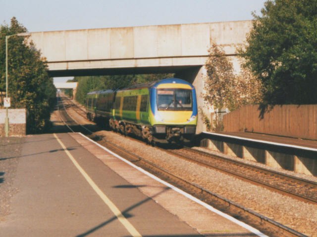
Photo: Stephen Craven, CC BY-SA 2.0.
Bromsgrove railway station serves the town of Bromsgrove in Worcestershire, England. It is located at the foot of the two-mile Lickey Incline which ascends at a gradient of 1-in-37.7 towards Barnt Green on the line between Birmingham and Worcester. Bromsgrove railway station is situated 1¼ miles northeast of Stoke Pound Lane.
Places in the Area
Nearby places include Stoke Prior and Charford.
Stoke Prior
Village

Photo: Chris Allen, CC BY-SA 2.0.
Stoke Prior is a village in the civil parish of Stoke in the Bromsgrove district of Worcestershire. The parish includes the settlement of Stoke Wharf and hamlet of Woodgate, along with neighbouring Stoke Heath.
Charford
Suburb

Photo: Roy Hughes, CC BY-SA 2.0.
Charford is a small village located close to the town centre of Bromsgrove in Worcestershire, England.
Aston Fields
Suburb

Photo: al partington, CC BY-SA 2.0.
Aston Fields is a village in the district of Bromsgrove, Worcestershire, United Kingdom. It is situated to the south of Bromsgrove and is the site of Bromsgrove railway station.
Stoke Pound Lane
- Type: Bus stop
- Category: transportation
- Location: Stoke Heath, Bromsgrove District, Worcestershire, West Midlands, England, United Kingdom, Britain and Ireland, Europe
- View on OpenStreetMap
Latitude
52.30586° or 52° 18′ 21″ northLongitude
-2.06302° or 2° 3′ 47″ westOpen location code
9C4V8W4P+8QOpenStreetMap ID
node 502412145OpenStreetMap feature
highway=bus_stopOpenStreetMap feature
public_transport=platform
This page is based on OpenStreetMap, Wikidata, and Wikimedia Commons.
We’d love your help improving our open data sources. Thank you for contributing.
Satellite Map
Discover Stoke Pound Lane from above in high-definition satellite imagery.
Notable Places Nearby
Highlights include Stoke Prior Hill and Crafted Boats.
Nearby Places
Explore places such as Whitford Bridge and Queen’s Head Inn.
Worcestershire: Must-Visit Destinations
Delve into Worcester, Redditch, Kidderminster, and Evesham.
Curious Bus Stops to Discover
Uncover intriguing bus stops from every corner of the globe.
About Mapcarta. Data © OpenStreetMap contributors and available under the Open Database License". Text is available under the CC BY-SA 4.0 license, except for photos, directions, and the map. Photo: brianac37, CC BY 2.0.