Shambles Street/Dog Lane
Shambles Street/Dog Lane is a bus stop in Barnsley, England. Shambles Street/Dog Lane is situated nearby to the government office Westgate Plaza One, as well as near the health club The Gym.| Tap on a place to explore it |
Places of Interest Nearby
Highlights include Cooper Gallery and St Mary’s Church.
Cooper Gallery
Museum

Photo: Alan Murray-Rust, CC BY-SA 2.0.
Cooper Gallery is a museum, which is situated 830 feet northeast of Shambles Street/Dog Lane.
St Mary’s Church
Church

Photo: Bill Henderson, CC BY-SA 2.0.
St Mary's Church is an active parish church in the town of Barnsley, within the Metropolitan Borough of Barnsley, South Yorkshire, England. Built in the year 1400, the church is located on Church Lane and is directly next to the college and town hall. St Mary’s Church is situated 800 feet north of Shambles Street/Dog Lane.
Oakwell
Stadium
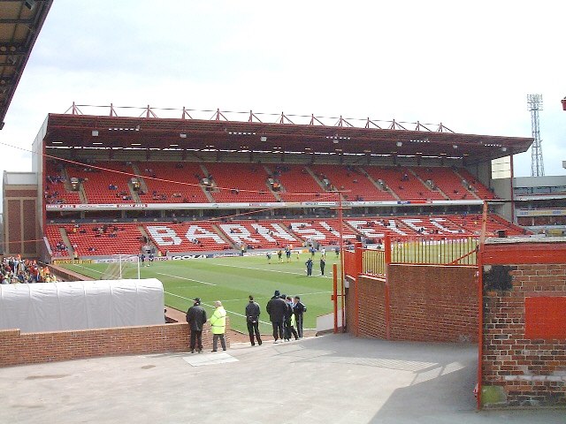
Photo: Martin Thirkettle, CC BY-SA 2.0.
Oakwell is a multi-purpose sports ground in Barnsley, South Yorkshire, England used by Barnsley Football Club for home fixtures, and those of their reserves. Oakwell is situated 3,600 feet east of Shambles Street/Dog Lane.
Places in the Area
Nearby places include Honeywell and Old Town.
Honeywell
Neighborhood
Barnsley is a market town in South Yorkshire, England. It is the main settlement of the Metropolitan Borough of Barnsley and the fourth largest settlement in South Yorkshire.
Old Town
Neighborhood
Old Town is an area of Barnsley in South Yorkshire, England. It is also the name of a ward of Barnsley Metropolitan Borough Council.
Wilthorpe
Neighborhood
Wilthorpe is an area of Barnsley in South Yorkshire, England. Bisected by the A635 Huddersfield Road, Wilthorpe has several small shops and an infant school, as well as an ATS garage and a dentist.
Shambles Street/Dog Lane
- Type: Bus stop
- Category: transportation
- Location: Barnsley, England, United Kingdom, Britain and Ireland, Europe
- View on OpenStreetMap
Latitude
53.55335° or 53° 33′ 12″ northLongitude
-1.48413° or 1° 29′ 3″ westOpen location code
9C5WHG38+88OpenStreetMap ID
node 502467404OpenStreetMap feature
highway=bus_stopOpenStreetMap feature
public_transport=platform
This page is based on OpenStreetMap, Wikidata, and Wikimedia Commons.
We’d love your help improving our open data sources. Thank you for contributing.
Satellite Map
Discover Shambles Street/Dog Lane from above in high-definition satellite imagery.
Notable Places Nearby
Highlights include The Gym and Westgate Plaza One.
Nearby Places
Explore places such as nutopia and Stan Plus Stan Two.
England: Must-Visit Destinations
Delve into London, Manchester, Sheffield, and Leeds.
Curious Bus Stops to Discover
Uncover intriguing bus stops from every corner of the globe.
About Mapcarta. Data © OpenStreetMap contributors and available under the Open Database License". Text is available under the CC BY-SA 4.0 license, except for photos, directions, and the map. Photo: Badics, CC BY-SA 3.0.