Birk Avenue/Neville Avenue
Birk Avenue/Neville Avenue is a bus stop in Barnsley, England. Birk Avenue/Neville Avenue is situated nearby to Kendray Post Office, as well as near the church St Andrew.| Tap on a place to explore it |
Places of Interest Nearby
Highlights include Oakwell and Barnsley Academy.
Oakwell
Stadium
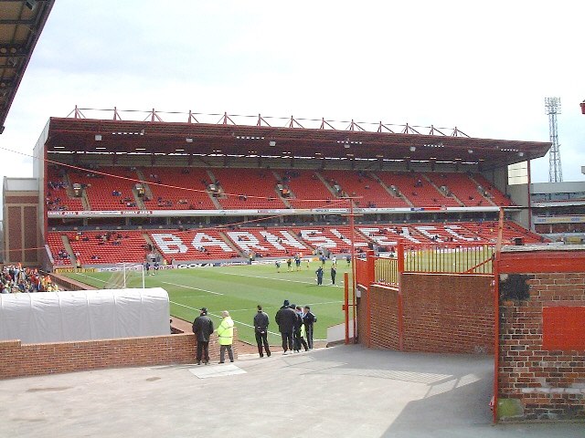
Photo: Martin Thirkettle, CC BY-SA 2.0.
Oakwell is a multi-purpose sports ground in Barnsley, South Yorkshire, England used by Barnsley Football Club for home fixtures, and those of their reserves. Oakwell is situated 1 mile northwest of Birk Avenue/Neville Avenue.
Barnsley Academy
School
Barnsley Academy is a secondary school in Barnsley, South Yorkshire, England. The school opened in September 2006. The school has academy status, having joined United Learning when opened. Barnsley Academy is situated 1,900 feet southwest of Birk Avenue/Neville Avenue.
Oaks Colliery Disaster Memorial
Memorial

Photo: Badics, CC BY-SA 3.0.
Oaks Colliery Disaster Memorial is situated 2,600 feet northwest of Birk Avenue/Neville Avenue.
Places in the Area
Nearby places include Stairfoot and Worsbrough.
Stairfoot
Suburb
Stairfoot is a ward in Barnsley, South Yorkshire, England. It is perhaps so named because it lies at the bottom of a valley in between the undulations of two small hills on the old road from Barnsley to Doncaster.
Worsbrough
Village

Photo: Dave Bevis, CC BY-SA 2.0.
Worsbrough is a district 2 to 3 miles south of Barnsley in the metropolitan borough of Barnsley, South Yorkshire, England. Before 1974, Worsbrough had its own urban district council in the West Riding of Yorkshire.
Birk Avenue/Neville Avenue
- Type: Bus stop
- Category: transportation
- Location: Barnsley, England, United Kingdom, Britain and Ireland, Europe
- View on OpenStreetMap
Latitude
53.54084° or 53° 32′ 27″ northLongitude
-1.44945° or 1° 26′ 58″ westOpen location code
9C5WGHR2+86OpenStreetMap ID
node 502469124OpenStreetMap feature
highway=bus_stopOpenStreetMap feature
public_transport=platform
This page is based on OpenStreetMap, Wikidata, and Wikimedia Commons.
We’d love your help improving our open data sources. Thank you for contributing.
Satellite Map
Discover Birk Avenue/Neville Avenue from above in high-definition satellite imagery.
Notable Places Nearby
Highlights include Kendray Post Office and St Andrew.
Nearby Places
Explore places such as Birk Avenue/Croft Road and Poundland.
England: Must-Visit Destinations
Delve into London, Manchester, Sheffield, and Leeds.
Curious Bus Stops to Discover
Uncover intriguing bus stops from every corner of the globe.
About Mapcarta. Data © OpenStreetMap contributors and available under the Open Database License". Text is available under the CC BY-SA 4.0 license, except for photos, directions, and the map. Photo: Badics, CC BY-SA 3.0.