Cheltenham Rd
Cheltenham Rd is a bus stop in Gloucester District, Gloucestershire, England. Cheltenham Rd is situated nearby to the manor estate Elmbridge Court, as well as near the nature reserve Memorial Woodland.| Tap on a place to explore it |
Places of Interest Nearby
Highlights include Holy Trinity Church and Sir Thomas Rich’s School.
Holy Trinity Church
Church

Photo: Philafrenzy, CC BY-SA 4.0.
Holy Trinity Church is a Grade II listed Church of England parish church in Longlevens, Gloucester. It was designed by Harold Stratton Davis and built in 1933–1934 in a fifteenth-century perpendicular Gothic style. Holy Trinity Church is situated 1,800 feet west of Cheltenham Rd.
Sir Thomas Rich’s School
School
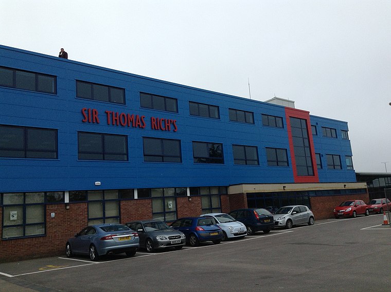
Photo: Mdann52, CC BY-SA 3.0.
Sir Thomas Rich's School is a grammar school with academy status for boys and girls in Longlevens, Gloucester, England, locally known as "Tommies". It is one of 7 grammar schools in Gloucestershire. Sir Thomas Rich’s School is situated 1,900 feet south of Cheltenham Rd.

Places in the Area
Nearby places include Gloucester and Walham.
Gloucester

Photo: Traveler100, CC BY-SA 4.0.
Gloucester is the county town of Gloucestershire in England's West Country. A major attraction of the city is Gloucester Cathedral, which is the burial place of King Edward II.
Walham
Hamlet
Walham is a hamlet in Longford parish, north of Gloucester, England. It lies on the banks of the River Severn and north of the A40 road. It is a suburb of Gloucester, which is to its south. Walham is situated 2½ miles west of Cheltenham Rd.
Bamfurlong
Hamlet
Bamfurlong is a village in Gloucestershire, England, between Cheltenham and Gloucester, near Gloucestershire Airport, and divided in two by the M5 motorway. Bamfurlong is situated 2½ miles northeast of Cheltenham Rd.
Cheltenham Rd
- Type: Bus stop
- Category: transportation
- Location: Gloucester District, Gloucestershire, West Country, England, United Kingdom, Britain and Ireland, Europe
- View on OpenStreetMap
Latitude
51.87693° or 51° 52′ 37″ northLongitude
-2.20316° or 2° 12′ 11″ westOpen location code
9C3VVQGW+QPOpenStreetMap ID
node 502493406OpenStreetMap feature
highway=bus_stop
This page is based on OpenStreetMap, Wikidata, and Wikimedia Commons.
We’d love your help improving our open data sources. Thank you for contributing.
Satellite Map
Discover Cheltenham Rd from above in high-definition satellite imagery.
Notable Places Nearby
Highlights include Elmbridge Court and Memorial Woodland.
Nearby Places
Explore places such as Greyhound Gardens and The Greyhound.
Gloucestershire: Must-Visit Destinations
Delve into Gloucester, Cheltenham, Cirencester, and Yate.
Curious Bus Stops to Discover
Uncover intriguing bus stops from every corner of the globe.
About Mapcarta. Data © OpenStreetMap contributors and available under the Open Database License". Text is available under the CC BY-SA 4.0 license, except for photos, directions, and the map. Photo: Matthew Hartley, CC BY-SA 2.0.