Tristram Road
Tristram Road is a bus stop in North Hertfordshire District, Hertfordshire, England. Tristram Road is situated nearby to the sports venue Riverain Bowls Club, as well as near Guru Nanak Sikh Gurdwara.| Tap on a place to explore it |
Places of Interest Nearby
Highlights include Hitchin railway station and St Faith’s Church.
Hitchin railway station
Railway station

Photo: Wikimedia, Copyrighted free use.
Hitchin railway station serves the market town of Hitchin in Hertfordshire. It is located approximately 1 mile north east of the town centre and 31 miles 74 chains north of London King's Cross on the East Coast Main Line. Hitchin railway station is situated 2,700 feet south of Tristram Road.
St Faith’s Church
Church

Photo: Jim Osley, CC BY-SA 2.0.
St Faith’s Church is situated 2,000 feet southeast of Tristram Road.
Purwell Meadows
Nature reserve
Purwell Meadows is an 8.6-hectare nature reserve in Hitchin, Hertfordshire, England. It was declared a Local Nature Reserve in 1994. It is owned and managed by North Hertfordshire District Council.
Places in the Area
Nearby places include Walsworth and Bearton.
Walsworth
Suburb

Photo: Nigel Cox, CC BY-SA 2.0.
Walsworth is a part of the town of Hitchin in Hertfordshire, England. It was originally a village about a mile north east of the town, and later became incorporated into it, although it is still referred to as a village by some locals.
Bearton
Suburb
Bearton was a small hamlet lying to the north of Hitchin in Hertfordshire, England. It was incorporated into Hitchin over a century ago, and now forms part of the Hitchin Bearton ward of North Hertfordshire District Council.
Ickleford
Village
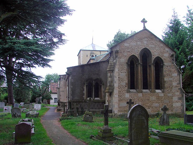
Photo: OLU, CC BY-SA 2.0.
Ickleford is a village and civil parish in the North Hertfordshire district of Hertfordshire, England. It lies immediately north of the town of Hitchin, from which it is separated by the River Oughton.
Tristram Road
- Type: Bus stop
- Category: transportation
- Location: North Hertfordshire District, Hertfordshire, East of England, England, United Kingdom, Britain and Ireland, Europe
- View on OpenStreetMap
Latitude
51.96055° or 51° 57′ 38″ northLongitude
-0.26324° or 0° 15′ 48″ westOpen location code
9C3XXP6P+6POpenStreetMap ID
node 502536921OpenStreetMap feature
highway=bus_stop
This page is based on OpenStreetMap, Wikidata, and Wikimedia Commons.
We’d love your help improving our open data sources. Thank you for contributing.
Satellite Map
Discover Tristram Road from above in high-definition satellite imagery.
Notable Places Nearby
Highlights include Riverain Bowls Club and Guru Nanak Sikh Gurdwara.
Nearby Places
Explore places such as VW Audi Specialists and Girdle Road.
Hertfordshire: Must-Visit Destinations
Delve into St Albans, Watford, Stevenage, and Hertford.
Curious Bus Stops to Discover
Uncover intriguing bus stops from every corner of the globe.
About Mapcarta. Data © OpenStreetMap contributors and available under the Open Database License". Text is available under the CC BY-SA 4.0 license, except for photos, directions, and the map. Photo: Wikimedia, CC0.