Hatfield Park Lodge
Hatfield Park Lodge is a bus stop in Hatfield, Hertfordshire, England. Hatfield Park Lodge is situated nearby to the golf course Mill Green Golf Club, as well as near the forest The Warren.| Tap on a place to explore it |
Places of Interest Nearby
Highlights include Hatfield House and Mill Green Museum.
Hatfield House
Manor estate
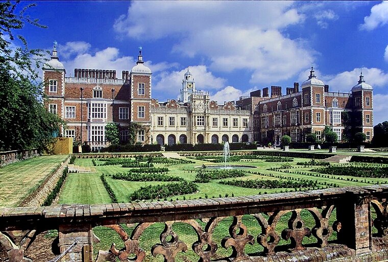
Photo: Allan Engelhardt, CC BY-SA 2.0.
Hatfield House is a Grade I listed country house set in a large park, the Great Park, on the eastern side of Hatfield, Hertfordshire, England. The present Jacobean house, a leading example of the prodigy house, was built in 1611 by Robert Cecil, 1st Earl of Salisbury and Chief Minister to King James I. Hatfield House is situated 1¼ miles southwest of Hatfield Park Lodge.
Mill Green Museum
Museum
Mill Green Museum is a working watermill in Hatfield, Hertfordshire, England. The building is listed grade II* and dates from the 17th century. The local museum is in the old miller's house. Three galleries show changing displays of art and local history. Mill Green Museum is situated 2,800 feet west of Hatfield Park Lodge.
Queen Elizabeth II Hospital
Hospital

Photo: Melvyn Cousins, CC BY-SA 2.0.
The New QEII Hospital is located in Welwyn Garden City and managed by East and North Hertfordshire Teaching NHS Trust. Queen Elizabeth II Hospital is situated 3,300 feet north of Hatfield Park Lodge.
Places in the Area
Nearby places include Old Hatfield and Welwyn Garden City.
Old Hatfield
Suburb
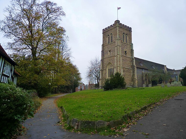
Photo: Cmglee, CC BY-SA 3.0.
Old Hatfield, sometimes called Bishops Hatfield, is a historic village in Hertfordshire, England. It is in the town of Hatfield. It grew up on the Great North Road, one day's journey from London by horse or coach and once had many coaching inns.
Welwyn Garden City

Photo: Cmglee, CC BY-SA 4.0.
Welwyn Garden City is a town in Hertfordshire, England. It was the second "garden city" in England, and one of the first "new towns". It is unique in being both a garden city and a new town and exemplifies the physical, social and cultural planning ideals of the periods in which it was built.
Cole Green
Village
Cole Green is a hamlet in Hertfordshire, England. It is 1 mile south-east of Welwyn Garden City just off the A414. It is in the Hertingfordbury Ward of East Herts District Council. Cole Green is situated 2½ miles northeast of Hatfield Park Lodge.
Hatfield Park Lodge
- Type: Bus stop
- Category: transportation
- Location: Hatfield, Welwyn Hatfield, Hertfordshire, East of England, England, United Kingdom, Britain and Ireland, Europe
- View on OpenStreetMap
Latitude
51.77432° or 51° 46′ 28″ northLongitude
-0.19213° or 0° 11′ 32″ westOpen location code
9C3XQRF5+P4OpenStreetMap ID
node 502550761OpenStreetMap feature
highway=bus_stopOpenStreetMap feature
public_transport=platform
This page is based on OpenStreetMap, Wikidata, and Wikimedia Commons.
We’d love your help improving our open data sources. Thank you for contributing.
Satellite Map
Discover Hatfield Park Lodge from above in high-definition satellite imagery.
Notable Places Nearby
Highlights include Mill Green Golf Club and The Warren.
Nearby Places
Explore places such as Hatfield Park Lodge and Lewis Tyler & Sons (Fencing) Ltd.
Hertfordshire: Must-Visit Destinations
Delve into St Albans, Watford, Stevenage, and Hertford.
Curious Bus Stops to Discover
Uncover intriguing bus stops from every corner of the globe.
About Mapcarta. Data © OpenStreetMap contributors and available under the Open Database License". Text is available under the CC BY-SA 4.0 license, except for photos, directions, and the map. Photo: RobThinks, CC BY-SA 4.0.