Delaval Avenue
Delaval Avenue is a bus stop in North Tyneside, England. Delaval Avenue is situated nearby to St Peter’s Church, as well as near the community center St Peters Parish Centre.| Tap on a place to explore it |
Places of Interest Nearby
Highlights include Collingwood Primary School and North Shields.
Collingwood Primary School
School
North Shields is a town in the borough of North Tyneside in Tyne and Wear, England. It is 8 miles north-east of Newcastle upon Tyne and borders nearby Wallsend and Tynemouth. Collingwood Primary School is situated 1,200 feet southwest of Delaval Avenue.
North Shields
Railway station
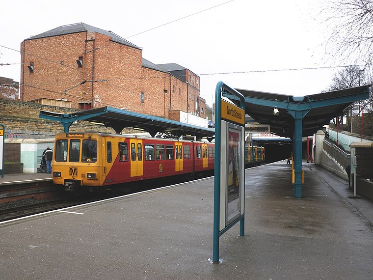
Photo: Roger Cornfoot, CC BY-SA 2.0.
North Shields is a Tyne and Wear Metro station, serving the coastal town of North Shields, North Tyneside in Tyne and Wear, England. It joined the network on 14 November 1982, following the opening of the fourth phase of the network, between Tynemouth and St James via Wallsend. North Shields is situated 3,700 feet east of Delaval Avenue.
Meadow Well
Railway station

Photo: hayley green, CC BY-SA 2.0.
Meadow Well is a Tyne and Wear Metro station, serving the suburbs of Chirton and Meadow Well, North Tyneside in Tyne and Wear, England. It joined the network as Smith's Park on 14 November 1982, following the opening of the fourth phase of the network, between Tynemouth and St James via Wallsend. Meadow Well is situated 3,400 feet south of Delaval Avenue.
Places in the Area
Nearby places include North Shields and New York.
North Shields
Town

Photo: Bill Henderson, CC BY-SA 2.0.
North Shields is a town in the borough of North Tyneside in Tyne and Wear, England. It is 8 miles north-east of Newcastle upon Tyne and borders nearby Wallsend and Tynemouth.
New York
Village

Photo: Ken Brown, CC BY-SA 2.0.
New York is a suburban village in the metropolitan county of Tyne and Wear, North East England. Approximately 4 miles from Whitley Bay, and 5 miles from the town of Tynemouth, it locally governed as part of the metropolitan borough of North Tyneside.
South Shields
Town

Photo: AlasdairW, CC BY-SA 3.0.
South Shields is a coastal town in South Tyneside, Tyne and Wear, England; it lies on the south bank of the mouth of the River Tyne. The town was known in Roman times as Arbeia and as Caer Urfa by the Early Middle Ages. South Shields is situated 1½ miles southeast of Delaval Avenue.
Delaval Avenue
- Type: Bus stop
- Category: transportation
- Location: North Tyneside, England, United Kingdom, Britain and Ireland, Europe
- View on OpenStreetMap
Latitude
55.01081° or 55° 0′ 39″ northLongitude
-1.46586° or 1° 27′ 57″ westOpen location code
9C7W2G6M+8MOpenStreetMap ID
node 502587816OpenStreetMap feature
highway=bus_stopOpenStreetMap feature
public_transport=platform
This page is based on OpenStreetMap, Wikidata, and Wikimedia Commons.
We’d love your help improving our open data sources. Thank you for contributing.
Satellite Map
Discover Delaval Avenue from above in high-definition satellite imagery.
Places with the Same Name
Discover other places named “Delaval Avenue”.
Notable Places Nearby
Highlights include St Peters Parish Centre and St Peter’s Church.
Nearby Places
Explore places such as THE QUADRANT-HEATON TERRACE-S/B and Verne Road Dental Practice.
England: Must-Visit Destinations
Delve into London, Manchester, Sheffield, and Leeds.
Curious Bus Stops to Discover
Uncover intriguing bus stops from every corner of the globe.
About Mapcarta. Data © OpenStreetMap contributors and available under the Open Database License". Text is available under the CC BY-SA 4.0 license, except for photos, directions, and the map. Photo: sidibousaid, CC BY 2.0.