Birżebbuġa - Marniżi
Birżebbuġa - Marniżi is a bus stop in Birżebbuġa, Malta. Birżebbuġa - Marniżi is situated nearby to the museum Għar Dalam, as well as near the garden Ġnien il-Komunità tal-Qajjenza.| Tap on a place to explore it |
Places of Interest Nearby
Highlights include Malta Island and Għar Dalam.
Malta Island

Photo: Csaba Bajkó, CC BY-SA 2.0.
Malta is an island in Southern Europe. It is the largest and most populous of the three major islands that constitute the Maltese Archipelago and the country of Malta.
Għar Dalam
Cave
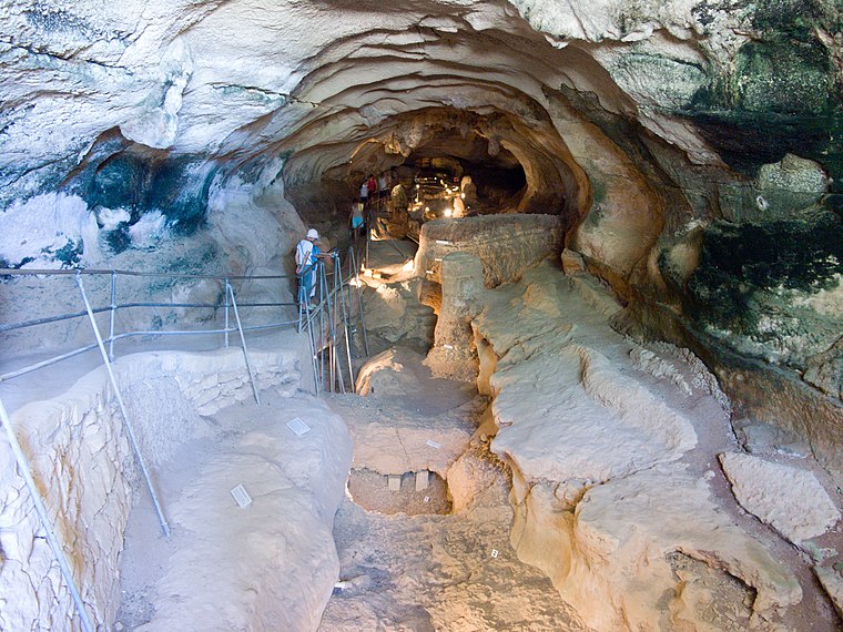
Photo: Jean-Christophe BENOIST, CC BY 2.5.
Għar Dalam is a 144-metre long phreatic tube and cave, located in the outskirts of Birżebbuġa, Malta. The cave contains the bones of animals that lived on Malta during the Pleistocene and Holocene epochs. Għar Dalam is situated 770 metres south of Birżebbuġa - Marniżi.
Ta’ Kaċċatura
Archaeological site

Photo: Zugraga, CC BY-SA 4.0.
Ta' Kaċċatura is an archaeological complex on the outskirts of Birżebbuġa, in southern Malta. The complex includes a rustic Roman villa and a number of underground cisterns. Ta’ Kaċċatura is situated 1 km south of Birżebbuġa - Marniżi.
Places in the Area
Nearby places include Għaxaq and Żejtun.
Għaxaq
Village

Photo: Alecastorina93, CC BY-SA 3.0.
Għaxaq is a village in the Southern Region of Malta, with a population of 5,538 as of November 2021. The surrounding areas are predominantly used for agriculture.
Żejtun
Town

Photo: Continentaleurope, CC BY-SA 4.0.
Żejtun is a city of 11,000 people in Malta Island, Malta. It is the largest city in the south of the island and one of the oldest cities in Malta.
Southern Harbor of Malta

Photo: Tony Hisgett, CC BY-SA 4.0.
The Southern Harbour of Malta extends around the natural harbour between Valetta and the Three Cities, with numerous settlements, most of them dating back centuries, on rocks and cliffs immediately around the harbour bay, as well as further inland.
Birżebbuġa - Marniżi
- Type: Bus stop
- Category: transportation
- Location: Birżebbuġa, Malta, Europe
- View on OpenStreetMap
Latitude
35.84293° or 35° 50′ 35″ northLongitude
14.528° or 14° 31′ 41″ eastOperator
Malta Public TransportNetwork
Malta Public TransportOpen location code
8F7PRGVH+55OpenStreetMap ID
node 5029298805OpenStreetMap feature
highway=bus_stopOpenStreetMap feature
public_transport=platform
This page is based on OpenStreetMap, Wikidata, and Wikimedia Commons.
We’d love your help improving our open data sources. Thank you for contributing.
Satellite Map
Discover Birżebbuġa - Marniżi from above in high-definition satellite imagery.
Notable Places Nearby
Highlights include Għar Dalam and Ġnien il-Komunità tal-Qajjenza.
Nearby Places
Explore places such as Birżebbuġa - Marniżi and Saint Joseph Fireworks factory.
Malta: Must-Visit Destinations
Delve into Valletta, Mdina, Sliema, and Victoria.
Curious Bus Stops to Discover
Uncover intriguing bus stops from every corner of the globe.
About Mapcarta. Data © OpenStreetMap contributors and available under the Open Database License". Text is available under the CC BY-SA 4.0 license, except for photos, directions, and the map. Photo: Dirk.heldmaier, CC BY-SA 3.0.