Merlin Way
Merlin Way is a bus stop in Rushmoor District, Hampshire, England. Merlin Way is situated nearby to Southwood Infant School, as well as near Southwood country park.| Tap on a place to explore it |
Places of Interest Nearby
Highlights include Farnborough Airport and National Gas Turbine Establishment.
Farnborough Airport
Aerodrome

Photo: MilborneOne, CC BY-SA 3.0.
Farnborough Airport is an operational business/executive general aviation airport in Farnborough, Rushmoor, Hampshire, England. The 310-hectare airport covers about 8% of Rushmoor's land area.
National Gas Turbine Establishment
Historic site
The National Gas Turbine Establishment in Farnborough, part of the Royal Aircraft Establishment, was the prime site in the UK for the design and development of gas turbine and jet engines. National Gas Turbine Establishment is situated 1 mile southwest of Merlin Way.
Church of St Christopher
Church
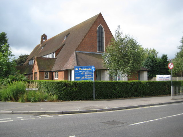
Photo: Nigel Cox, CC BY-SA 2.0.
Church of St Christopher is situated 1 mile east of Merlin Way.
Places in the Area
Nearby places include Cove and Farnborough.
Cove
Neighborhood

Photo: Michael FORD, CC BY-SA 2.0.
Cove is an ancient village turned suburb, forming the western part of Farnborough, in the Rushmoor district, in the county of Hampshire, England. The appropriate ward is called Cove and Southwood.
Farnborough

Photo: AlasdairW, CC BY-SA 3.0.
Farnborough is a town in the northeastern corner of the English county of Hampshire, adjacent to the borders with Surrey and Berkshire. Once an isolated hamlet, Farnborough grew into a medium-sized town over the course of the 20th century.
Minley
Village
Minley is a slightly depopulated rural, well-wooded village in the Hart District of Hampshire, England. It has the only church of the C of E ecclesiastical parish of Minley and is in the civil parish of Blackwater and Hawley. Minley is situated 2 miles northwest of Merlin Way.
Merlin Way
- Type: Bus stop
- Category: transportation
- Location: Rushmoor District, Hampshire, South East England, England, United Kingdom, Britain and Ireland, Europe
- View on OpenStreetMap
Latitude
51.28965° or 51° 17′ 23″ northLongitude
-0.78761° or 0° 47′ 15″ westOpen location code
9C3X76Q6+VXOpenStreetMap ID
node 503413144OpenStreetMap feature
highway=bus_stopOpenStreetMap feature
public_transport=platform
This page is based on OpenStreetMap, Wikidata, and Wikimedia Commons.
We’d love your help improving our open data sources. Thank you for contributing.
Satellite Map
Discover Merlin Way from above in high-definition satellite imagery.
Places with the Same Name
Discover other places named “Merlin Way”.
Notable Places Nearby
Highlights include Southwood Infant School and Southwood country park.
Nearby Places
Explore places such as Southwood and Morrisons.
Hampshire: Must-Visit Destinations
Delve into Southampton, Portsmouth, Winchester, and Farnborough.
Curious Bus Stops to Discover
Uncover intriguing bus stops from every corner of the globe.
About Mapcarta. Data © OpenStreetMap contributors and available under the Open Database License". Text is available under the CC BY-SA 4.0 license, except for photos, directions, and the map. Photo: TomHab, CC BY-SA 3.0.