Monsoon Indian
Monsoon Indian is a restaurant in Rustington, Arun District, England which is located on The Street. Monsoon Indian is situated nearby to Rustington Methodist Church, as well as near Rustington Library.| Tap on a place to explore it |
Places of Interest Nearby
Highlights include The Parish Church of St Peter and St Paul and Angmering railway station.
The Parish Church of St Peter and St Paul
Church

Photo: The Voice of Hassocks, CC0.
The Parish Church of St Peter and St Paul is situated 630 feet west of Monsoon Indian.
Angmering railway station
Railway station

Photo: Janine Forbes, CC BY-SA 2.0.
Angmering is a railway station on the West Coastway Line, on the border of Angmering and East Preston, West Sussex in the district of Arun. It was opened in 1846. Angmering railway station is situated 1 mile northeast of Monsoon Indian.
Knightscroft
Building

Photo: Josie Campbell, CC BY-SA 2.0.
Knightscroft is a building, which is situated 1,700 feet southwest of Monsoon Indian.
Places in the Area
Nearby places include Rustington and East Preston.
Rustington
Village
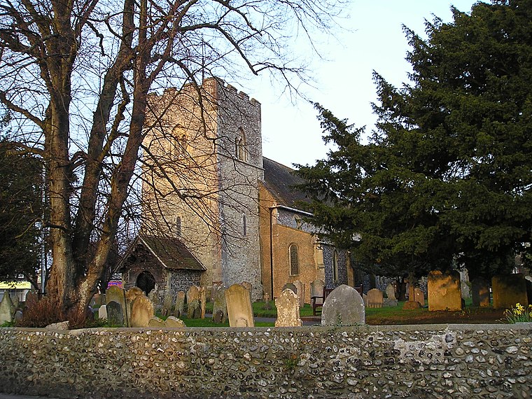
Photo: Dashers, Public domain.
Rustington is a village and civil parish in the Arun District of West Sussex. Rustington is approximately at the midpoint of the West Sussex coast and midway between Chichester and Brighton.
East Preston
Village

Photo: The Voice of Hassocks, CC0.
East Preston is a coastal village and civil parish in the Arun District of West Sussex, England. It lies roughly halfway between Littlehampton and Worthing.
Littlehampton
 Littlehampton is a seaside town in West Sussex. It lies midway on the Sussex coast between Bognor Regis and Worthing. It is just over 15 miles west from the larger tourist area of Brighton and 55 miles south of London…
Monsoon Indian
- Type: Restaurant
- Address: 5, Sterling Parade, The Street, Rustington, BN16 3DR
- Category: food
- Location: Rustington, Arun District, West Sussex, South East England, England, United Kingdom, Britain and Ireland, Europe
- View on OpenStreetMap
Latitude
50.81027° or 50° 48′ 37″ northLongitude
-0.50753° or 0° 30′ 27″ westOpen location code
9C2XRF6R+4XOpenStreetMap ID
node 5036406622OpenStreetMap feature
amenity=restaurant
This page is based on OpenStreetMap, Wikidata, and Wikimedia Commons.
We’d love your help improving our open data sources. Thank you for contributing.
Satellite Map
Discover Monsoon Indian from above in high-definition satellite imagery.
Notable Places Nearby
Highlights include Rustington Methodist Church and Rustington Library.
Nearby Places
Explore places such as Lukes News and Coral.
West Sussex: Must-Visit Destinations
Delve into Chichester, Crawley, Worthing, and Horsham.
Curious Restaurants to Discover
Uncover intriguing restaurants from every corner of the globe.
About Mapcarta. Data © OpenStreetMap contributors and available under the Open Database License". Text is available under the CC BY-SA 4.0 license, except for photos, directions, and the map. Photo: wildlife encounters, CC BY 2.0.