Ashby Close (opp)
Ashby Close (opp) is a bus stop in Wellingborough District, North Northamptonshire, England. Ashby Close (opp) is situated nearby to Redwell Primary School, as well as near the park Glenvale Green.| Tap on a place to explore it |
Places of Interest Nearby
Highlights include Harrowden Hall and Church of All Saints.
Harrowden Hall
Sports venue
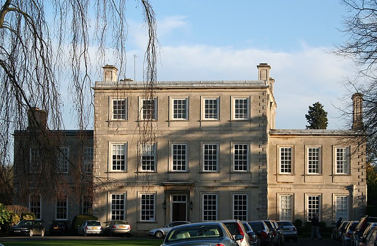
Photo: Wikimedia, CC BY-SA 3.0.
Harrowden Hall is a sports venue, which is situated 1 mile north of Ashby Close (opp).
Church of All Saints
Church

Photo: M J Richardson, CC BY-SA 2.0.
Church of All Saints is situated 1 mile north of Ashby Close (opp).
Chapel Of St Hubert
Church

Photo: Dennis simpson, CC BY-SA 2.0.
Chapel Of St Hubert is a church, which is situated 4,200 feet north of Ashby Close (opp).
Places in the Area
Nearby places include Great Harrowden and Wellingborough.
Great Harrowden
Village
Photo: M J Richardson, CC BY-SA 2.0.
Great Harrowden is a village and civil parish in North Northamptonshire, with a population at the 2011 census of 161. The village is located near the A509 road running between Kettering and Wellingborough.
Wellingborough

Photo: Alan Wilson, CC BY-SA 2.0.
Wellingborough is a market town and borough in Northamptonshire, England, situated some 11 miles from the county town of Northampton. The town is situated on the north side of the River Nene, most of the older town is sited on the flanks of the hills above the river's current flood plain.
Hardwick
Village
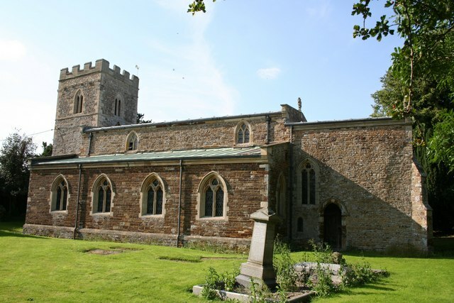
Photo: Richard Croft, CC BY-SA 2.0.
Hardwick is a small village in North Northamptonshire, England, close to the town of Wellingborough. The population is included in the civil parish of Great Harrowden. The village's name means "herd farm". Hardwick is situated 2 miles west of Ashby Close (opp).
Ashby Close (opp)
- Type: Bus stop
- Category: transportation
- Location: Wellingborough District, North Northamptonshire, England, United Kingdom, Britain and Ireland, Europe
- View on OpenStreetMap
Latitude
52.31694° or 52° 19′ 1″ northLongitude
-0.71154° or 0° 42′ 42″ westOpen location code
9C4X878Q+Q9OpenStreetMap ID
node 5104114767OpenStreetMap feature
highway=bus_stopOpenStreetMap feature
public_transport=platform
This page is based on OpenStreetMap, Wikidata, and Wikimedia Commons.
We’d love your help improving our open data sources. Thank you for contributing.
Satellite Map
Discover Ashby Close (opp) from above in high-definition satellite imagery.
Notable Places Nearby
Highlights include Redwell Primary School and Glenvale Green.
Nearby Places
Explore places such as Orton Place (opp) and Redwell Leisure Centre (o/s).
England: Must-Visit Destinations
Delve into London, Manchester, Sheffield, and Leeds.
Curious Bus Stops to Discover
Uncover intriguing bus stops from every corner of the globe.
About Mapcarta. Data © OpenStreetMap contributors and available under the Open Database License". Text is available under the CC BY-SA 4.0 license, except for photos, directions, and the map. Photo: sidibousaid, CC BY 2.0.