Escuela Infantil Chiquilín
Escuela Infantil Chiquilín is a kindergarten in Comuna 3, Buenos Aires, Buenos Aires. Escuela Infantil Chiquilín is situated nearby to Hospital Español, as well as near the park Plaza Manzana 66.| Tap on a place to explore it |
- Email: jardinchiquilin@gmail.com
- Type: Kindergarten
- Address: Ciudad Autónoma de Buenos Aires, 1209
Places of Interest Nearby
Highlights include Venezuela and Hospital Ramos Mejía.
Venezuela
Metro station

Photo: Wikimedia, CC BY-SA 4.0.
Venezuela Station is a station on Line H of the Buenos Aires Underground. The station was opened on 18 October 2007, as part of the inaugural section of the line, between Once - 30 de Diciembre and Caseros. Venezuela is situated 210 metres east of Escuela Infantil Chiquilín.
Hospital Ramos Mejía
Hospital
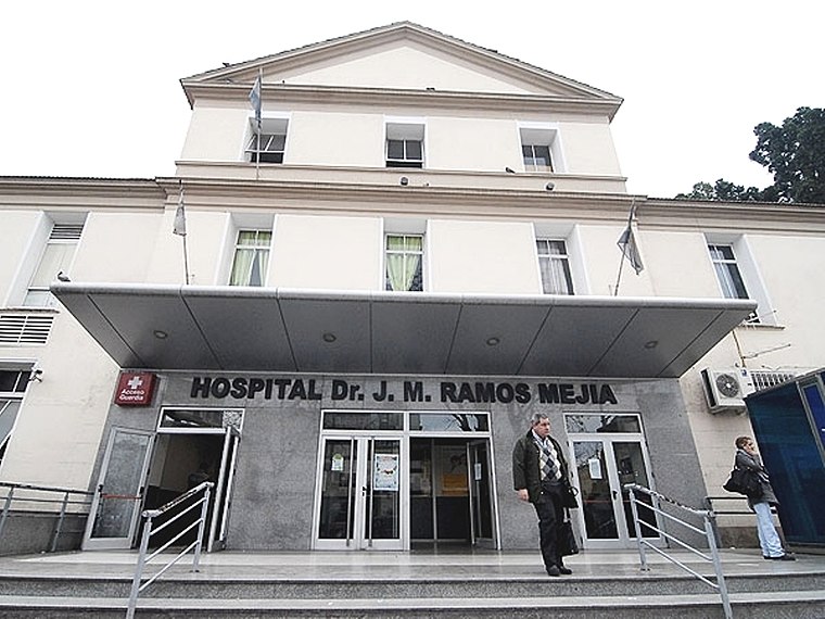
Photo: Wikimedia, CC BY 2.5 ar.
Hospital Ramos Mejía is a hospital in Buenos Aires, Argentina. Hospital Ramos Mejía is situated 420 metres southwest of Escuela Infantil Chiquilín.
Plaza Miserere
Park

Photo: Beatrice Murch, CC BY 2.0.
Plaza Miserere is one of the main plazas of Buenos Aires, Argentina. It is located alongside the Once de Septiembre Station of the Ferrocarril Domingo Faustino Sarmiento in the heart of the Balvanera neighborhood. Plaza Miserere is situated 590 metres north of Escuela Infantil Chiquilín.
Places in the Area
Nearby places include Once and Barrio Norte.

Barrio Norte
Quarter
Barrio Norte is the informal name given to a part of Buenos Aires centering on Santa Fe Avenue and the district of Recoleta. Barrio Norte is situated 2½ km north of Escuela Infantil Chiquilín.
Centro

Photo: Roger Schultz, CC BY 2.0.
The center of Buenos Aires has most of the city's attractions, including performances in the Tribunales theater district, the dense downtown area with government buildings, the San Telmo tango scene, and the biggest train station and the general bus station that offers connections to the surrounding provinces and neighboring countries.
Escuela Infantil Chiquilín
- Category: education
- Location: Comuna 3, Buenos Aires, Buenos Aires, Pampas, Argentina, South America
- View on OpenStreetMap
Latitude
-34.61504° or 34° 36′ 54″ southLongitude
-58.40704° or 58° 24′ 25″ westOpen location code
48Q39HMV+X5OpenStreetMap ID
node 5117449221OpenStreetMap feature
amenity=kindergarten
This page is based on OpenStreetMap, Wikidata, and Wikimedia Commons.
We’d love your help improving our open data sources. Thank you for contributing.
Satellite Map
Discover Escuela Infantil Chiquilín from above in high-definition satellite imagery.
Notable Places Nearby
Highlights include Hospital Español and Plaza Manzana 66.
Nearby Places
Explore places such as La Iberica and Dormiteca.
Buenos Aires: Must-Visit Destinations
Delve into Centro, Palermo & Recoleta, La Boca & Barracas, and Outskirts.
Curious Kindergartens to Discover
Uncover intriguing kindergartens from every corner of the globe.
About Mapcarta. Data © OpenStreetMap contributors and available under the Open Database License". Text is available under the CC BY-SA 4.0 license, except for photos, directions, and the map. Photo: Moemoemoe, CC0.