Amsterdam Street station
The QLINE is a 3.3-mile-long streetcar system in Detroit, Michigan, United States. Opened in 2017, it connects Downtown Detroit with Midtown and New Center, running along Woodward Avenue for its entire route.| Tap on a place to explore it |
Places of Interest Nearby
Highlights include Detroit station and Our Lady of the Rosary Church.
Detroit station
Railway station

Photo: JasonParis, CC BY 2.0.
Detroit station is an intermodal transit station in Detroit, Michigan. Located in New Center, the facility currently serves Amtrak and QLine streetcars. Detroit station is situated 720 feet northwest of Amsterdam Street station.
Our Lady of the Rosary Church
Church

Photo: Andrew Jameson, CC BY-SA 3.0.
The Our Lady of the Rosary Church is a Roman Catholic church located at 5930 Woodward Avenue in Detroit, Michigan. It was originally built as St. Joseph's Episcopal Church – from 1893 to 1896 – and is a historic Romanesque Revival church complex. Our Lady of the Rosary Church is situated 800 feet southeast of Amsterdam Street station.
Ford Piquette Avenue Plant
Museum

Photo: Jackdude101, CC BY-SA 4.0.
The Ford Piquette Avenue Plant is a former car factory located within the Milwaukee Junction area of Detroit, Michigan, in the United States. Built in 1904, it was the second center of automobile production for the Ford Motor Company, after the Ford Mack Avenue Plant. Ford Piquette Avenue Plant is situated 1,700 feet northeast of Amsterdam Street station.
Places in the Area
Nearby places include Midtown-New Center and New Center.
Midtown-New Center

Photo: Ken Lund, CC BY-SA 2.0.
Midtown is the cultural center of Detroit. It is home to several museums and galleries, such as the Detroit Institute of Arts and the Charles H. Wright Museum of African American History.
New Center
Suburb
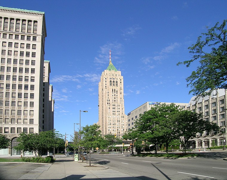
Photo: Andrew Jameson, CC BY-SA 3.0.
New Center is a commercial and residential district located in Detroit, Michigan, adjacent to Midtown, one mile north of the Cultural Center, and approximately three miles north of Downtown.
Ford–Lodge interchange
Locality
The Ford–Lodge interchange is a freeway interchange in Detroit, Michigan. It forms the junction of Interstate 94, with M-10. The interchange was completed in 1955, and is the first full freeway-to-freeway interchange in the United States.
Amsterdam Street station
- Type: Tram stop
- Description: QLINE streetcar station in Detroit, Michigan, USA
- Categories: railway stop, transport stop, and transportation
- Location: City of Detroit, Wayne County, Michigan, Midwest, United States, North America
- View on OpenStreetMap
Latitude
42.36627° or 42° 21′ 59″ northLongitude
-83.07066° or 83° 4′ 14″ westNetwork
QLineOpen location code
86JR9W8H+GPOpenStreetMap ID
node 5120273742OpenStreetMap feature
public_transport=stop_positionOpenStreetMap feature
railway=tram_stopWikidata ID
Q20861618
This page is based on OpenStreetMap, Wikidata, Wikimedia Commons, and Wikipedia.
We’d love your help improving our open data sources. Thank you for contributing.
Satellite Map
Discover Amsterdam Street station from above in high-definition satellite imagery.
In Other Languages
“Amsterdam Street station” goes by many names.
- French: “Amsterdam Street”
Notable Places Nearby
Highlights include James-Martin Chevrolet and WSU Police Department.
Nearby Places
Explore places such as Amsterdam Street and Woodward / Amsterdam (SB).
Wayne County: Must-Visit Destinations
Delve into Detroit, Dearborn, Downtown Detroit, and Livonia.
Curious Tram Stops to Discover
Uncover intriguing tram stops from every corner of the globe.
About Mapcarta. Data © OpenStreetMap contributors and available under the Open Database License". Text is available under the CC BY-SA 4.0 license, except for photos, directions, and the map. Description text is based on the Wikipedia page “Amsterdam Street station”. Photo: Wikimedia, CC0.