Redcar East
Redcar East is a railway stop in Redcar and Cleveland, England. Redcar East is situated nearby to John Emmerson Batty Primary School, as well as near Ings Farm Primary School.| Tap on a place to explore it |
Places of Interest Nearby
Highlights include Redcar East railway station and Zetland Lifeboat Museum and Redcar Heritage Centre.
Redcar East railway station
Railway station
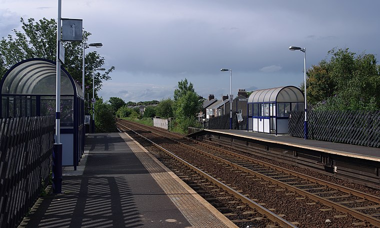
Photo: Mattbuck, CC BY-SA 3.0.
Redcar East is a railway station on the Tees Valley Line, which runs between Bishop Auckland and Saltburn via Darlington. The station, situated 8 miles 60 chains east of Middlesbrough, serves the seaside town of Redcar, Redcar and Cleveland in North Yorkshire, England.
Zetland Lifeboat Museum and Redcar Heritage Centre
Museum

Photo: JohnYeadon, CC BY 3.0.
Zetland Lifeboat Museum and Redcar Heritage Centre is situated 3,800 feet northwest of Redcar East.
Redcar Racecourse
Sports venue
Redcar Racecourse is a thoroughbred horse racing venue located in Redcar, North Yorkshire, England. The racecourse was opened in 1872. Redcar Racecourse is situated 3,100 feet southwest of Redcar East.
Places in the Area
Nearby places include Redcar and Marske.
Redcar
Town

Photo: George Robinson, CC BY-SA 2.0.
Redcar is a seaside town on the Yorkshire Coast in the Redcar and Cleveland unitary authority. It is in the ceremonial county of North Yorkshire, England, and is located 7 miles east of Middlesbrough.
Marske
Village

Photo: Computerjoe, Public domain.
Marske-by-the-Sea is a village in the civil parish of Saltburn, Marske and New Marske, North Yorkshire, England, between the seaside resorts of Redcar and Saltburn-by-the-Sea. Marske comprises the wards of Longbeck and St Germains. Marske is situated 2 miles southeast of Redcar East.
Warrenby
Hamlet
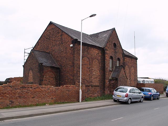
Photo: Stephen McCulloch, CC BY-SA 2.0.
Warrenby is a depopulated area of Redcar in the ceremonial county of North Yorkshire, England. It is a light industrial area and is no longer residential. Warrenby is situated 2 miles west of Redcar East.
Redcar East
- Type: Railway stop
- Categories: transport stop and transportation
- Location: Redcar and Cleveland, England, United Kingdom, Britain and Ireland, Europe
- View on OpenStreetMap
Latitude
54.60919° or 54° 36′ 33″ northLongitude
-1.05209° or 1° 3′ 8″ westOpen location code
9C6WJW5X+M5OpenStreetMap ID
node 5120443742OpenStreetMap feature
public_transport=stop_position
This page is based on OpenStreetMap, Wikidata, and Wikimedia Commons.
We’d love your help improving our open data sources. Thank you for contributing.
Satellite Map
Discover Redcar East from above in high-definition satellite imagery.
Places with the Same Name
Discover other places named “Redcar East”.
Notable Places Nearby
Highlights include John Emmerson Batty Primary School and Ings Farm Primary School.
Nearby Places
Explore places such as Redcar East and The Cleveland Bay.
England: Must-Visit Destinations
Delve into London, Manchester, Sheffield, and Leeds.
Curious Railway Stops to Discover
Uncover intriguing railway stops from every corner of the globe.
About Mapcarta. Data © OpenStreetMap contributors and available under the Open Database License". Text is available under the CC BY-SA 4.0 license, except for photos, directions, and the map. Photo: sidibousaid, CC BY 2.0.