St Luke’s Coffee Shop
St Luke’s Coffee Shop is a café in Bath and North East Somerset, England. St Luke’s Coffee Shop is situated nearby to Church of St Luke, as well as near the pub Devonshire Arms.| Tap on a place to explore it |
Places of Interest Nearby
Highlights include Church of St Luke and Devonshire Tunnel.

Devonshire Tunnel
Tunnel

Photo: DBailey635, CC BY-SA 3.0.
Devonshire Tunnel is on the closed Somerset & Dorset Joint Railway main line, between Midford and Bath Green Park railway stations, below high ground and the southern suburbs of Bath, England, emerging below the northern slopes of Combe Down village. Devonshire Tunnel is situated 330 feet north of St Luke’s Coffee Shop.
Bath Spa Railway Station
Railway station
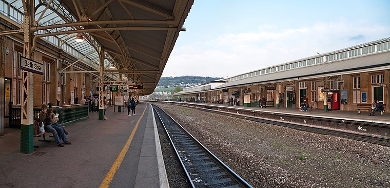
Photo: Diliff, CC BY-SA 3.0.
Bath Spa railway station is the principal station serving the city of Bath in Somerset, England. It is on the Great Western Main Line, 106 miles 71 chains down the line from the zero point at London Paddington between Chippenham to the east and Oldfield Park to the west. Bath Spa Railway Station is situated 3,800 feet northeast of St Luke’s Coffee Shop.
Places in the Area
Nearby places include Bear Flat and Lyncombe.
Bear Flat
Suburb

Photo: Rwendland, CC BY-SA 3.0.
Bear Flat is a neighbourhood within the city of Bath, Somerset, England, to the south of the city centre and to the west of Beechen Cliff. It forms the southern part of the Widcombe and Lyncombe electoral ward.
Lyncombe
Suburb

Photo: Derek Harper, CC BY-SA 2.0.
Lyncombe is a district and electoral ward in Bath, Somerset, and a former parish in the Diocese of Bath and Wells. In the mid-19th century the parish was formed when the parish of Widcombe and Lyncombe was split in two, but it was abolished in the late 1960s.
Bath
 Bath is a historic Roman and Georgian spa city. It is famous for its hot springs, Roman period baths, Medieval heritage and stately Georgian architecture.
St Luke’s Coffee Shop
- Type: Café
- Postal code: BA2 2BD
- Location: Bath and North East Somerset, England, United Kingdom, Britain and Ireland, Europe
- View on OpenStreetMap
Latitude
51.36904° or 51° 22′ 9″ northLongitude
-2.36652° or 2° 21′ 60″ westOpen location code
9C3V9J9M+J9OpenStreetMap ID
node 5198902611OpenStreetMap feature
amenity=cafe
This page is based on OpenStreetMap, Wikidata, and Wikimedia Commons.
We’d love your help improving our open data sources. Thank you for contributing.
Satellite Map
Discover St Luke’s Coffee Shop from above in high-definition satellite imagery.
Notable Places Nearby
Highlights include Devonshire Arms and Devonshire Cottage.
Nearby Places
Explore places such as St. Luke’s Church Centre and Devonshire Buildings.
England: Must-Visit Destinations
Delve into London, Manchester, Sheffield, and Leeds.
Curious Cafés to Discover
Uncover intriguing cafés from every corner of the globe.
About Mapcarta. Data © OpenStreetMap contributors and available under the Open Database License". Text is available under the CC BY-SA 4.0 license, except for photos, directions, and the map. Photo: sidibousaid, CC BY 2.0.