Rocher du Liban
Rocher du Liban is a fast food restaurant in Paris, Île-de-France. Rocher du Liban is situated nearby to the historic site Fontaine Wallace, as well as near the park Federica Montseny Garden.| Tap on a place to explore it |
Places of Interest Nearby
Highlights include Arts et Métiers ParisTech and Herbarium.
Arts et Métiers ParisTech
College

Photo: Mbzt, CC BY-SA 3.0.
Arts et Métiers ParisTech is a French engineering and research institute of higher education. It is a grande école, recognized for leading in the fields of mechanics and industrialization. Arts et Métiers ParisTech is situated 320 metres south of Rocher du Liban.
Herbarium
Museum

Photo: DIST Lyon1, CC BY-SA 4.0.
A herbarium is a collection of preserved plant specimens and associated data used for scientific study. The specimens may be whole plants or plant parts; these will usually be in dried form mounted on a sheet of paper but, depending upon the material, may also be stored in boxes or kept in alcohol or other preservative. Herbarium is situated 680 metres north of Rocher du Liban.

Places in the Area
Nearby places include Quartier de Croulebarbe and 13th arrondissement.

13th arrondissement

Photo: PHGCOM, Public domain.
The 13th arrondissement of Paris is primarily a residential and business district in the southeast of Paris, on the Left Bank of the Seine. Although not usually recognised as a natural magnet for tourists, the 13th nonetheless does hold several attractions…
5th arrondissement
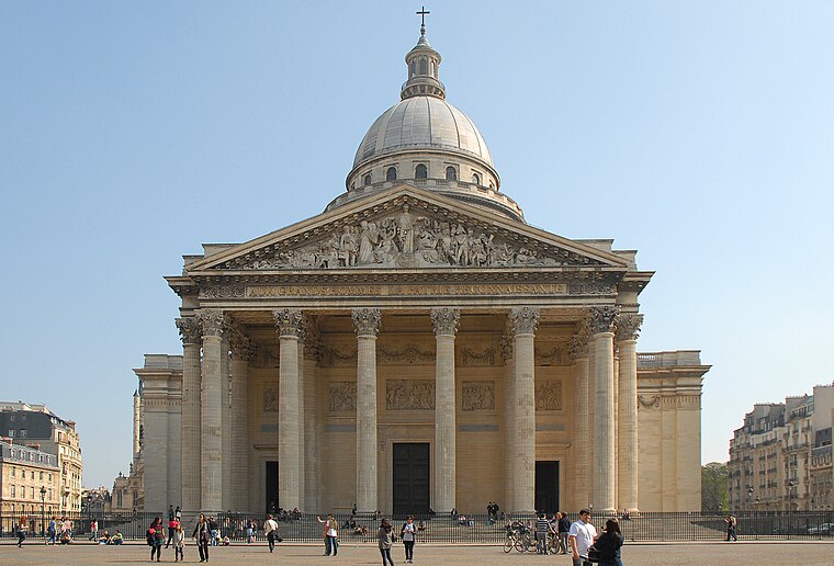
Photo: K’m, CC BY-SA 3.0.
The 5th Arrondissement of Paris is one of the best known of the city's central districts, located on the Left Bank of the river Seine. Also commonly known as the "Latin Quarter" because the first great Parisian university, the Sorbonne, was founded here and Latin was the language the medieval period students used once to speak.
Rocher du Liban
- Type: Fast food restaurant
- Cuisine: Lebanese
- Categories: food and restaurant
- Location: Paris, Île-de-France, France, Europe
- View on OpenStreetMap
Latitude
48.8364° or 48° 50′ 11″ northLongitude
2.35879° or 2° 21′ 32″ eastOpen location code
8FW4R9P5+HGOpenStreetMap ID
node 5224671133OpenStreetMap feature
amenity=fast_foodOpenStreetMap attribute
cuisine=lebanese
This page is based on OpenStreetMap, Wikidata, and Wikimedia Commons.
We’d love your help improving our open data sources. Thank you for contributing.
Satellite Map
Discover Rocher du Liban from above in high-definition satellite imagery.
Notable Places Nearby
Highlights include Fontaine Wallace and Hôpital - Campo-Formio.
Nearby Places
Explore places such as Vanity Hair and GSM.COM.
Paris: Must-Visit Destinations
Delve into La Défense, 1st arrondissement, 7th arrondissement, and 8th arrondissement.
Curious Fast Food Restaurants to Discover
Uncover intriguing fast food restaurants from every corner of the globe.
About Mapcarta. Data © OpenStreetMap contributors and available under the Open Database License". Text is available under the CC BY-SA 4.0 license, except for photos, directions, and the map. Photo: Benh, CC BY-SA 4.0.