Rößlers Winzerwirtschaft
Rößlers Winzerwirtschaft is a recreation area in Lorch am Rhein, Rheingau-Taunus-Kreis, Hesse. Rößlers Winzerwirtschaft is situated nearby to the marina Steganlage Wassersportverein Lorch, as well as near the cemetery Friedhof Lorch.| Tap on a place to explore it |
Places of Interest Nearby
Highlights include Hilchenhaus and St. Martin.
Hilchenhaus
Manor estate

Photo: Bytfisch, CC BY-SA 3.0 de.
Hilchenhaus is a manor estate, which is situated 340 metres northwest of Rößlers Winzerwirtschaft.
St. Martin
Church

Photo: Wikimedia, CC BY-SA 3.0.
St. Martin is a Gothic church and the associated Catholic parish in Lorch am Rhein, Hesse, Germany. In 2002, it became part of the Rhine Gorge, a UNESCO World Heritage Site. St. Martin is situated 410 metres northwest of Rößlers Winzerwirtschaft.
Heimburg in Niederheimbach
Castle
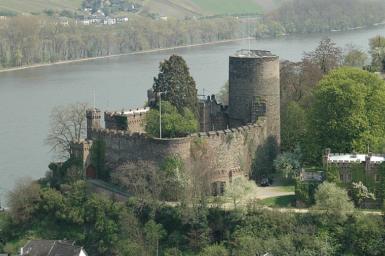
Photo: Peter Weller, CC BY-SA 3.0.
The Heimburg is a castle in the village of Niederheimbach in Rhineland-Palatinate, Germany. Heimburg in Niederheimbach is situated 1 km south of Rößlers Winzerwirtschaft.
Places in the Area
Nearby places include Niederheimbach and Ranselberg.
Niederheimbach
Village

Photo: Wikimedia, CC BY-SA 4.0.
Niederheimbach is an Ortsgemeinde – a municipality belonging to a Verbandsgemeinde, a kind of collective municipality – in the Mainz-Bingen district in Rhineland-Palatinate, Germany.

Oberdiebach
Village
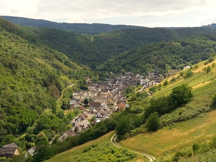
Photo: Wikimedia, CC BY-SA 4.0.
Oberdiebach is an Ortsgemeinde – a municipality belonging to a Verbandsgemeinde, a kind of collective municipality – in the Mainz-Bingen district in Rhineland-Palatinate, Germany.
Rößlers Winzerwirtschaft
- Type: Recreation area
- Wheelchair access: limited
- Categories: tourist attraction and tourism
- Location: Lorch am Rhein, Rheingau-Taunus-Kreis, South Hesse, Hesse, Germany, Central Europe, Europe
- View on OpenStreetMap
Latitude
50.04178° or 50° 2′ 30″ northLongitude
7.80881° or 7° 48′ 32″ eastOpen location code
9F292RR5+PGOpenStreetMap ID
node 532368193OpenStreetMap feature
leisure=outdoor_seatingOpenStreetMap attribute
wheelchair=limited
This page is based on OpenStreetMap, Wikidata, and Wikimedia Commons.
We’d love your help improving our open data sources. Thank you for contributing.
Satellite Map
Discover Rößlers Winzerwirtschaft from above in high-definition satellite imagery.
Notable Places Nearby
Highlights include Steganlage Wassersportverein Lorch and Friedhof Lorch.
Nearby Places
Explore places such as Weingut Michael Rößler and Weingut Mohr.
South Hesse: Must-Visit Destinations
Delve into Darmstadt, Bensheim, Lorsch, and Heppenheim.
Curious Recreation Areas to Discover
Uncover intriguing recreation areas from every corner of the globe.
About Mapcarta. Data © OpenStreetMap contributors and available under the Open Database License". Text is available under the CC BY-SA 4.0 license, except for photos, directions, and the map. Photo: Alexander Hoernigk, CC BY 3.0.