Milne Way
Milne Way is a bus stop in Newport, Isle of Wight, England. Milne Way is situated nearby to the suburb Shide, as well as near The Church of Jesus Christ of Latter-day Saints.| Tap on a place to explore it |
Places of Interest Nearby
Highlights include Newport Roman Villa and Carisbrooke Castle.
Newport Roman Villa
Museum
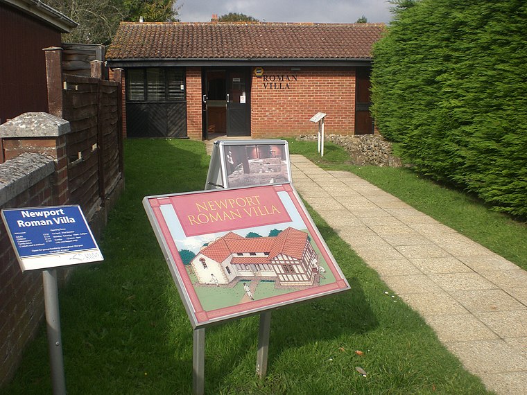
Photo: Editor5807, Public domain.
Newport Roman Villa was a Romano-British farmhouse constructed in 280 AD. It is located near to Newport, Isle of Wight. Newport Roman Villa is situated 860 feet north of Milne Way.
Carisbrooke Castle
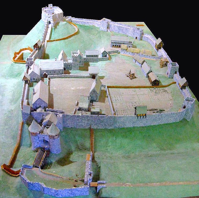
Photo: Charles D P Miller, CC BY 2.0.
Carisbrooke Castle is a historic motte-and-bailey castle located in the village of Carisbrooke, Isle of Wight, England. Charles I was imprisoned at the castle in the months prior to his trial. Carisbrooke Castle is situated 1 mile west of Milne Way.
Church of St John the Baptist
Church

Photo: Hassocks5489, CC0.
The Church of St. John the Baptist, Newport is a parish church in the Church of England located in Newport, Isle of Wight. It is a Grade II listed building, the only surviving building by the British architect Robert Gunter Wetten. Church of St John the Baptist is situated 1,600 feet northwest of Milne Way.
Places in the Area
Nearby places include Shide and Barton.
Shide
Suburb

Photo: Graham Horn, CC BY-SA 2.0.
Shide is a small settlement on the Isle of Wight, some of which is considered to be in the Newport conurbation. Shide Hill House, which was demolished in the 1970s, was situated with its back towards St.
Barton
Suburb
Barton is an area in the east of Newport on the Isle of Wight. Transport is provided by Southern Vectis community service route 39 to the town centre and standard service routes 8 and 9 to Sandown and Ryde, which run nearby.
Carisbrooke
Village

Photo: Mypix, CC BY-SA 4.0.
Carisbrooke is a village on the south-western outskirts of Newport, in the civil parish of Newport and Carisbrooke, Isle of Wight, England. It is best known as the site of Carisbrooke Castle.
Milne Way
- Type: Bus stop
- Category: transportation
- Location: Newport, Isle of Wight, South East England, England, United Kingdom, Britain and Ireland, Europe
- View on OpenStreetMap
Latitude
50.69207° or 50° 41′ 31″ northLongitude
-1.29213° or 1° 17′ 32″ westOpen location code
9C2WMPR5+R4OpenStreetMap ID
node 533813659OpenStreetMap feature
highway=bus_stopOpenStreetMap feature
public_transport=platform
This page is based on OpenStreetMap, Wikidata, and Wikimedia Commons.
We’d love your help improving our open data sources. Thank you for contributing.
Satellite Map
Discover Milne Way from above in high-definition satellite imagery.
Places with the Same Name
Discover other places named “Milne Way”.
Notable Places Nearby
Highlights include The Church of Jesus Christ of Latter-day Saints and St George’s School.
Nearby Places
Explore places such as Watergate Roundabout and Newport Residential Care.
Isle of Wight: Must-Visit Destinations
Delve into Cowes, Ryde, Ventnor, and Yarmouth.
Curious Bus Stops to Discover
Uncover intriguing bus stops from every corner of the globe.
About Mapcarta. Data © OpenStreetMap contributors and available under the Open Database License". Text is available under the CC BY-SA 4.0 license, except for photos, directions, and the map. Photo: Adrian Farwell, CC BY 3.0.