EATON ROAD/NORTH DRIVE
EATON ROAD/NORTH DRIVE is a bus stop in Liverpool, England. EATON ROAD/NORTH DRIVE is situated nearby to the hospital Alder Grange Nursing Home, as well as near St Paul’s Church, West Derby.| Tap on a place to explore it |
Places of Interest Nearby
Highlights include St Paul’s Church, West Derby and St Edward’s College.
St Paul’s Church, West Derby
Church
St Paul's Church is in Town Row, West Derby, a suburb of Liverpool, Merseyside, England. It is an active Roman Catholic parish church in Pastoral Area 5 of the Archdiocese of Liverpool. St Paul’s Church, West Derby is situated 1,000 feet northeast of EATON ROAD/NORTH DRIVE.
St Edward’s College
School
St Edward's College is a co-educational Catholic school with academy status in the UK located in the Liverpool suburb of West Derby. Founded in 1853 as the Catholic Institute, the college was formerly a boys grammar school run by the Congregation of Christian Brothers, known widely as the Irish Christian Brothers. St Edward’s College is situated 1,400 feet southwest of EATON ROAD/NORTH DRIVE.
St James’ Church, West Derby, Liverpool
Church
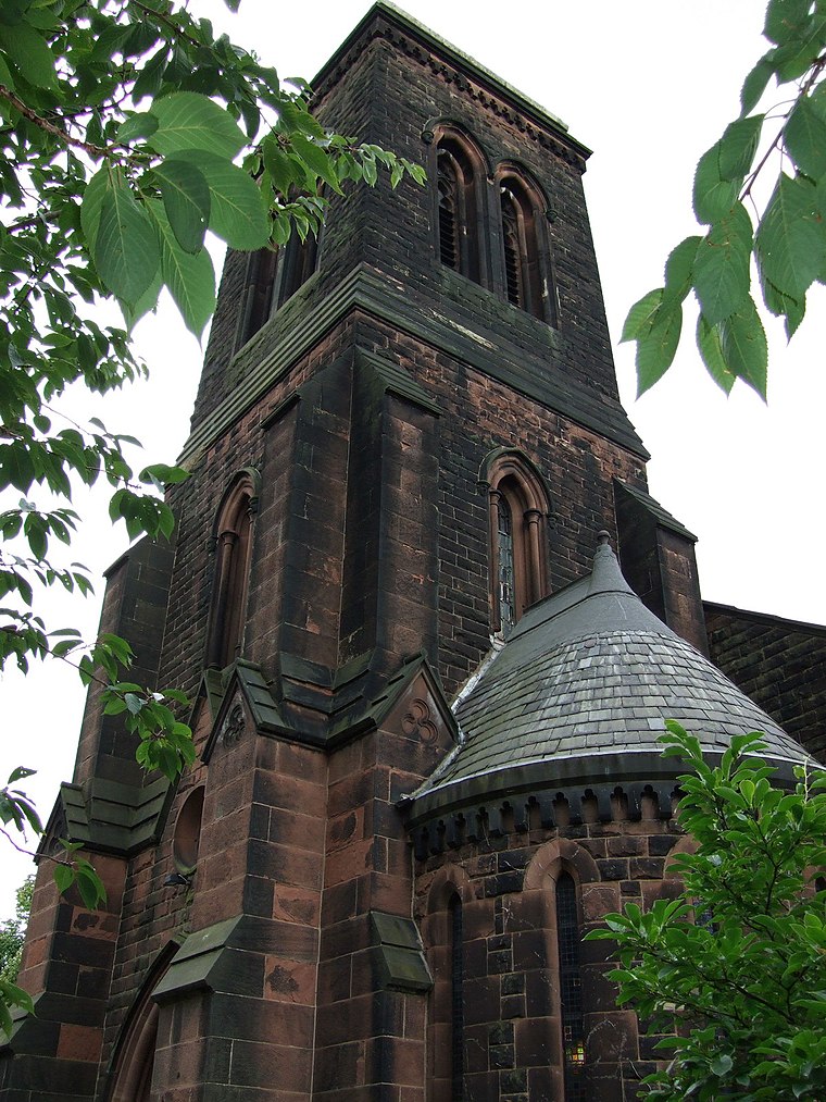
Photo: Wikimedia, CC BY-SA 2.0.
St James' Church is in Mill Lane, West Derby, a suburb of Liverpool, Merseyside, England. It was an active Anglican parish church in the deanery of West Derby, the archdeaconry of Liverpool, and the diocese of Liverpool until 23 June 2019 when responsibility was handed over to the Indian Orthodox Church. St James’ Church, West Derby, Liverpool is situated 2,000 feet west of EATON ROAD/NORTH DRIVE.
Places in the Area
Nearby places include Stockbridge Village and Page Moss.
Stockbridge Village
Suburb
Stockbridge Village is an area of Knowsley in Merseyside, England. The population of the ward at the 2011 census was 6,018. Up until 1983, the area was formerly known as Cantril Farm, and was the subject of an article in a special report by The Economist entitled "A new kind of ghetto", which described it a predominantly White area of high unemployment and low aspirations. Stockbridge Village is situated 2 miles east of EATON ROAD/NORTH DRIVE.
Page Moss
Suburb
Page Moss is an area in the borough of Knowsley, Merseyside. It borders the city of Liverpool to the east. Previously known as "The Horns" due to the crime and previous people using guns naming them horns. Page Moss is situated 2 miles east of EATON ROAD/NORTH DRIVE.
Walton
Suburb

Photo: Rept0n1x, CC BY-SA 3.0.
Walton is an area of Liverpool, in Merseyside, England, north of Anfield and east of Bootle and Orrell Park. Historically in Lancashire, it is largely residential, with a diverse population. Walton is situated 2½ miles northwest of EATON ROAD/NORTH DRIVE.
EATON ROAD/NORTH DRIVE
- Type: Bus stop
- Category: transportation
- Location: Liverpool, England, United Kingdom, Britain and Ireland, Europe
- View on OpenStreetMap
Latitude
53.42683° or 53° 25′ 37″ northLongitude
-2.90442° or 2° 54′ 16″ westOpen location code
9C5VC3GW+P6OpenStreetMap ID
node 533858310OpenStreetMap feature
highway=bus_stopOpenStreetMap feature
public_transport=platform
This page is based on OpenStreetMap, Wikidata, and Wikimedia Commons.
We’d love your help improving our open data sources. Thank you for contributing.
Satellite Map
Discover EATON ROAD/NORTH DRIVE from above in high-definition satellite imagery.
Notable Places Nearby
Highlights include Alder Grange Nursing Home and Crown Inn Crown Green Bowls Club.
Nearby Places
Explore places such as EATON ROAD/APSLEY ROAD and EATON ROAD/NORRIS GREEN ROAD.
England: Must-Visit Destinations
Delve into London, Manchester, Sheffield, and Leeds.
Curious Bus Stops to Discover
Uncover intriguing bus stops from every corner of the globe.
About Mapcarta. Data © OpenStreetMap contributors and available under the Open Database License". Text is available under the CC BY-SA 4.0 license, except for photos, directions, and the map. Photo: sidibousaid, CC BY 2.0.