Hindon Walk
Hindon Walk is a bus stop in North Lincolnshire, England. Hindon Walk is situated nearby to the school Oasis Academy Parkwood, as well as near Scunthorpe Westcliff Church of Reconciliation.| Tap on a place to explore it |
Places of Interest Nearby
Highlights include Glanford Park and Quibell Park Stadium.
Glanford Park
Stadium
Glanford Park, currently known as The Attis Arena for sponsorship reasons, is a football stadium in Scunthorpe, Lincolnshire, England, and is the home of National League team Scunthorpe United. Glanford Park is situated 4,200 feet northwest of Hindon Walk.
Quibell Park Stadium
Motorsport racing track

Photo: Paul Harrop, CC BY-SA 2.0.
Quibell Park Stadium is a multi-purpose stadium in Scunthorpe, North Lincolnshire, owned by North Lincolnshire Council, primarily used for athletics, cycling, and American football. Quibell Park Stadium is situated 2,000 feet northeast of Hindon Walk.
John Leggott College
College
John Leggott College is a sixth form college on West Common Lane, in Old Brumby, Scunthorpe, North Lincolnshire, England. John Leggott College is situated 3,300 feet east of Hindon Walk.
Places in the Area
Nearby places include Frodingham and Crosby.
Frodingham
Suburb

Photo: fred roberts, CC BY-SA 2.0.
Frodingham is a historic hamlet and now a suburb of Scunthorpe in the borough of North Lincolnshire, in Lincolnshire, England. The village lay directly to the south of Scunthorpe town centre, the name Frodingham is now often used to refer to the area directly to the north of the town centre.
Crosby
Suburb
Crosby was a small hamlet which has grown into a suburb in the north of Scunthorpe, in the North Lincolnshire district, in the ceremonial county of Lincolnshire, England.
Ashby
Suburb
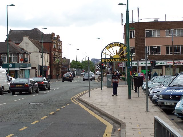
Photo: Steve Parker, CC BY-SA 2.0.
Ashby is a suburb of Scunthorpe, in the North Lincolnshire district, in the ceremonial county of Lincolnshire, England.
Hindon Walk
- Type: Bus stop
- Category: transportation
- Location: North Lincolnshire, England, United Kingdom, Britain and Ireland, Europe
- View on OpenStreetMap
Latitude
53.57784° or 53° 34′ 40″ northLongitude
-0.68313° or 0° 40′ 59″ westOpen location code
9C5XH8H8+4POpenStreetMap ID
node 533864825OpenStreetMap feature
highway=bus_stop
This page is based on OpenStreetMap, Wikidata, and Wikimedia Commons.
We’d love your help improving our open data sources. Thank you for contributing.
Satellite Map
Discover Hindon Walk from above in high-definition satellite imagery.
Notable Places Nearby
Highlights include Oasis Academy Parkwood and Scunthorpe Westcliff Church of Reconciliation.
Nearby Places
Explore places such as Melbury Walk and Weymouth Crescent.
England: Must-Visit Destinations
Delve into London, Manchester, Sheffield, and Leeds.
Curious Bus Stops to Discover
Uncover intriguing bus stops from every corner of the globe.
About Mapcarta. Data © OpenStreetMap contributors and available under the Open Database License". Text is available under the CC BY-SA 4.0 license, except for photos, directions, and the map. Photo: sidibousaid, CC BY 2.0.