García y Boló Bolaño
García y Boló Bolaño is a bus stop in Tigre Partido, Buenos Aires. García y Boló Bolaño is situated nearby to the health club Gimnasio Club Nautico Hacoal, as well as near the police station Policía Infanteria Tigre.| Tap on a place to explore it |
Places of Interest Nearby
Highlights include Tigre Station and Carupa Station.
Tigre Station
Railway station
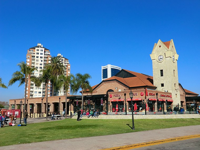
Photo: Aleksandrs Timofejev…, CC BY 3.0.
Tigre Station is a railway station, which is situated 1 km north of García y Boló Bolaño.
Carupa Station
Railway station

Photo: Chryslerark, CC BY-SA 3.0.
Carupa Station is a railway station, which is situated 2 km southeast of García y Boló Bolaño.
Delta train station
Railway station

Photo: Falk2, CC BY-SA 4.0.
Delta train station is a railway station, which is situated 1½ km northeast of García y Boló Bolaño.
Places in the Area
Nearby places include Tigre and San Fernando.
Tigre

Photo: Mauro Cacciola, CC BY 2.0.
Tigre is a city near Buenos Aires, in Buenos Aires province, Argentina. Located between some of the rivers of the Paraná Delta, Tigre is a popular weekend destination from Buenos Aires and a great location for seeing the delta.
San Fernando
Town

Photo: Wikimedia, Public domain.
San Fernando is a city in the Gran Buenos Aires area, in Argentina, and capital of the San Fernando Partido, 20 km north of the city of Buenos Aires.
Virreyes
Town
Virreyes is a town located in the San Fernando Partido of Buenos Aires Province, Argentina. It forms part of the Greater Buenos Aires urban conurbation. Virreyes is situated 3½ km southeast of García y Boló Bolaño.
García y Boló Bolaño
- Type: Bus stop
- Category: transportation
- Location: Tigre Partido, Buenos Aires, Pampas, Argentina, South America
- View on OpenStreetMap
Latitude
-34.43092° or 34° 25′ 51″ southLongitude
-58.58496° or 58° 35′ 6″ westOpen location code
48Q3HC98+J2OpenStreetMap ID
node 5365305431OpenStreetMap feature
highway=bus_stopOpenStreetMap feature
public_transport=platform
This page is based on OpenStreetMap, Wikidata, and Wikimedia Commons.
We’d love your help improving our open data sources. Thank you for contributing.
Satellite Map
Discover García y Boló Bolaño from above in high-definition satellite imagery.
Notable Places Nearby
Highlights include Gimnasio Club Nautico Hacoal and Policía Infanteria Tigre.
Nearby Places
Explore places such as García y Boló Bolaño and García y Montevideo.
Buenos Aires: Must-Visit Destinations
Delve into Buenos Aires, La Plata, Mar del Plata, and Centro.
Curious Bus Stops to Discover
Uncover intriguing bus stops from every corner of the globe.
About Mapcarta. Data © OpenStreetMap contributors and available under the Open Database License". Text is available under the CC BY-SA 4.0 license, except for photos, directions, and the map. Photo: Mbusin, CC BY-SA 4.0.