Deán Funes y Carlos Calvo
Deán Funes y Carlos Calvo is a bus stop in Comuna 3, Buenos Aires, Buenos Aires. Deán Funes y Carlos Calvo is situated nearby to the hospital Unidad Asistencial Doctor Cesar Milstein, as well as near the church Iglesia Santa Cruz, Buenos Aires.| Tap on a place to explore it |
Places of Interest Nearby
Highlights include Museum of Experimental Psychology in Argentina ‘Dr. Horacio G. Piñero’ and Hospital Ramos Mejía.
Museum of Experimental Psychology in Argentina ‘Dr. Horacio G. Piñero’
Museum

Photo: Ojota, Public domain.
Museum of Experimental Psychology in Argentina ‘Dr. Horacio G. Piñero’ is situated 310 metres northwest of Deán Funes y Carlos Calvo.
Hospital Ramos Mejía
Hospital
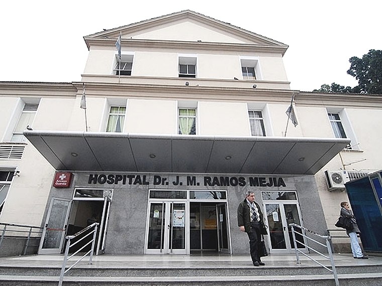
Photo: Wikimedia, CC BY 2.5 ar.
Hospital Ramos Mejía is a hospital in Buenos Aires, Argentina. Hospital Ramos Mejía is situated 560 metres northwest of Deán Funes y Carlos Calvo.
Iglesia Santa Cruz, Buenos Aires
Church

Photo: Trucoto, CC BY-SA 3.0.
Iglesia Santa Cruz, Buenos Aires is a church, which is situated 300 metres west of Deán Funes y Carlos Calvo.
Places in the Area
Nearby places include Once and Centro.

Centro

Photo: Roger Schultz, CC BY 2.0.
The center of Buenos Aires has most of the city's attractions, including performances in the Tribunales theater district, the dense downtown area with government buildings, the San Telmo tango scene, and the biggest train station and the general bus station that offers connections to the surrounding provinces and neighboring countries.
Barracas
Suburb

Photo: Jorge Gobbi, CC BY 2.0.
Barracas is a barrio, or district, in the southeast part of the city of Buenos Aires, Argentina. It is located between the railroad of Ferrocarril General Manuel Belgrano and the Riachuelo River, and the streets Regimiento de Patricios, Defensa, Caseros, Vélez Sársfield, Amancio Alcorta, Lafayette, and Lavardén. Barracas is situated 3 km southeast of Deán Funes y Carlos Calvo.
Deán Funes y Carlos Calvo
- Type: Bus stop
- Category: transportation
- Location: Comuna 3, Buenos Aires, Buenos Aires, Pampas, Argentina, South America
- View on OpenStreetMap
Latitude
-34.62163° or 34° 37′ 18″ southLongitude
-58.40625° or 58° 24′ 23″ westOpen location code
48Q39HHV+8FOpenStreetMap ID
node 5382351851OpenStreetMap feature
highway=bus_stopOpenStreetMap feature
public_transport=platform
This page is based on OpenStreetMap, Wikidata, and Wikimedia Commons.
We’d love your help improving our open data sources. Thank you for contributing.
Satellite Map
Discover Deán Funes y Carlos Calvo from above in high-definition satellite imagery.
Notable Places Nearby
Highlights include Unidad Asistencial Doctor Cesar Milstein and Grupo Scout Santa Cruz.
Nearby Places
Explore places such as Deán Funes y Carlos Calvo and Escuela Primaria Común 17 Luis Jose Chorroarín.
Buenos Aires: Must-Visit Destinations
Delve into Centro, Palermo & Recoleta, La Boca & Barracas, and Outskirts.
Curious Bus Stops to Discover
Uncover intriguing bus stops from every corner of the globe.
About Mapcarta. Data © OpenStreetMap contributors and available under the Open Database License". Text is available under the CC BY-SA 4.0 license, except for photos, directions, and the map. Photo: Moemoemoe, CC0.