Lindsey Close
Lindsey Close is a bus stop in Merton, Greater London, England. Lindsey Close is situated nearby to the community center Pollards Hill Youth Centre, as well as near Pollards Hill Police Station.| Tap on a place to explore it |
Places of Interest Nearby
Highlights include Pollards Hill and The Parish Church of St Philip - Home to Libera.
Pollards Hill
Park
Pollards Hill is a small residential district straddling the south London boroughs of Croydon and Merton between Mitcham, Norbury and Thornton Heath. The boundary of the two boroughs is a street named Recreation Way. Pollards Hill is situated 1,100 feet north of Lindsey Close.
The Parish Church of St Philip - Home to Libera
Church

Photo: John Salmon, CC BY-SA 2.0.
The Parish Church of St Philip - Home to Libera is situated 1,700 feet north of Lindsey Close.
The Ascension
Church

Photo: Peter Trimming, CC BY-SA 2.0.
The Ascension is a church, which is situated 2,100 feet west of Lindsey Close.
Places in the Area
Nearby places include Norbury and Lambeth.
Norbury
Suburb
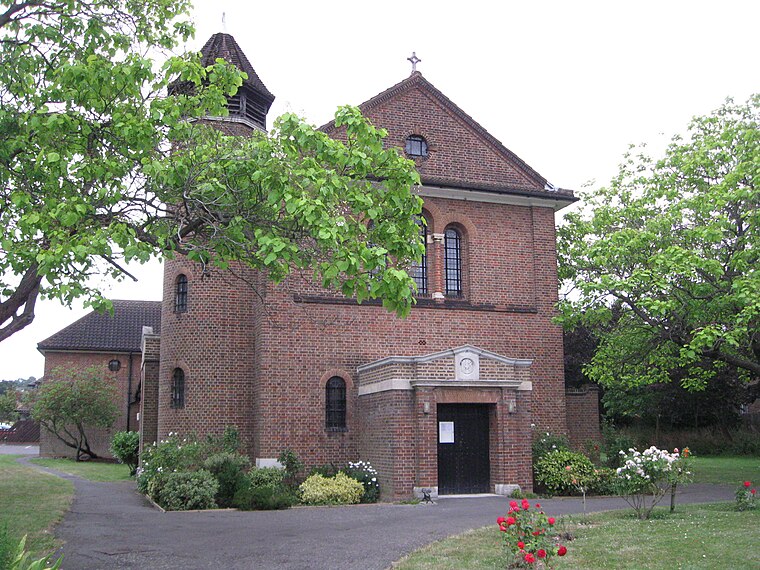
Photo: Eagleash, CC BY-SA 4.0.
Norbury is an town and suburb in south London. It shares the postcode London SW16 with neighbouring Streatham. The area is mainly in the borough of Croydon, with some parts extending into the neighbouring borough of Lambeth.
Lambeth

Photo: brodiepunk, CC BY 2.0.
Lambeth is a borough of inner south-west London. Here is the official residence of the Archbishop of Canterbury at Lambeth Palace, St. Thomas's Hospital and County Hall.
Thornton Heath
Suburb

Photo: Danny Robinson, CC BY-SA 2.0.
Thornton Heath is a district of South London, England, within the London Borough of Croydon. It is around 1.5 miles north of the town of Croydon, and 7.2 miles south of Charing Cross.
Lindsey Close
- Type: Bus stop
- Category: transportation
- Location: Merton, Greater London, England, United Kingdom, Britain and Ireland, Europe
- View on OpenStreetMap
Latitude
51.40006° or 51° 24′ 0″ northLongitude
-0.12665° or 0° 7′ 36″ westOpen location code
9C3XCV2F+28OpenStreetMap ID
node 5480402722OpenStreetMap feature
highway=bus_stopOpenStreetMap feature
public_transport=platform
This page is based on OpenStreetMap, Wikidata, and Wikimedia Commons.
We’d love your help improving our open data sources. Thank you for contributing.
Satellite Map
Discover Lindsey Close from above in high-definition satellite imagery.
Notable Places Nearby
Highlights include Pollards Hill Youth Centre and Pollards Hill Police Station.
Nearby Places
Explore places such as Huntingdon Close and Yorkshire Road.
England: Must-Visit Destinations
Delve into London, Manchester, Sheffield, and Leeds.
Curious Bus Stops to Discover
Uncover intriguing bus stops from every corner of the globe.
About Mapcarta. Data © OpenStreetMap contributors and available under the Open Database License". Text is available under the CC BY-SA 4.0 license, except for photos, directions, and the map. Photo: sidibousaid, CC BY 2.0.