Frannelide høj
Frannelide høj is an archaeological site in Rebild Municipality, North Jutland. Frannelide høj is situated nearby to the village Haverslev, as well as near Ravnkilde.| Tap on a place to explore it |
Places of Interest Nearby
Highlights include Nørlund Slot and Haverslev Church.
Nørlund Slot
Manor estate

Photo: Wikimedia, Public domain.
Nørlund Slot is a manor estate, which is situated 2½ km northeast of Frannelide høj.
Haverslev Church
Church
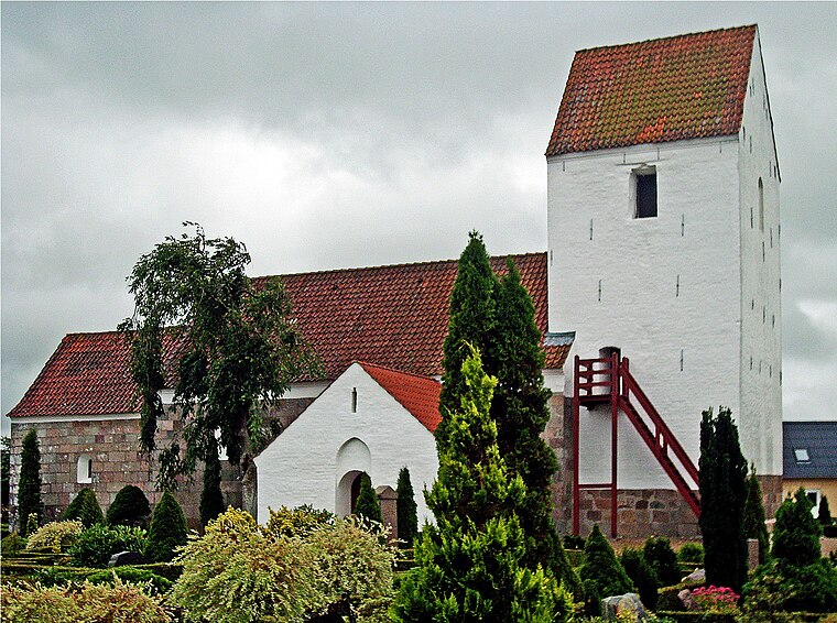
Photo: Bococo, CC BY-SA 3.0.
Haverslev Church is situated 2½ km northwest of Frannelide høj.
Brorstrup Church
Church

Photo: Bococo, CC BY-SA 3.0.
Brorstrup Church is situated 3 km west of Frannelide høj.
Places in the Area
Nearby places include Haverslev and Ravnkilde.
Haverslev
Village
Haverslev is a village, with a population of 797, in Rebild Municipality, North Jutland Region in Denmark. It is located 11 km east of Aars, 14 km south of Støvring, 11 km west of Arden and 10 km north of Nørager Haverslev Church is located in the village. Haverslev is situated 2½ km north of Frannelide høj.
Ravnkilde
Village

Photo: Bococo, CC BY-SA 3.0.
Ravnkilde is a small countryside town in Denmark with a population of 331, located in Rebild Municipality, North Jutland Region. Ravnkilde is situated 3½ km east of Frannelide høj.
Rørbæk
Village

Photo: Bococo, CC BY-SA 3.0.
Rørbæk is a village, which is situated 7 km south of Frannelide høj.
Frannelide høj
- Type: Archaeological site
- Description: ancient monument in Rebild Municipality (29126)
- Categories: tumulus, historic site, tourist attraction, and tourism
- Location: Rebild Municipality, North Jutland, Jutland, Denmark, Nordic countries, Europe
- View on OpenStreetMap
Latitude
56.76604° or 56° 45′ 58″ northLongitude
9.6981° or 9° 41′ 53″ eastOpen location code
9F8FQM8X+C6OpenStreetMap ID
node 5486953732OpenStreetMap feature
historic=archaeological_siteWikidata ID
Q30123576
This page is based on OpenStreetMap, Wikidata, and Wikimedia Commons.
We’d love your help improving our open data sources. Thank you for contributing.
Satellite Map
Discover Frannelide høj from above in high-definition satellite imagery.
In Other Languages
“Frannelide høj” goes by many names.
- Danish: “Frannelide høj”
Notable Places Nearby
Highlights include Stellplatz E45 and Enshøj.
Nearby Places
Explore places such as Hedegård and Ny Overvad.
North Jutland: Must-Visit Destinations
Delve into Aalborg, Frederikshavn, Skagen, and Hjørring.
Curious Archaeological Sites to Discover
Uncover intriguing archaeological sites from every corner of the globe.
About Mapcarta. Data © OpenStreetMap contributors and available under the Open Database License". Text is available under the CC BY-SA 4.0 license, except for photos, directions, and the map. Photo: Slaunger, CC BY-SA 3.0.