Manantiial de Vida
Manantiial de Vida is a church in Lomas de Zamora Partido, Buenos Aires which is located on Carhué. Manantiial de Vida is situated nearby to the community center Grupo Scout San Miguel Arcángel, as well as near the town hall Delegación Municipal.| Tap on a place to explore it |
Places of Interest Nearby
Highlights include Estadio Florencio Sola and Lomas de Zamora train station.
Estadio Florencio Sola
Stadium

Photo: Vincenzo.togni, CC BY 4.0.
Florencio Sola Stadium is a stadium in Banfield, Buenos Aires. It is located on 900 Arenales Street, in the heart of the city of the city and surrounded by a neighborhood characterized by cobblestone streets, chalets with tile roofs and a lush grove that is always highlighted by those who visit the stadium. Estadio Florencio Sola is situated 2 km northwest of Manantiial de Vida.
Lomas de Zamora train station
Railway station

Photo: Banfield, CC BY-SA 2.5 ar.
Lomas de Zamora train station is a railway station, which is situated 2½ km west of Manantiial de Vida.
Cathedral Basilica of Our Lady of Peace
Church
 The Cathedral Basilica of Our Lady of Peace, also called Lomas de Zamora Cathedral is a Catholic church located in the central square of the city of Lomas de Zamora, in Argentina under the patronage of Our Lady of Peace. Cathedral Basilica of Our Lady of Peace is situated 3 km west of Manantiial de Vida.
Places in the Area
Nearby places include San José and José Mármol.
San José
Town
San José is a localidad located in the south of Lomas de Zamora Partido in Buenos Aires Province. It forms part of the Greater Buenos Aires conurbation.
José Mármol
Town
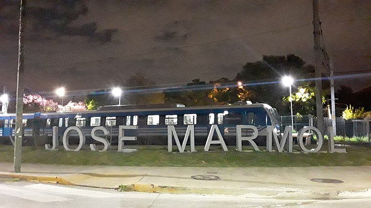
Photo: Ceci Pinto 2020, CC BY-SA 4.0.
José Marmol is a city in Greater Buenos Aires, Argentina, located 25 km south of Buenos Aires. It belongs to the Almirante Brown Partido. It has 5.14 km2, thus occupying 3.97% of the district. José Mármol is situated 3 km south of Manantiial de Vida.
Monte Chingolo
Neighborhood

Photo: Ulises Icardi, CC BY-SA 4.0.
Monte Chingolo is a town in Buenos Aires Province, Argentina. Located in Lanús Partido in the south of the Greater Buenos Aires metropolitan area. Monte Chingolo is situated 3½ km northeast of Manantiial de Vida.
Manantiial de Vida
- Type: Church
- Address: 722 Carhué, Temperley, 1835
- Categories: place of worship and religion
- Location: Lomas de Zamora Partido, Buenos Aires, Pampas, Argentina, South America
- View on OpenStreetMap
Latitude
-34.75984° or 34° 45′ 35″ southLongitude
-58.36846° or 58° 22′ 7″ westOpen location code
48Q36JRJ+3JOpenStreetMap ID
node 5518293322OpenStreetMap feature
amenity=place_of_worship
This page is based on OpenStreetMap, Wikidata, and Wikimedia Commons.
We’d love your help improving our open data sources. Thank you for contributing.
Satellite Map
Discover Manantiial de Vida from above in high-definition satellite imagery.
Notable Places Nearby
Highlights include Grupo Scout San Miguel Arcángel and Delegación Municipal.
Nearby Places
Explore places such as Centro de Atención Primaria de la Salud Doctor M. J. Oliveras and GK Com S.A..
Buenos Aires: Must-Visit Destinations
Delve into Buenos Aires, La Plata, Mar del Plata, and Centro.
Curious Churches to Discover
Uncover intriguing churches from every corner of the globe.
About Mapcarta. Data © OpenStreetMap contributors and available under the Open Database License". Text is available under the CC BY-SA 4.0 license, except for photos, directions, and the map. Photo: Mbusin, CC BY-SA 4.0.