Calcaria Roman Town
Calcaria Roman Town is an archaeological site in Tadcaster, Selby District, England. Calcaria Roman Town is situated nearby to the pitch Magnet Sports/Queens Gardens Crown Green Bowls Club, as well as near Tadcaster Methodist Church.| Tap on a place to explore it |
Places of Interest Nearby
Highlights include Tadcaster Library and Tadcaster Bridge.
Tadcaster Library
Library
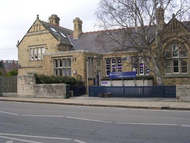
Photo: Betty Longbottom, CC BY-SA 2.0.
Tadcaster Library is situated 2,300 feet northwest of Calcaria Roman Town.
Tadcaster Bridge
Bridge
 Tadcaster Bridge or Wharfe Bridge spans the River Wharfe in Tadcaster, North Yorkshire, England. The road bridge is believed to date from around 1700. It is the main route connecting the two sides of the town and one of two road crossings in the town, the other being the bridge for the A64 bypass. Tadcaster Bridge is situated 2,100 feet north of Calcaria Roman Town.
Tadcaster Viaduct
Bridge

Photo: BC, CC BY-SA 2.0.
The Leeds and York Railway was a proposed railway line, promoted in the mid 1840s, intended to connect York and Leeds. The line lost a significant promoter, the Manchester and Leeds Railway in 1845/6 as a result of a non-competition arrangement between that company and the York and North Midland Railway. Tadcaster Viaduct is situated 3,400 feet north of Calcaria Roman Town.
Places in the Area
Nearby places include Stutton and Kirkby Wharfe.
Stutton
Hamlet

Photo: Paul Glazzard, CC BY-SA 2.0.
Stutton is a small village in the county of North Yorkshire, England, a mile south-west of Tadcaster. It lies in the valley of the Cock Beck which discharges into the River Wharfe one mile to the east of the village.
Kirkby Wharfe
Hamlet

Photo: Paul Glazzard, CC BY-SA 2.0.
Kirkby Wharfe is a village 1.9 miles south of Tadcaster, in North Yorkshire, England. The village is in the civil parish of Kirkby Wharfe with North Milford. Kirkby Wharfe is situated 1½ miles southeast of Calcaria Roman Town.
Newton Kyme
Hamlet

Photo: Bill Henderson, CC BY-SA 2.0.
Newton Kyme is a village in North Yorkshire, England, 1.5 miles north west of Tadcaster and 5 miles east of Wetherby. It lies on the south bank of the River Wharfe, just off the A659 road. Newton Kyme is situated 2 miles northwest of Calcaria Roman Town.
Calcaria Roman Town
- Type: Archaeological site
- Categories: historic site, tourist attraction, and tourism
- Location: Tadcaster, Selby District, North Yorkshire, Yorkshire, England, United Kingdom, Britain and Ireland, Europe
- View on OpenStreetMap
Latitude
53.87932° or 53° 52′ 46″ northLongitude
-1.26185° or 1° 15′ 43″ westOpen location code
9C5WVPHQ+P7OpenStreetMap ID
node 5537473618OpenStreetMap feature
historic=archaeological_site
This page is based on OpenStreetMap, Wikidata, and Wikimedia Commons.
We’d love your help improving our open data sources. Thank you for contributing.
Satellite Map
Discover Calcaria Roman Town from above in high-definition satellite imagery.
Notable Places Nearby
Highlights include Magnet Sports/Queens Gardens Crown Green Bowls Club and Tadcaster Methodist Church.
Nearby Places
Explore places such as John Smith’s Brewery and Tadcaster.
North Yorkshire: Must-Visit Destinations
Delve into York, Middlesbrough, Harrogate, and Ripon.
Curious Archaeological Sites to Discover
Uncover intriguing archaeological sites from every corner of the globe.
About Mapcarta. Data © OpenStreetMap contributors and available under the Open Database License". Text is available under the CC BY-SA 4.0 license, except for photos, directions, and the map. Photo: Tim Green, CC BY 2.0.