Kildonan Road
Kildonan Road is a bus stop in Dublin, Leinster. Kildonan Road is situated nearby to the community center West Finglas Tenants and Residents Association, as well as near the health club Finglas Sports and Fitness Centre.| Tap on a place to explore it |
Places of Interest Nearby
Highlights include Coláiste Eoin and National Orthopaedic Hospital Cappagh.
Coláiste Eoin
School

Photo: Wikimedia, CC BY-SA 2.5.
Coláiste Eoin is a Catholic voluntary Gaelcholáiste for boys, under the trusteeship of the Edmund Rice Schools Trust, in Booterstown, County Dublin, Ireland. Coláiste Eoin is situated 520 metres south of Kildonan Road.
National Orthopaedic Hospital Cappagh
Hospital
National Orthopaedic Hospital Cappagh, situated in Finglas, Dublin, is the largest orthopaedic hospital in Ireland. It is managed by Ireland East Hospital Group. National Orthopaedic Hospital Cappagh is situated 1 km west of Kildonan Road.
Dunsink Observatory

Photo: JP, CC BY-SA 2.0.
The Dunsink Observatory is an astronomical observatory established in 1785 in the townland of Dunsink in the outskirts of the city of Dublin, Ireland. Dunsink's most famous director was William Rowan Hamilton, who, amongst other things, discovered quaternions, the first non-commutative algebra form, while walking from the observatory to the city with his wife. Dunsink Observatory is situated 2 km west of Kildonan Road.
Places in the Area
Nearby places include Finglas and Cabra.
Finglas
Suburb

Photo: JP, CC BY-SA 2.0.
Finglas is a northwestern outer suburb of Dublin, Ireland. It lies close to Junction 5 of the M50 motorway, and the N2 road. Nearby suburbs include Glasnevin and Ballymun; Dublin Airport is seven km to the north.
Cabra
Suburb
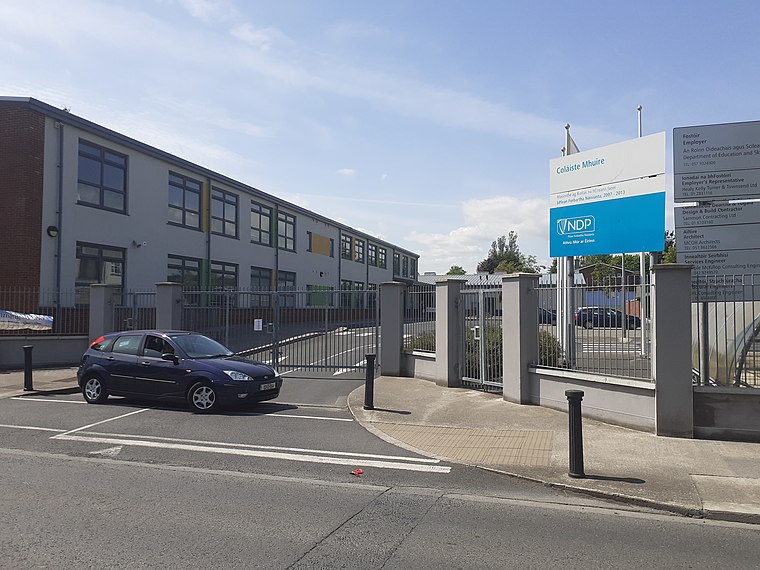
Photo: Darren J. Prior, CC BY-SA 4.0.
Cabra is an inner suburb on the northside of Dublin city in Ireland. It is approximately 2 kilometres northwest of the city centre, in the administrative area of Dublin City Council. Cabra is situated 3 km southeast of Kildonan Road.
Ballymun
Suburb

Photo: JP, CC BY-SA 2.0.
Ballymun is a suburb of Dublin, Ireland, at the northern edge of the city's Northside. Ballymun has several sub-districts, such as Sillogue, Coultry, Shangan and Poppintree, and is close to Dublin Airport. Ballymun is situated 3 km east of Kildonan Road.
Kildonan Road
- Type: Bus stop
- Wheelchair access: limited
- Category: transportation
- Location: Dublin, Leinster, Ireland, Britain and Ireland, Europe
- View on OpenStreetMap
Latitude
53.39234° or 53° 23′ 32″ northLongitude
-6.31154° or 6° 18′ 42″ westOperator
Dublin BusNetwork
Dublin BusOpen location code
9C5M9MRQ+W9OpenStreetMap ID
node 5555359916OpenStreetMap feature
highway=bus_stopOpenStreetMap feature
public_transport=platformOpenStreetMap attribute
wheelchair=limited
This page is based on OpenStreetMap, Wikidata, and Wikimedia Commons.
We’d love your help improving our open data sources. Thank you for contributing.
Satellite Map
Discover Kildonan Road from above in high-definition satellite imagery.
Places with the Same Name
Discover other places named “Kildonan Road”.
Notable Places Nearby
Highlights include West Finglas Tenants and Residents Association and Finglas Sports and Fitness Centre.
Nearby Places
Explore places such as Kildonan Road and Changing Pavillion.
Ireland: Must-Visit Destinations
Delve into Cork, Limerick, Galway, and Waterford.
Curious Bus Stops to Discover
Uncover intriguing bus stops from every corner of the globe.
About Mapcarta. Data © OpenStreetMap contributors and available under the Open Database License". Text is available under the CC BY-SA 4.0 license, except for photos, directions, and the map. Photo: Wikimedia, CC0.