Can Pere Menut
Can Pere Menut is a dwelling in Cardedeu, Barcelona, Catalonia. Can Pere Menut is situated nearby to the church Sant Jaume de Rifà, as well as near the house Can Bordoi.| Tap on a place to explore it |
Places of Interest Nearby
Highlights include Sant Jaume de Rifà and Sant Julià del Fou.
Sant Jaume de Rifà
Church
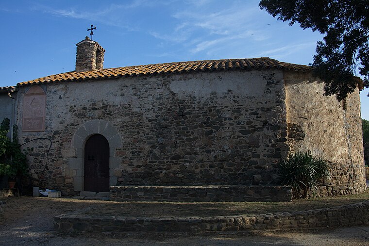
Photo: Amadalvarez, CC BY-SA 4.0.
Sant Jaume de Rifà is a church, which is situated 540 metres northeast of Can Pere Menut.
Sant Julià del Fou
Church

Photo: Amadalvarez, CC BY-SA 4.0.
Sant Julià del Fou is a church, which is situated 1½ km southeast of Can Pere Menut.
Can Jaumet
Dwelling

Photo: Amadalvarez, CC BY-SA 4.0.
Can Jaumet is a dwelling, which is situated 1 km west of Can Pere Menut.
Places in the Area
Nearby places include Sant Antoni de Vilamajor and Sant Pere de Vilamajor.
Sant Antoni de Vilamajor
Village

Photo: amadalvarez, CC BY-SA 2.5.
Sant Antoni de Vilamajor is a village in the comarca of Vallès Oriental in the province of Barcelona and autonomous community of Catalonia, Spain. The municipality covers an area of 13.7 square kilometres and the population in 2014 was 5,708. Sant Antoni de Vilamajor is situated 3 km northeast of Can Pere Menut.
Sant Pere de Vilamajor
Village

Photo: Orila872, Public domain.
Sant Pere de Vilamajor is a village in the province of Barcelona and autonomous community of Catalonia, Spain. The municipality covers an area of 13.8 square kilometres and the population in 2014 was 4,248. Sant Pere de Vilamajor is situated 3 km northeast of Can Pere Menut.
Llinars del Vallès
Village
Photo: Oriol20, CC BY-SA 3.0.
Llinars del Vallès is a village and a municipality in the comarca of Vallès Oriental, in the province of Barcelona and autonomous community of Catalonia, Spain. Llinars del Vallès is situated 3½ km southeast of Can Pere Menut.
Can Pere Menut
- Type: Dwelling
- Categories: locality, residential building, and building
- Location: Cardedeu, Barcelona, Catalonia, Eastern Spain, Spain, Iberia, Europe
- View on OpenStreetMap
Latitude
41.66146° or 41° 39′ 41″ northLongitude
2.37148° or 2° 22′ 17″ eastOpen location code
8FH4M96C+HHOpenStreetMap ID
node 5591121490OpenStreetMap feature
place=isolated_dwelling
This page is based on OpenStreetMap, Wikidata, and Wikimedia Commons.
We’d love your help improving our open data sources. Thank you for contributing.
Satellite Map
Discover Can Pere Menut from above in high-definition satellite imagery.
In Other Languages
“Can Pere Menut” goes by many names.
- Catalan: “Can Pere Menut”
Notable Places Nearby
Highlights include Can Bordoi and Can Tram.
Nearby Places
Explore places such as Can Pere Menut and Cal Barraquer.
Barcelona: Must-Visit Destinations
Delve into Barcelona, Malgrat de Mar, Terrassa, and Badalona.
Curious Dwellings to Discover
Uncover intriguing dwellings from every corner of the globe.
About Mapcarta. Data © OpenStreetMap contributors and available under the Open Database License". Text is available under the CC BY-SA 4.0 license, except for photos, directions, and the map. Photo: Alex Micheu Photography, CC BY-SA 3.0.