Can Capa
Can Capa is a dwelling in Llinars del Vallès, Barcelona, Catalonia. Can Capa is situated nearby to the church Santa Francesca, as well as near the house Can Gallard.| Tap on a place to explore it |
Places of Interest Nearby
Highlights include Castell del Far and Llinars del Vallès station.
Castell del Far

Photo: amadalvarez, CC BY 3.0.
Castell del Far is situated 590 metres southeast of Can Capa.
Llinars del Vallès station
Railway station
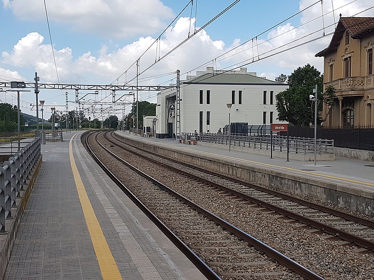
Photo: 9pm, CC BY-SA 4.0.
Llinars del Vallès station is a railway station, which is situated 1 km north of Can Capa.
Can Gallard
House

Photo: Pere prlpz, CC BY-SA 4.0.
Can Gallard is a house, which is situated 270 metres north of Can Capa.
Places in the Area
Nearby places include Sant Carles and Cardedeu.
Sant Carles
Neighborhood

Photo: Pere prlpz, CC BY-SA 4.0.
Sant Carles is a neighborhood, which is situated 4 km southwest of Can Capa.
Cardedeu
Town

Photo: Wikimedia, Public domain.
Cardedeu is a municipality in the comarca of Vallès Oriental in the province of Barcelona and autonomous community of Catalonia, Spain. It is near Granollers, the capital of Vallès Oriental, and it is placed between Serralada Litoral and Montseny. Cardedeu is situated 4 km west of Can Capa.
Dosrius
Village

Photo: 1997, Public domain.
Dosrius is a municipality in the comarca of Maresme in Catalonia, Spain, located in the interior of the comarca on the border with the Eastern Valleys, and is at the head of the Argentona Riera. Dosrius is situated 4 km south of Can Capa.
Can Capa
- Type: Dwelling
- Categories: locality, residential building, and building
- Location: Llinars del Vallès, Barcelona, Catalonia, Eastern Spain, Spain, Iberia, Europe
- View on OpenStreetMap
Latitude
41.63023° or 41° 37′ 49″ northLongitude
2.40212° or 2° 24′ 8″ eastOpen location code
8FH4JCJ2+3ROpenStreetMap ID
node 5592820133OpenStreetMap feature
place=isolated_dwelling
This page is based on OpenStreetMap, Wikidata, and Wikimedia Commons.
We’d love your help improving our open data sources. Thank you for contributing.
Satellite Map
Discover Can Capa from above in high-definition satellite imagery.
In Other Languages
“Can Capa” goes by many names.
- Catalan: “Can Capa”
Notable Places Nearby
Highlights include Santa Francesca and Font dels Àngels.
Nearby Places
Explore places such as Can Censat and Can Gallard.
Barcelona: Must-Visit Destinations
Delve into Barcelona, Malgrat de Mar, Terrassa, and Badalona.
Curious Dwellings to Discover
Uncover intriguing dwellings from every corner of the globe.
About Mapcarta. Data © OpenStreetMap contributors and available under the Open Database License". Text is available under the CC BY-SA 4.0 license, except for photos, directions, and the map. Photo: Alex Micheu Photography, CC BY-SA 3.0.