Andalus
Andalus is a greengrocer in Tangier, Mediterranean Morocco which is located on Avenue Al Hiwar. Andalus is situated nearby to the mosque Masjid Fadl llah, as well as near the government office Dg. Sanitaire al akhawayn.| Tap on a place to explore it |
Places of Interest Nearby
Highlights include Tangier Grand Stadium and Grand Mosque of Tangier.
Tangier Grand Stadium
Stadium
 The Tangier Grand Stadium or commonly known as Ibn Batouta Stadium is a stadium in Tangier, Morocco. It is used mostly for football matches and big events such as ceremonies or concerts. Tangier Grand Stadium is situated 2 km west of Andalus.
Grand Mosque of Tangier
Mosque
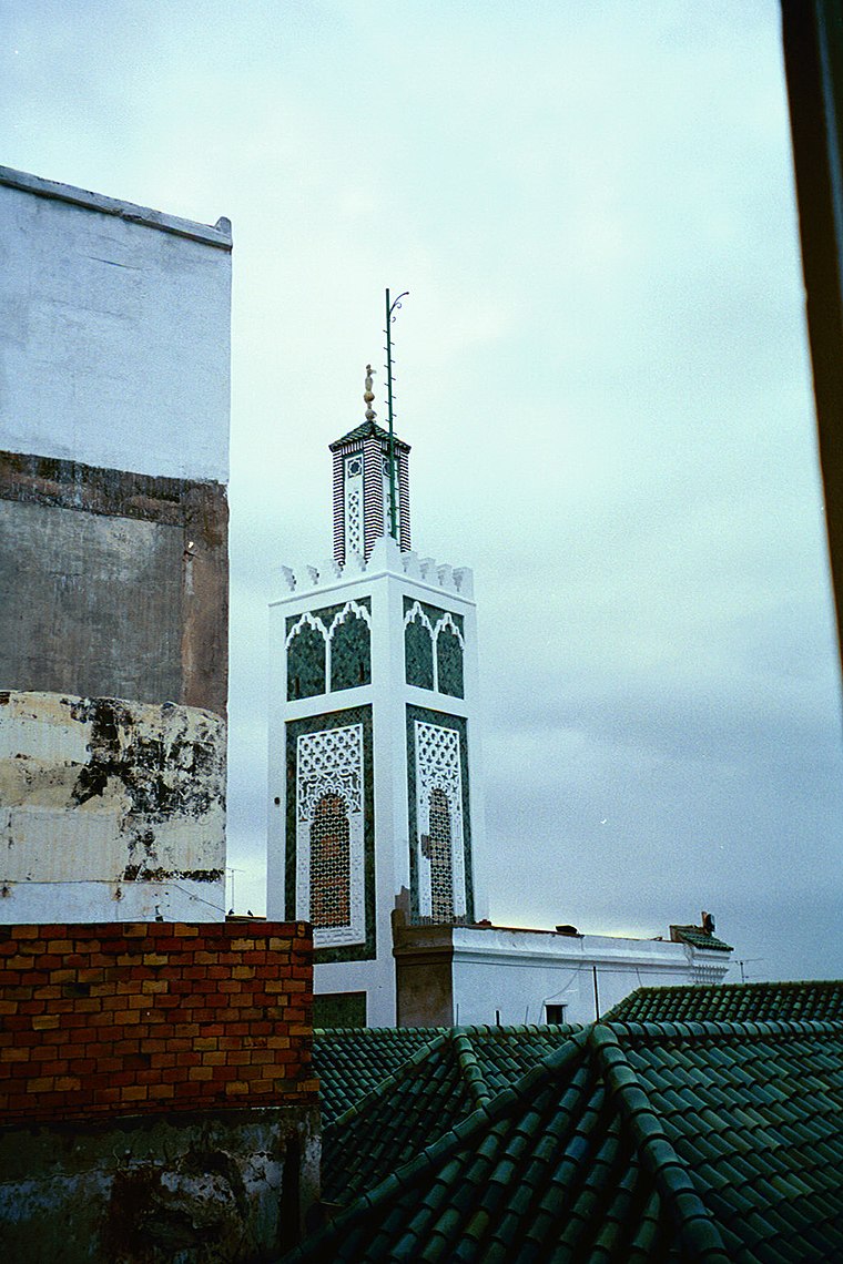
Photo: chris-yunker, CC BY-SA 2.0.
The Grand Mosque of Tangier is the historic main mosque of Tangier, Morocco, located in the city's old medina. While the design of the current mosque dates from the early 19th century during the Alaouite period, the site has been occupied by a succession of religious buildings since antiquity. Grand Mosque of Tangier is situated 3 km northeast of Andalus.
Places in the Area
Nearby places include Laaouama and Gueznaïa.
Laaouama
Village
Laaouama is a small town and rural commune in Fahs-Anjra Province of the Tanger-Tetouan-Al Hoceima region of Morocco. At the time of the 2004 census, the commune had a total population of 20,541 people living in 3834 households. Laaouama is situated 4 km southeast of Andalus.
Gueznaïa
Village

Photo: أنس, CC BY-SA 4.0.
Gueznaïa is a village, which is situated 6 km southwest of Andalus.
Andalus
- Type: Greengrocer
- Address: Avenue Al Hiwar
- Categories: shop and food
- Location: Tangier, Tangier-Tétouan-Al Hoceima, Mediterranean Morocco, Morocco, North Africa, Africa
- View on OpenStreetMap
Latitude
35.74246° or 35° 44′ 33″ northLongitude
-5.83651° or 5° 50′ 11″ westOpen location code
8C7PP5R7+X9OpenStreetMap ID
node 5607430964OpenStreetMap feature
shop=greengrocer
This page is based on OpenStreetMap, Wikidata, and Wikimedia Commons.
We’d love your help improving our open data sources. Thank you for contributing.
Satellite Map
Discover Andalus from above in high-definition satellite imagery.
Places with the Same Name
Discover other places named “Andalus”.
Notable Places Nearby
Highlights include Masjid Fadl llah and Dg. Sanitaire al akhawayn.
Nearby Places
Explore places such as Pharmacie Chems Ahlan صيدلية شمس أهلا and Scolaire.
Mediterranean Morocco: Must-Visit Destinations
Delve into Tétouan, Oujda, Chefchaouen, and Nador.
Curious Greengrocers to Discover
Uncover intriguing greengrocers from every corner of the globe.
About Mapcarta. Data © OpenStreetMap contributors and available under the Open Database License". Text is available under the CC BY-SA 4.0 license, except for photos, directions, and the map. Photo: calflier001, CC BY-SA 2.0.