Sandwich Bay
Sandwich Bay is a monitoring station in Worth, Dover District, England. Sandwich Bay is situated nearby to the nature reserve Sandwich & Pegwell Bay NNR, as well as near the golf course The Royal St. George’s Golf Club.| Tap on a place to explore it |
Places of Interest Nearby
Highlights include Prince’s Golf Club and Royal St George’s Golf Club.
Prince’s Golf Club
Golf course
Prince's Golf Club is a links golf course located in Sandwich in Kent in southeast England. Prince's is immediately adjacent to the more famous Royal St George's golf club, and both clubs lie on the same stretch of coastline as nearby Royal Cinque Ports Golf Club. Prince’s Golf Club is situated 1 mile northwest of Sandwich Bay.
Royal St George’s Golf Club
Building

Photo: Nick Smith, CC BY-SA 2.0.
The Royal St George's Golf Club is a golf club located in Sandwich, Kent, England. It is one of the courses on The Open Championship rota, and the only one in South East England.
Sandwich railway station
Railway station
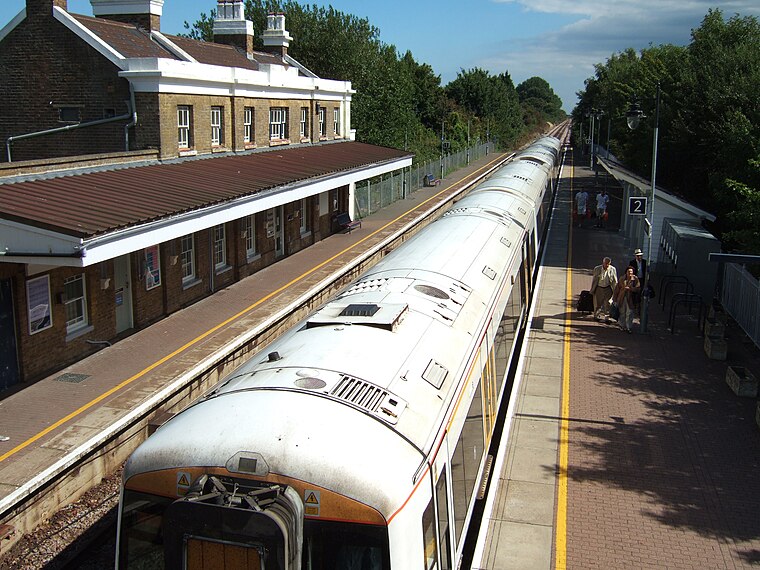
Photo: Edward, CC BY-SA 3.0.
Sandwich railway station serves Sandwich in Kent, England. The station, and all trains serving it, are operated by Southeastern. The station is 8+1⁄4 miles south of Ramsgate on the Kent Coast Line. Sandwich railway station is situated 2 miles southwest of Sandwich Bay.
Places in the Area
Nearby places include Sandwich and Worth.
Sandwich

Photo: Traveler100, CC BY-SA 4.0.
Sandwich is a village in Kent, one of the Cinque Ports responsible for England's maritime defence. In the 14th and 15th centuries the harbour silted up and the river changed its course, leaving Sandwich well inland: so it lost its importance and its attractive medieval centre was preserved.
Worth
Village

Photo: Nick Smith, CC BY-SA 2.0.
Worth is a village and civil parish in the Dover District of Kent, England, situated 2 kilometres south of Sandwich. It has two public houses, a church, and a school. Worth is situated 2½ miles southwest of Sandwich Bay.
Ebbsfleet
Village

Photo: Nick Smith, CC BY-SA 2.0.
Ebbsfleet is a hamlet near Ramsgate, Kent, at the head of Pegwell Bay. Historically it was a peninsula on the southern coast of the Isle of Thanet, marking the eastern end of the Wantsum Channel that separated Thanet from the Kentish mainland. Ebbsfleet is situated 2½ miles northwest of Sandwich Bay.
Sandwich Bay
- Type: Monitoring station
- Location: Worth, Dover District, Kent, South East England, England, United Kingdom, Britain and Ireland, Europe
- View on OpenStreetMap
Latitude
51.2826° or 51° 16′ 57″ northLongitude
1.37962° or 1° 22′ 47″ eastOperator
Environment AgencyOpen location code
9F3379MH+2ROpenStreetMap ID
node 5609576440OpenStreetMap feature
man_made=monitoring_station
This page is based on OpenStreetMap, Wikidata, and Wikimedia Commons.
We’d love your help improving our open data sources. Thank you for contributing.
Satellite Map
Discover Sandwich Bay from above in high-definition satellite imagery.
Places with the Same Name
Discover other places named “Sandwich Bay”.
Notable Places Nearby
Highlights include Sandwich & Pegwell Bay NNR and The Royal St. George’s Golf Club.
Nearby Places
Explore places such as Sandwich & Pegwell Bay and Sandwich Bay.
Kent: Must-Visit Destinations
Delve into Canterbury, Dover, Maidstone, and Rochester.
Curious Monitoring Stations to Discover
Uncover intriguing monitoring stations from every corner of the globe.
About Mapcarta. Data © OpenStreetMap contributors and available under the Open Database License". Text is available under the CC BY-SA 4.0 license, except for photos, directions, and the map. Photo: Diliff, CC BY-SA 3.0.